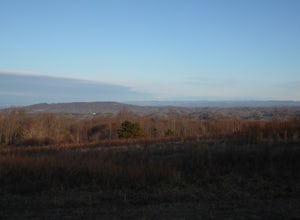
Sparta, North Carolina
Looking for the best hiking in Sparta? We've got you covered with the top trails, trips, hiking, backpacking, camping and more around Sparta. The detailed guides, photos, and reviews are all submitted by the Outbound community.
Top Hiking Spots in and near Sparta
-
Purlear, North Carolina
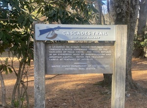
Cascades Trail
5.00.86 mi / 220 ft gainCascades Trail is an out-and-back trail that takes you by a waterfall located near Deep Gap, North Carolina.Read more -
Creston, North Carolina
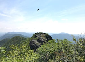
Three Top Mountain
4.2 mi / 1260 ft gainThree Top Mountain sits within the same vicinity of Elk Knob. The mountain gets its name from its three prominent rock projections at its peak. The highest point, unofficially named “Big Rock”, is at an elevation of 5020 feet. Prior to the originally named rock peak, you will arrive at Huckleb...Read more -
Troutdale, Virginia
Hike the Appalachian Trail from Elk Garden to Buzzard Rock
5.06.6 mi / 1000 ft gainStarting at the Elk Garden Parking Area hike the Appalachian Trail south (do not cross the road, follow the trail from the parking area). Hike along the trail following the white blazes and at 2.4 miles you'll reach a campsite on your left. This is a great place to camp overnight if you decide to...Read more -
Wytheville, Virginia
Hike the High Rock Trail
3.02.7 mi / 636 ft gainThe hike to High Rocks begins at a gravel parking lot up a long winding road, seems like forever but really is only mile or two past the quarry when your turn onto the road. The out-and-back hike begins by passing through the two large boulders near the back of the parking lot. The trail leads d...Read more -
Todd, North Carolina
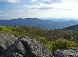
Hike the Elk Knob Summit Trail
5.03.8 mi / 1000 ft gainThere are no bathrooms at the trailhead, so if needed, drive a little past it to the park bathrooms on the left. Park at the summit trailhead and start your hike on the new gravel path. The trail gains 1000 ft in elevation in just under 2 miles so take your time if need be - and bring plenty of w...Read more -
Marion, Virginia
Hike Molly's Knob
5.03.4 mi / 1100 ft gainThe parking lot is located on the east side of the lake, just before the group lodge on Lake Drive. The Molly’s Knob trail begins just uphill on the right and is marked by white blazes. You can also take an alternate route and follow the Lake Loop Trail (located to the left of the parking area)...Read more -
Marion, Virginia
Hike the Lake Trail Loop at Hungry Mother SP
6 mi / 800 ft gainHungry Mother State Park is located in the picturesque Blue Ridge Mountains in Southern Virginia. Located inside the state park is the Lake Trail Loop that winds itself around the man-made reservoir and the park. Hikers can access the trail in numerous locations throughout the park but the easies...Read more -
Hiddenite, United States
Hike The Hollow Rock Trail at Rocky Face Mountain
4.02.4 mi / 514 ft gainFrom the parking lot, head northwest to find the trailhead for Buzzard Roost Loop. Follow that and stay left to meet up with the Hollow Rock Trail. This is a moderate hike with great views of the park. Perfect for a quick escape with the family. For a quick and tasty bite after your hike, hit up ...Read more -
Pinnacle, North Carolina
Hike the Jomeokee Trail at Pilot Mountain SP
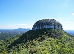
4.30.8 mi / 100 ft gainThis unique peak, also known as the Big Pinnacle, is in Pilot Mountain State Park. From the main parking area on top of the mountain on Pilot Knob Park Road, you can first view the Big Pinnacle from the overlook attached to the parking lot. The prominent mountain behind the Big Pinnacle is Hang...Read more -
Willis, Virginia
Hike Buffalo Mountain
4.72 mi / 700 ft gainCOVID-19 CLOSURE: Due to Covid-19, this trail will be closed effective April 10, 2020 at 8 PM until June 24, 2020. A short 1.0 mile hike to the summit with 700’ elevation gain, the trail switchbacks steeply up to the exposed rocky summit. To the north you can see Sharp Top and Flat Top at the Pe...Read more -
Blowing Rock, North Carolina
Boone Fork Trail
4.05.06 mi / 1030 ft gainBoone Fork Trail is a loop trail that takes you by a waterfall located near Boone, North Carolina.Read more -
Blowing Rock, North Carolina
Price Lake Loop Trail
5.02.23 mi / 387 ft gainPrice Lake Loop Trail is a loop trail that takes you by a lake located near Blowing Rock, North Carolina.Read more -
Blowing Rock, North Carolina
Camp and Paddle at Price Lake
This campground is all kinds of amazing, and if you get one of the sites in the A loop, you will have lakefront property (just be warned, if I see you there, I'll have to crash with you ;-). Price Lake is a gorgeous lake right off the Blue Ridge Parkway in North Carolina and perfect for canoeing...Read more -
Banner Elk, North Carolina
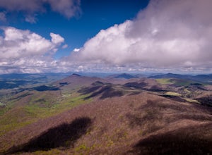
Calloway Peak via Daniel Boone Scout Trail
5.06.31 mi / 1991 ft gainAt 5,946 feet, Calloway Peak provides hikers with perhaps the best view of North Carolina's Blue Ridge Mountains. You'll have to earn this view - it is a tough climb up, although not terribly long. Begin at the trailhead for Tanawha Trail in the Boone Fork Parking Area on the Blue Ridge Parkway....Read more -
Banner Elk, North Carolina
Explore Boone Fork Creek
0.25 mi / 75 ft gainBoone Fork Bridge and creek is situated at the base of Grandfather Mountain, on the Blue Ridge Parkway, milepost 299.9. Elevation 3905'.The trailhead is at the left side of Boone Fork Creek parking area and the trail is a gentle meander through Rhododendrons and a hardwood forest.As you head tow...Read more -
Walnut Cove, North Carolina
Hike the Sauratown Trail
22 mi / 800 ft gainYou can through-hike or section hike. I did it from Tory's Den to the Corridor Trail Parking Lot in about 10 hours. Check the Sauratown Trail Association's website before traveling. It is a bridle and hiking trail so the hiking is fairly easy. A lot of it travels beside streams. In other places...Read more

