Arch Cape, Oregon
Looking for the best hiking in Arch Cape? We've got you covered with the top trails, trips, hiking, backpacking, camping and more around Arch Cape. The detailed guides, photos, and reviews are all submitted by the Outbound community.
Top Hiking Spots in and near Arch Cape
-
Arch Cape, Oregon
Hug Point Waterfall and Cave
4.60.67 mi / 141 ft gainHug Point is located just 4-5 miles south of the famous Cannon Beach along HWY 101 and is a must stop on any travel along the Oregon coast. Hug Point got its name from the original travelers to this beautiful area. Without the modern day highways we know today, visitors to this rugged coast line ...Read more -
Arch Cape, Oregon
Cape Falcon Trail
5.04.67 mi / 561 ft gainCape Falcon is one of two major hikes within Oswald West State Park, fifteen minutes south of Canon Beach on the Oregon Coast. Park in the lot at the trailhead off Highway 101 and head in. After a half a mile or so you’ll come to a junction with options for “The Beach” or “Cape Falcon”. Go right ...Read more -
Nehalem, Oregon
Surf Smuggler Cove
5.0The beach in Oswald West State Park is one of the more secluded beaches on the Oregon coast. Most tourists tend to stay by Canon Beach and Seaside, Oregon, so this little gem gets much less traffic.The parking lot is right on the highway with plenty of parking, a bathroom, and a drinking fountai...Read more -
Nehalem, Oregon
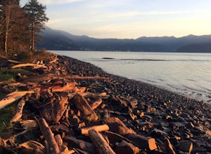
Short Sands Beach
5.01.16 mi / 184 ft gainIt is located just off the side of highway 101 north of Manzanita and south of Cannon Beach. To get here, you need to just pull off into the Oswald West parking lot on the ocean side of the freeway. From here, It is just a short walk through the old growth forrest covered in dense green moss wher...Read more -
Nehalem, Oregon
Neahkahnie Mountain Trail
5.03.3 mi / 1142 ft gainThis hike can be done as either a loop or an out-and-back beginning from either the North or the South trailhead, both located off Route 101. If opting for the loop you will have to walk ~1 mile on the highway to connect back to your starting point. Since we were hiking with our kids we wanted t...Read more -
Nehalem, Oregon
Neahkahnie Mountain via South Trailhead
5.02.92 mi / 860 ft gainYou have a couple different options on how to access this hike (North and South trailhead) also if you would like to hike the loop trail or out-and-back option. Driving directions for this hike isn't to difficult, heading south on highway 101 drive 16.6 miles past the exists for Cannon Beach and ...Read more -
Cannon Beach, Oregon
Crescent Beach Trail
5.02.28 mi / 797 ft gainHead off the 101 to Ecola State Park and drive to the large main car area. From here the trailhead is located just above the restroom facility and is well signed, you can't miss the huge placard. Starting with a few short incline stair sets, you will hit the main roadway; follow the sidewalk for ...Read more -
Manzanita, Oregon
Camp at Nehalem Bay State Park
5.0Nehalem Bay State Park is a great central location on the Oregon Coast to use as a base camp, whether you want to go south to explore Cape Kiwanda or go north to photograph the famous Cannon Beach. There are six loops: A-F, and only A-C are open in the winter. The only first-come-first-served are...Read more -
Nehalem, Oregon
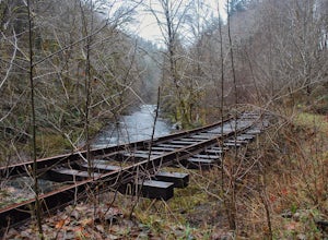
Hike the Salmonberry Train Track Trail
4.010 mi / 275 ft gainBeware, there is no actual trailhead! This trail (Lower Salmonberry River Hike) starts on Lower Nehalem Rd (Foss Rd) where the Salmonberry River and the Nehalem River meet. Before you cross the tracks, find parking there (but be aware of private property) and follow the train tracks into the fore...Read more -
Seaside, Oregon
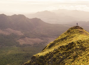
Saddle Mountain Trail
4.74.59 mi / 1644 ft gainSaddle Mountain is a pretty stellar spot if you are looking for a beginner/intermediate hike with incredible views close to Portland. The trail is a 5.2 mile round trip trail with an elevation gain of 1600 ft that starts at the Saddle Mountain Trailhead. You can actually camp right at the trail...Read more -
Astoria, Oregon
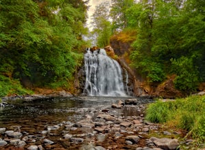
Youngs River Falls
4.50.33 mi / 59 ft gainYoungs River Falls is a scenic 50-foot waterfall on Youngs River, about 15 minutes outside of Astoria. The falls are somewhat unique in that the base is located only about 10 feet above sea level From Astoria. The falls have been featured in several movies, most notably Free Willy 2 and Teenage M...Read more -
Tillamook, Oregon
Explore Bayocean Peninsula Park
5.08 mi / 100 ft gainLocated just west of Tillamook on the way to Cape Meares is an expansive forested park that juts out into Tillamook Bay. The main "trail" is an old unpaved narrow road called Bayocean Dike Road that stretches 4 miles down to the point. It's perfect for a long run, leisurely hike or mountain bikin...Read more -
Tillamook, Oregon
Big Spruce Trail
5.00.29 mi / 3 ft gainBig Spruce Trail is an out-and-back trail where you may see beautiful wildflowers located near Tillamook, Oregon.Read more -
Astoria, Oregon
Airport Dike Trail
3.04.11 mi / 79 ft gainParking for this hike can be found at either end of the trail. It starts at the west end of the Lewis & Clark Bridge from a small access road that is used as a parking lot. From here it is a flat walk along an old grassy road that is well maintained. If you forgot to bring along bags to pi...Read more -
Tillamook, Oregon
Hike along Short Beach, Oregon
5.00.25 mi / 200 ft gainHike: The trail is basically a handmade wooden staircase that takes you all the way down to the beach, so once you locate it, just keep following the stairs all the way down until you've reached the beach.Directions: Drive North along Cape Meares Loop Rd just past Oceanside until you reach the po...Read more -
Oceanside, Oregon
Tunnel Beach
5.00.47 mi / 75 ft gainThe main beach is located adjacent to Oceanside Beach State Park, which can be accessed via Cape Meares Loop/Netarts Oceanside Hwy. Once you arrive at the park, head down towards the beach and start walking North. You'll notice a little hole-in-the-wall past a small group of rocks which you'll h...Read more

