Kodak, Tennessee
Looking for the best camping in Kodak? We've got you covered with the top trails, trips, hiking, backpacking, camping and more around Kodak. The detailed guides, photos, and reviews are all submitted by the Outbound community.
Top Camping Spots in and near Kodak
-
Del Rio, Tennessee
Max Patch Mountain
5.01.51 mi / 315 ft gainMax Patch Mountain was once cleared for pasture land, leaving an expansive flat summit that now serves as the ideal location for a picnic hike, flying a kite, or laying in the sun surrounded by the Great Smoky Mountains. With little elevation gain and a short distance it is also very family (and ...Read more -
Robbinsville, North Carolina
Hike the Big Fat Gap Trail
12 mi / 3000 ft gainThere are many trailheads leading into the wilderness on either the Tennessee or North Carolina side. My favorite is the Big Fat Gap trail on the North Carolina side at an elevation of 3,060'. To see the best of what this area has to offer take the Hangover Lead South Trail to the 5,180' Hangover...Read more -
Joyce Kilmer-Slickrock Wilderness, North Carolina
Backpack Slickrock Creek Trail #42
30 mi / 3700 ft gain8:30 a.m. and we’re winding our way down Highway 129 near Robbinsville, NC. The fog is still thick over the Little Tennessee River as we slow down crossing the bridge into Graham County. “I think we missed it,” I say as we continue onward. Within minutes the Tapoco Lodge comes into view. My pre-h...Read more -
Hot Springs, North Carolina
Camp at Rich Mountain Fire Tower
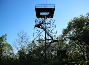
5.0Rich Mountain fire tower is located in the Cherokee National Forest just outside of Hot springs North Carolina. Getting there is pretty easy once you get off of US 25W you drive up a gravel road for about 5 miles until you get to the tower. Once you get to the top its about a 100 foot walk until ...Read more -
Vonore, Tennessee
Camp at Citico Creek
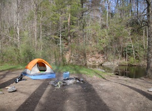
5.0There are a few options for getting to Citico Creek, you can either go up the windy gravel road from US 411 or get off of the Cherohala Skyway and go down the mountain past the Indian Boundary campground. The Citico Creek campground has about 5 or 6 spots but is rarely full because it is very sec...Read more -
Wartburg, Tennessee
Hike to Frozen Head State Park Fire Tower
4.54.5 mi / 1300 ft gainTo get to this hike the easiest way is to go up Petros hwy near the closed Brushy Mountain State prison. The trailhead is a large gravel lot on the side of the road. The trail is an old road so it is wide and well taken care of. However, the trail is very steep all the way up. The trail has only ...Read more -
Ewing, Virginia
Hike to White Rocks
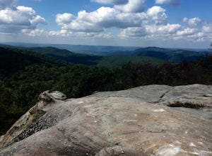
5.06 mi / 1500 ft gainStarting at the Ewing Trailhead, in Ewing, VA, you will meander up the ridge for about 2.5 mi before meeting up with Ridge Trail. The ascent is approximately 1500 ft up the side of the majestic White Rock Ridge. Mud, loose rocks, and some very steep climbs are included.Once at the top, left takes...Read more -
Ewing, Virginia
Backpack to White Rocks in Cumberland Gap National Historic Park
6.4 mi / 2000 ft gainCumberland Gap National Historic Park encompasses more than 20,000 acres of mountainous terrain spread out across Virginia, Tennessee, and Kentucky. The park offers miles of trails and many historic curiosities, including the actual saddle where pioneers first found their way over the Cumberland ...Read more -
Franklin, North Carolina
Wesser Bald Fire Tower
4.72.36 mi / 807 ft gainThe road leading to the trailhead is rough the last mile, but doable in any car. Just make sure to take it easy going up and be careful, especially if there has been any rain or snow. You will have reached the parking area for the hike once you see a large green Appalachian trail sign and a few...Read more


