Iron County, Utah
Top Spots in and near Iron County
-
New Harmony, Utah
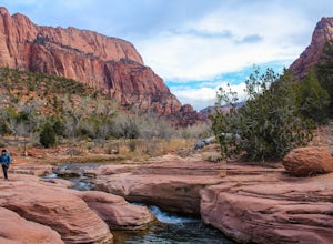
Middle Fork Taylor Creek in Kolob Canyon
4.04.86 mi / 889 ft gainThe Taylor Creek trailhead sits in the little-explored part of Zion National Park known as Kolob Canyon just south of Cedar City. The trail starts at around 6,000 feet and then drops a little lower in to the canyon and runs along Taylor Creek. With 450 feet of elevation change along the five-mile...Read more -
New Harmony, Utah
Kolob Arch
4.713.86 miIn the lesser traveled area of Zion National Park sits Kolob Arch, a sandstone arch high up on a cliff tucked back in the canyon. To get to Kolob Arch take exit 40 on I-15 in Utah. You'll see a Zion National Park Visitor's Center. Here you can fill up on water, use the bathroom, and get a map to...Read more -
New Harmony, Utah
Backpack Kolob Canyons, Zion NP
5.016 mi / 1000 ft gainOverview Starting at Lee Pass trailhead the trail descends down to run alongside the Timber Creek, past the open finger canyons of the nearby cliffs. At roughly mile 3 the trail will bend slowly to the left and climb up before descending again to run upstream and alongside La Verkin creek. Cam...Read more -
New Harmony, Utah
Trans-Zion Trek, Zion NP
5.0100.6 miThe following adventure guide for the Trans-Zion Trek will actually consist of six separate trails. The trails listed below are listed in order, going West to East. If the individual trail adventure is composed on the site as going east to west, it will be indicated that the reverse hike will be...Read more -
New Harmony, Utah
Backpack the La Verkin Creek Trail
5.014 mi / 1200 ft gainI've visited Zion National Park twice this year and the experience between the two visitations were like night and day. Zion National Park is by no means a secret, and for good reason. Hikes such as Angels Landing, and the Narrows are locations which are sought after by every outdoorsman and novi...Read more -
Mount Carmel, Utah
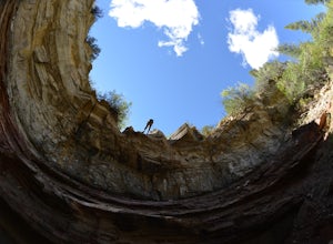
Canyoneering Birch Hollow
4.3Birch Hollow is near Zion National Park, and accessible from North Fork Road (East Zion) past the Ponderosa Resort. If you do not hike out through Orderville into Zion National Park (ZNP) and the Narrows, then a ZNP Permit is not required (turning around and hiking back to your vehicle).The time ...Read more -
New Harmony, Utah
Hike to the Timber Creek Overlook in Kolob Canyon
5.01.15 mi / 102 ft gainThe Timber Creek Overlook trail is located at the end of the Kolob Canyon drive in Zion National Park. This hike is very family friendly and offers restrooms, picnic tables, and a well maintained trail. Bring your camera and hike the trail around sunset to get beautiful sunset shots of the valle...Read more -
New Harmony, Utah
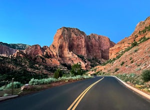
Kolob Canyon Scenic Drive
10.35 mi / 1503 ft gainKolob Canyon Scenic Drive is an out-and-back drive where you may see beautiful wildflowers located near New Harmony, Utah.Read more -
Springdale, Utah
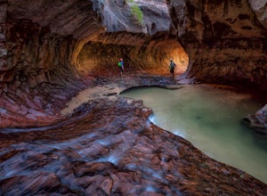
The Subway - Top-Down
5.07.78 miThe Subway (rated 3B III), also known as the Left Fork of the North Creek, is the most popular backcountry hike in Zion. It is one of the most diverse and beautiful canyons, as well as a fun and challenging day trip canyoneering adventure. There are two ways to explore the Subway: from the botto...Read more -
Springdale, Utah
Hike Wildcat Canyon Trail, Zion NP
5.05.88 miThis 5.8 mile (one-way) trek is a multi-functional trail. The trail can serve as standalone trail allowing hikers to get in either a solid in-and-out day hike or as a leg to a much bigger and epic Trans-Zion Trek. For those interested in the later, the Wildcat Canyon Trail is the leg of the journ...Read more -
Springdale, Utah
Hike the Northgate Peaks Trail
5.06.14 mi / 958 ft gainThe only access to the Northgate Peaks Trail is by the Wildcat Canyon Trail, which has a trailhead just off Kolob Terrace Road. From the start of the trail you have a good view of Pine Valley Peak on your right. The trail passes on the left into an open green and lush area. After hiking a little ...Read more -
Virgin, Utah
Hop Valley Trail, Zion NP
3.014.58 mi / 1000 ft gainThis 6.5 mile (one-way) trek is a multi-functional trail. The trail can serve as standalone trail allowing hikers to get in either a solid in-and-out day hike or as a leg to a much bigger and epic Trans-Zion Trek. For those interested in the later, the Hop Valley Trail is the leg of the journey t...Read more -
Virgin, Utah
Connector Trail, Zion NP
5.04.9 miThis 4.9-mile (one-way) trek is a multi-functional trail. The trail can serve as standalone trail allowing hikers to get in either a solid in-and-out day hike or as a leg to a much bigger and epic Trans-Zion Trek. For those interested in the later, the Connector Trail is the leg of the journey th...Read more -
Springdale, Utah
The Narrows, Zion NP
4.99.73 miHiking the narrows in Zion National Park is one of my favorite hikes and something I return for almost every year, I can still remember my first visit as a kid. There's no other place like it in the National Park system and the stunning beauty of its towering walls and vibrant river make it a top...Read more -
Washington County, Utah
Zion National Park Bus stop 8
2.7According to the park, there is nothing at this spot, so not many people stop. If you do not like large crowds, this is the perfect place to stop. There is a small trail that leads to the river and a beautiful vista with the massive canyon walls on all sides. There are several areas in this part ...Read more -
Springdale, Utah
Weeping Rock
4.00.5 mi / 98 ft gainThis trail begins at the Weeping Rock parking lot. You must cross a stream on a bridge and then follow the trail to the left. The trail is nice and cool at the top and you may get some mist or water on you from the weeping rock. Perfect to cool you off after the steep trek up to the rock! It's ...Read more

