Front Royal, Virginia
Looking for the best hiking in Front Royal? We've got you covered with the top trails, trips, hiking, backpacking, camping and more around Front Royal. The detailed guides, photos, and reviews are all submitted by the Outbound community.
Top Hiking Spots in and near Front Royal
-
Stanley, Virginia
Lewis Falls via Lewis Spring
3.01.71 mi / 607 ft gainLewis Spring is the source of Hawksbill Creek which forms Lewis Falls (also known as Lewis Spring Falls) and eventually flows through the town of Luray and joins the Shenandoah River. The waterfall starts with 2 streams before hitting rock halfway down and fanning out. During dry seasons and summ...Read more -
Rapidan, Virginia
Hike to Historical Rapidan Camp in Shenandoah National Park
5.04.5 mi / 890 ft gainFor this hike park at the Milam Gap parking lot located at mile 52.8 on Skyline Drive. Once parked you will cross Skyline Drive to reach the trail. Hikers will follow the blue blazes along the trail and creek. After you have crossed the creek twice you will come to a larger waterfall. At this po...Read more -
Stanley, Virginia
Hike to Naked Creek Falls
3.01 mi / 1000 ft gainPlease note that there is no trail leading to these falls. This hike is for advanced hikers.Park your car at Naked Creek Overlook in Shenandoah National Park and walk through the field staying to the left. As you start to enter the woods you will hear the creek running on your left. Make your wa...Read more -
Basye, Virginia
Orkney Springs Trail
4.94 mi / 1440 ft gainEasy to get to from Bryce resort, Orkney Springs Trail is a moderate to challenging trail. It starts with an easy trail through the woods but does get very steep in mile 2 in what seems like a very rocky dried-out river bed. There is a spectacular view around mile 2. If that's what you’re after y...Read more -
Stanley, Virginia
Hike to Bear Church Rock via Bootens Gap
3.59.4 mi / 800 ft gainThe trail leads along the ridge of Jones Mountain to the gorgeous views at Bear Church Rock, and it's the perfect hike for those seeking solitude - didn't see another soul the entire time on a holiday weekend.From the parking lot, head out left on the AT northbound. In .4 miles you will come to a...Read more -
Madison, Virginia
Hike Bear Church Rock via the Graves Mill Trail
3.58.5 mi / 2250 ft gainStarting at the Graves Mill Parking area, head up the yellow blazed trail that is marked by a big cement marker. The trail will follow closely beside the gorgeous Rapidan River. Hike for half a mile until you come to the intersection of the Staunton River Trail. Turn left (do not cross the river)...Read more -
Madison, Virginia
Fly Fish on the Rapidan River
5.05 miPark at the Graves Mill Parking Area. From here you can easily follow the Rapidan River up the mountain. Fishing reports inform that the lowest concentration of brookies are at the lower boundaries of the park so take some time to enjoy the trail and hike up stream. At the lower boundaries you mi...Read more -
Elkton, Virginia
Bearfence Mountain Loop
4.81.04 mi / 220 ft gainThis is one of my favorite hikes in Shenandoah National Park for its views, easy access to the trail, and the option to combine it with a much further hike on the AT. There is also a really fun little rock scramble at the top that scares a lot of people away, but makes for a more secluded summit,...Read more -
Harpers Ferry, West Virginia
Hike Weverton Cliffs Overlook from Harpers Ferry
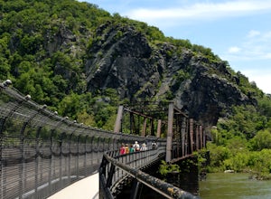
5.08.2 mi / 925 ft gainParking and trail head: Park at the Harpers Ferry Visitors Center for $10 (171 Shoreline Dr, Bolivar, WV 25425) and take the shuttle a mile and a half to lower town (free). Walk straight from the shuttle to the large bridge. Cross the bridge to hop on the C&O canal trail. This is the point w...Read more -
Harpers Ferry, West Virginia
Hike Maryland Heights via Harpers Ferry
4.54.2 mi / 800 ft gainParking and trail head: Park at the Harpers Ferry Visitors Center for $10 (171 Shoreline Dr, Bolivar, WV 25425) and take the shuttle a mile and a half to lower town (free). Walk straight from the shuttle to the large bridge. Cross the bridge and take a left on the C&O Canal trail. You will s...Read more -
Waterford, Virginia
Hike the Historical Phillips Farm in Waterford
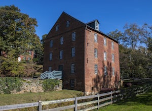
4.01 mi / 10 ft gainThis leisurely hike starts at the Old Mill at Waterford in Waterford, Virginia. You can find parking along the side of the road right near the mill. As you walk down and past the mill you'll see a fence and the beginning of the trail. This is a short, 1 mile hike and almost completely flat. If y...Read more -
Manassas, Virginia
Trail Run at Bull Run
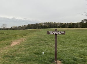
5.04 miGreat spot for a run! Very accessible for those in the DC region. A good starting point is the Henry Hill Visitor Center. If you want to avoid any crowds, start early. From the Henry Hill Visitor Center, you can't really go wrong (as far as direction is concerned) since most trails can be linke...Read more -
Manassas, Virginia
Hike and Explore Bull Run Battlefield
4.31.2 miLocated about 40 minutes from D.C. just off I-66 in Manassas, VA. Henry Hill is the starting point and headquarters that can lead you to multiple trails ranging from 1-5 miles depending on the route you choose here. Ample parking at HQ as well as clean restrooms. Tours are available here. Rolling...Read more -
Knoxville, Maryland
Hike to Maryland Heights
4.82.8 mi / 900 ft gainMaryland Heights is at the convergence of Maryland, West Virginia and Virginia, as well as the Potomac and Shenandoah Rivers. The Appalachian Trail and C&O Canal Towpath are also easily accessible from the trailhead parking lot. The parking lot holds about 16 cars and is between Locks 33 and ...Read more -
Knoxville, Maryland
Hike Maryland Heights Trail Loop
5.3 mi / 1600 ft gainLearn Civil War history as you hike through forts and read signs about the war. Enjoy beautiful lookouts, including one with a great view of Harpers Ferry. The 5.3 mile hike is relatively easy and offers an interesting opportunity to learn history in one of the most important historical areas i...Read more -
Purcellville, Virginia
Explore Potomac Wayside Park
4.00.25 mi / 75 ft gainThis is a small park along route 340 in Purcellville, Virginia near Harper's Ferry. After you have parked, look for the park sign which will be a few feet behind you. There is a trail that will take you down to the bottom of the waterfall and eventually to the Potomac River. There is also a trail...Read more

