Darrington, Washington
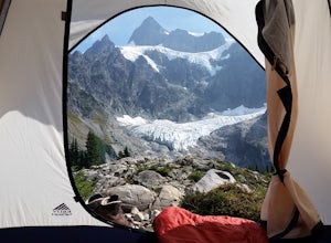
Looking for the best camping in Darrington? We've got you covered with the top trails, trips, hiking, backpacking, camping and more around Darrington. The detailed guides, photos, and reviews are all submitted by the Outbound community.
Top Camping Spots in and near Darrington
-
Deming, Washington
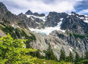
Lake Ann and Lower Curtiss Glacier
5.011.67 mi / 3241 ft gainThe trail begins just below Artist Point and is well marked from a paved parking lot. Make sure to have a Northwest Forest Pass for your vehicle. Start your hike by descending on switchbacks through sub-alpine forest. It's a nice start, but remember, that means an uphill hike out. After entering...Read more -
Deming, Washington
Climb Mt. Shuksan via The Fisher Chimneys
Out of all of the ruggedly beautiful, non-volcanic mountains in the Pacific Northwest, Mt. Shuksan is the center piece. Rising to a height of 9,131 feet, Mt. Shuksan is one of the most photographed mountains in the world with its jagged ridges, hanging glaciers, steep rocky faces and ease of acce...Read more -
Leavenworth, Washington
Hike to the Summit of Mt. McCausland
8 mi / 1800 ft gainBegin by driving a fairly smooth Forest Road 6700 for 2.5 miles to the Smith Brook Trailhead and park in the space on the left. Much of the signage has been taken down along the trail, so it may be helpful to bring some written directions with you. The hike begins by keeping close to the road, me...Read more -
Deming, Washington
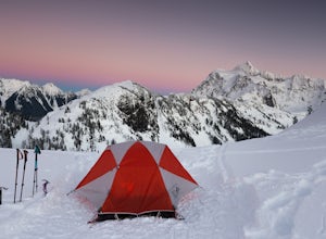
Winter Backpack to Artist Point
4 mi / 1000 ft gainYou do need a Northwest Forest Pass to park in the lot overnight. You can buy a day use E-pass online here (pick Mount Baker-Snoqualmie National Forest from the drop down menu) and print it out and it's ready to use. Or you can buy the annual pass here.The adventure to Artist Point begins in the ...Read more -
Deming, Washington
Backcountry Skiing Near Mt. Baker
5.0Park at Heather Meadows parking lot at Mount Baker Ski Resort and follow the Blueberry cat-track, which is actually a paved road in the summer, leading south up for 2 miles passing Austin Pass and continuing southwest on to Artist Point, gaining 1200 ft in elevation. From there, dig out your snow...Read more -
Deming, Washington
Winter Backpack to Lake Anne Ridge
14 mi / 2000 ft gainArrive at the upper ski resort parking lot (approx. 4300 feet elev.) and snowshoe, skin, or split board up. Make your way toward Artist Point and halt at Austin Pass, gaining approximately 1200 feet of elevation over approximately 2 miles (one way). From Austin Pass, turn left (south) to take the...Read more -
Leavenworth, Washington
Skyline Lake Trail
4.52.41 mi / 1020 ft gainThis 2.5 mile roundtrip hike with a little over 1,000 feet of elevation gain is a great winter trip for beginners. The trail is typically well-worn, making it easy to stay on target even in some of the most difficult conditions. If you have route finding and off trail skills, you can venture ou...Read more -
Skykomish, Washington
Hike to Josephine Lake
10.4 mi / 2100 ft gainStarting in the parking lot at Steven's Pass Ski Resort (roughly 4,062 feet in elevation; I recommend parking in E lot), start by walking between the two main lodges towards the ski lifts. You'll see a trail on the northwest-facing slope that switches back across the mountain - this is the PCT. O...Read more -
Skykomish, Washington
Jade Lake via the Necklace Valley Trail
15.26 mi / 3323 ft gainThis hike is definitely one of our all-time favorites. The first time we did it was in August 2015 and due to the exceptionally mild winter that year, fall was already beginning to show its colors. We wanted to see it again in the springtime when everything was in bloom, so we decided to go again...Read more -
Skykomish, Washington
Pacific Crest Trail's Section J: Stevens Pass to Snoqualmie Pass
70.27 mi / 14911 ft gainThis is the Section J hike of the Pacific Crest Trail between Stevens and Snoqualmie Pass. It is about a 70 mile hike, and I started near Stevens Pass heading South. The PCT starts at the Stevens Pass Ski Resort off of Highway 2. The trail starts out under chairlifts and through ski runs – I chos...Read more -
Winthrop, Washington
Heather-Maple Pass Loop
5.07.5 mi / 2185 ft gainNote to any hikers taking on this trail, this is a non-repeating trail meaning it goes in a big loop. The trailhead has 2 trail points of entrance. To the right (the pathway that is not paved) is the counter-clockwise route, a little less steep and more scenic at the start. To the left, the trail...Read more -
Pacific Crest Trail, Washington
Summit Black Peak
5.010 mi / 4400 ft gainStarting at the Heather-Maple Pass Loop Trailhead, jump onto the trail that will take you counter-clockwise along the loop. After about 1.25 miles, you will come to a split in the trail, take the right path and continue for just under a mile until you reach Heather Pass. Off to the right there ar...Read more -
Chelan County, Washington
Camp at Snowy Lakes
22 mi / 3550 ft gainTake Hwy 20 to Rainy Pass, and park at the trailhead on the east side of the highway. Begin on the Pacific Crest Trail (PCT), heading towards Cutthroat Pass.The trail winds it's way towards the pass at a gentle grade over 5 miles. As the trail ascends, you'll leave the forest behind as you enter ...Read more -
Deming, Washington
Hike Skyline Divide
5.09 mi / 2500 ft gainIf driving 13 miles on a forest road, and hiking miles of switchbacks doesn't bother you, your in for one of the most exquisite views that you can get from hiking in Washington state.Just a mile outside of the town of Glacier, turn onto Forest Road 37 and follow it up switchbacks for the majority...Read more -
Bow, Washington
North Butte via Chuckanut Trail
1.07.71 mi / 2047 ft gainThe HikeThe hike there isn't short, has several steep sections, and ends at the top of the mountain. There are cliff warnings at the top, so be careful as you explore the view! The steepest portions are at the beginning and right at the end. The trail is very well maintained (because it is so pop...Read more -
Skykomish, Washington
Hike to Lake Deer via Lake Dorothy Trailhead
12.6 mi / 1600 ft gainStart off by traveling along Highway 2 and turning towards the Money Creek Campground. Turn off onto Forest Road 6410 and follow that to the Lake Dorothy Trailhead (about 9 miles).This first section of the hike can be pretty crowded on a nice summer day as the trail is very family friendly and it...Read more

