Everett, Washington
Top Spots in and near Everett
-
North Bend, Washington
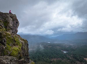
Hike Pratt Balcony
2.2 miThis one can be a bit tricky to find. The trailhead is unmarked and is a bit hidden around a curve of Middle Fork Road so it is easy to miss. At about 9.80 miles from the junction of 468th St. and Middle Fork Road, look for two signs on the right warning of upcoming gravel patches (probably will ...Read more -
Gold Bar, Washington
Blanca Lake
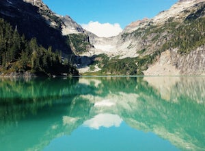
5.07.42 mi / 3540 ft gainAlthough the drive to the trailhead is mostly over gravel roads, Blanca Lake is a very popular hike. The drive is better for cars with clearance and AWD capabilities. The trail gets right down to it gaining almost 3,000 feet in the first 3 miles. But don't worry, the hard work is well worth the...Read more -
Gold Bar, Washington
Winter Backpack to Blanca Lake
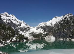
7.5 mi / 3300 ft gainSince Blanca Lake is a very popular place for folks to explore and with the nice and sunny weekend. I drove out Friday night and slept in my Jeep. Got up at 7:30am when folks first started arriving to the trail head.A couple of things to keep in mind before you start this hike. The 7.5 miles ro...Read more -
North Bend, Washington
Rainy Lake Trail
4.09 mi / 3205 ft gainThis is an abandoned trail that heads south along Rainy Creek, off of the downstream section of the Middle Fork Snoqualmie Trail, and up to Rainy Lake. The lake is popular among fisherman, since it is home to lots of trout, but be warned -- route-finding skills are a must on this trip. I do my be...Read more -
North Bend, Washington
Rattlesnake Ledge
3.95.46 mi / 2096 ft gainRATTLESNAKE LEDGE TRAIL:The hike to Rattlesnake Ledge begins at the trailhead next to the parking lot at Rattlesnake Lake. From here, you can look up and see the Ledge and rock face that you'll be hiking up toward. The trail begins covered under the forest, which can protect from the elements (su...Read more -
North Bend, Washington
Snowy Hike to Rattlesnake Ledge
4.54 mi / 1160 ft gainThe trail to Rattlesnake Ledge is one of the busiest in Washington. Usually, a Saturday or Sunday is a no go for a lot of avid hikers due to the crowds. Adding a little snow and cold diminishes the crowds nicely. While it is no secret, this hike is popular for a reason. The 2 miles it takes t...Read more -
North Bend, Washington
Rattlesnake Lake
5.0Being only a 10 minute drive off the 90, this Lake is often overlooked by the popular Rattlesnake Ledge hike right above. Take exit 32 from the 90E onto 436th SE Ave and continue onto Cedar Falls Rd SE and continue for about 3 miles. At this point, a parking lot will be on your right that is both...Read more -
North Bend, Washington
Otter Falls
4.08.37 mi / 853 ft gainThe hike begins at Snoqualmie Lake Trailhead, but you'll actually have to start your hike about a half mile down the road from the trailhead as some cement barricades are up. There is plenty of room to park below the barricades, and the walk up to the trial head is easy and quick. Once at the tr...Read more -
North Bend, Washington
Mailbox Peak New Trail
4.210.53 mi / 4127 ft gain*Disclaimer this article is in regards to the newly built trail.* For the old trail, head to Hike Mailbox Peak. Just off of exit 34, Mailbox Peak offers a birds-eye view of the surrounding area. This hike begins at a mere 800 ft. above sea level and by the time you are done you are nearly touch...Read more -
North Bend, Washington
Twin Falls
3.32.51 mi / 778 ft gainFor a portion of this 3-mile hike, you'll trek next to the South Fork Snoqualmie River, so take in the peaceful sound of the river running. Along the trail runs a river, where massive boulders create wading pools of icy water for warm summer days. At 1.5 miles, you'll reach a viewpoint bridge, wh...Read more -
North Bend, Washington
Middle Fork Snoqualmie River Trail
27.57 mi / 3609 ft gainThis beautiful tucked-away trail offers runners, hikers, and backpackers a new view of their favorite neighboring peaks - like Mailbox Peak and Mt. Si - from one of the most scenic river trails in the Seattle area. Often overlooked in favor of more rigorous hikes, the Middle Fork is a gently gra...Read more -
North Bend, Washington
Mailbox Peak Old Trail
4.44.96 mi / 3898 ft gainNote this adventure covers the old route. For the updated route, check out Hike Mailbox Peak New Trail. Take exit 34 from I-90. Head north on 468th Ave SE until the intersection with the SE Middle Fork Road. Turn right onto the Middle Fork Road. Follow SE Middle Fork Road 2.2 miles to the stop ...Read more -
Darrington, Washington
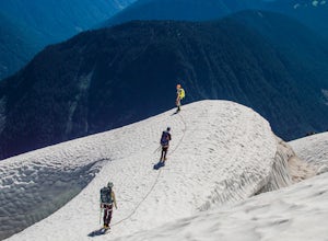
Climb Sloan Peak via the Corkscrew Route
5.014 mi / 6035 ft gainYou'll start the approach to this climb at the Sloan Peak trailhead at 1800ft elevation. Moving south along the trail, you'll begin with a traverse through some marshlands and several water crossings along the Sauk River and its tributaries for the first mile and before gaining any elevation. It ...Read more -
Brinnon, Washington
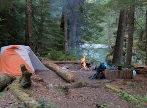
Camp at the Dose Forks
15 mi / 1200 ft gainThe Dose Forks Campground is an overlooked campsite deep within the Olympic National Park, making it a perfect weekend camping destination. A mild, 7.5 mile (one-way) trail delivers you to this enchanting area and is a must for those who love photographing forests. There are no reservation requir...Read more -
Anacortes, Washington
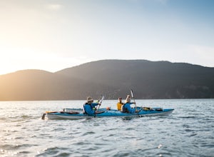
Kayak Camp on Cypress Island
16 miWe set out from the town of Anacortes, WA from Seafarers Memorial Park with a group of 6 people. Two in single kayaks and four in two tandem kayaks. After setting out into the water, keep to the west of Guemes island and follow the shoreline for a shorter trip or follow the east side for a longer...Read more -
Darrington, Washington
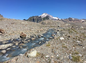
Backpack to Glacier Peak Meadows and White Chuck Glacier
34 mi / 9000 ft gainStarting at the North Fork Sauk Trailhead (NFD 49) off the Mountain Loop Highway, you will travel 5.3 miles and gain a leisurely 1,100 feet of elevation until you reach Mackinaw Shelter. This is where the real work begins. The trail gains a calf-burning 3,000 feet in the next 2.9 miles until you ...Read more

