Forks, Washington
Looking for the best hiking in Forks? We've got you covered with the top trails, trips, hiking, backpacking, camping and more around Forks. The detailed guides, photos, and reviews are all submitted by the Outbound community.
Top Hiking Spots in and near Forks
-
Port Angeles, Washington
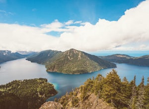
Camp at Fairholme Campground
3.0The campground is right at the very north end of Lake Crescent. It has bathroom and potable water, and for just $20 a night I think it is well worth it. Each campsite is equipped with a table and firepit (bring firewood). Open between May and October; first come first serve. As for activities, t...Read more -
Port Angeles, Washington
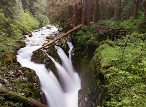
Sol Duc Falls and Deer Lake
4.67.17 mi / 1729 ft gainThe hike to Sol Duc Falls is a simple 0.8 mile walk to a roaring falls on the Sol Duc River. If you’re up for more of a hike, continue on the trail to Deer Lake from Sol Duc Falls. At the fork in the trail, turn left and hike up away from the Lover's Lane Trail. The trail steepens and the rocky ...Read more -
Port Angeles, Washington
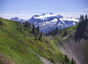
High Divide and 7 Lakes Basin
5.019.93 mi / 5056 ft gainA day spent plying the trails of the High Divide in Olympic National Park changes an outdoorsman. This moderate to strenuous loop boasts the best views on the peninsula, a chance to see foraging black bears and abundant deer, stunning waterfalls and marvelous old growth forests. By the time you f...Read more -
Neah Bay, Washington
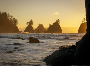
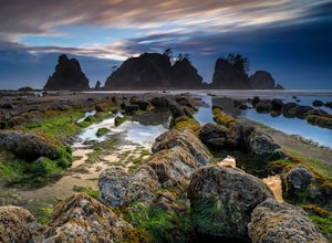
Hike to Shi Shi Beach - Point of the Arches
5.08 mi / 200 ft gainShi Shi offers an incredible reward for those who feel like venturing out a bit further and reaching a less accessible beach on the Olympic Coast, just be sure to time your hike with the low tide! The trail starts off near the fish hatchery on the Makah Indian Reservation. To get there from Port ...Read more -
Neah Bay, Washington
Backpack and Camp at Shi Shi Beach
5.04 mi / 200 ft gainIntroduction:My friends and I decided to head out to the Pacific Northwest (PNW) from Philadelphia to do some backpacking and beach camping. We choose Shi Shi Beach for it's terrific beach camping and extraordinary photography potential. Here is a rundown of the out and back, 2-night backpackin...Read more -
Port Angeles, Washington
Mount Storm King
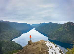
4.73.91 mi / 2251 ft gainThe trailhead is located right next to the Storm King ranger station adjacent to Lake Crescent right off Hwy 101 just past Port Angeles if heading West. It shares the same trail as, and breaks off left from the Marymere Falls trail (also worth seeing) about a quarter mile in (look for signage). ...Read more -
Port Angeles, Washington
Marymere Falls
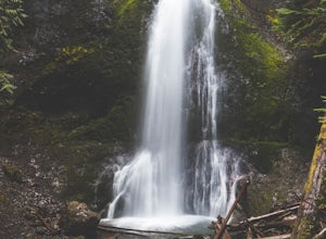
4.31.93 mi / 531 ft gainMarymere Falls (90 ft.) is located in Olympic National Park, near Lake Crescent. The falls can be accessed by a short, well-maintained dirt trail through old-growth lowland forest consisting of fir, cedar, hemlock, and alder trees. The creek descends from Aurora Ridge and tumbles over Marymere Fa...Read more -
Port Angeles, Washington
Spruce Railroad Trail
3.011.36 mi / 1138 ft gainThis versatile trail can adapt to your needs. It's can be an out-and-back hike, so you can make it as long as you like. If you do full distance, you are looking at an 8 mile day... OR, if you have two cars, you can park a car at either end of the trail and make it a 4 mile one-way hike. This des...Read more -
Neah Bay, Washington
Hobuck Beach
4.0Cape Flattery, the most northwesterly point of the lower contiguous 48 states is accessed via an easy trail which includes many board walks and sets of stairs. Maintained by the Makah Tribe of Indains, the trail provides spectacular views of the Pacific Ocean, Tatoosh Island, nearby rocky cliffs...Read more -
Neah Bay, Washington
Cape Flattery
4.62.09 mi / 528 ft gainDid you know that Cape Flattery is the northwesternmost point in the continental United States? This is the place where the Straight of Juan de Fuca collides with the Pacific, creating strong currents and loud crashing waves. This short and accessible hike leads you through a forest to an unfor...Read more -
Port Renfrew, British Columbia
Hike to Mystic Beach
5.0Head west from Victoria along Highway 14 past Sooke and Jordan River until you see the Juan De Fuca Marine Trail - China Creek trailhead about 5km past Jordan River on the West Coast Road. Ample signage, parking, and outhouses are available here.The trail taking you to Mystic Beach is just one s...Read more -
Shirley, British Columbia
Beach Day at Sandcut Beach
The adventure begins during the rugged wooded hike from the gravel parking lot to the stunning beach (10 minutes). Once you reach the stone and pebble beach, plant yourself down to enjoy the 180 degree view of the Juan de Fuca Strait (and a picnic lunch if you’ve come prepared!).Head east to find...Read more -
Port Angeles, Washington
West Elwha River Trail
5.06.11 mi / 1198 ft gainWest Elwha River Trail is an out-and-back trail that takes you by a river located near Port Angeles, Washington.Read more -
Port Angeles, Washington
Wolf Creek Trail
8.12 mi / 3970 ft gainTo tackle the Wolf Creek Trail, you start by winding up Whiskey Bend Road just outside of Port Angeles, falling the curves and hills of Elwha River. The peaks of the Olympic Mountains stand in the distance.Once you approach a clearing and small parking area, you grab the gear and hit the trail. T...Read more -
Port Angeles, Washington
Humes Ranch and Goblin Gates
6.4 mi / 994 ft gainThe Elwha River Trail cuts south into the heart of Olympic National Park along a densely forested valley, following the same route taken by some of the earliest explorers of the Olympic Peninsula at the end of the 19th century. Past Port Angeles, at a hard curve in US-101, take Olympic Hot Sprin...Read more -
Port Angeles, Washington
Olympic Hot Springs
3.721.52 mi / 3556 ft gainA local favorite, this moderate day hike winds its way uphill from the Appleton Pass trailhead through old growth stands of fir, hemlock and cedar for 2.2 miles to a cluster of hot springs interspersed among the trees. Note: This route is now closed due to a washed out road. The current route is ...Read more

