Lewis County, Washington
Looking for the best photography in Lewis County? We've got you covered with the top trails, trips, hiking, backpacking, camping and more around Lewis County. The detailed guides, photos, and reviews are all submitted by the Outbound community.
Top Photography Spots in and near Lewis County
-
Carbonado, Washington
Hike the Upper Foothills Trail along the Carbon River
10 mi / 30 ft gainThe upper Foothills Trail from the Fairfax Bridge to Manley Moore can be hiked starting from either end as an "out and back" hike or a "point to point" by shuttling with two vehicles. Starting from the upper end of the trail you begin by walking under the Kolisch Rd. Bridge, which has the Manley...Read more -
Cougar, Washington
Mount St. Helens Summit via Monitor Ridge
4.48.64 mi / 4652 ft gainMonitor Ridge is the "easiest" of the routes one can take in order to claim that they have stood on top of the sleeping giant better known as Mount St. Helens. This route is heavily favored over Worm Flows as the starting elevation is not only an additional 1,000 feet higher but the overall asce...Read more -
Packwood, Washington
Summit Castle Peak, Mount Rainier NP
4.06 mi / 1400 ft gainStart this route at the Narada Falls Parking lot. This route starts by following Stevens Canyon Road until you arrive at Reflection Lakes after 1.5 miles. About halfway along the lakeshore a path breaks off to the right into the forest. This is a popular route so there is often a snowshoe path be...Read more -
Packwood, Washington
Ski Tour to The Castle & Pinnacle Peak
4 mi / 1200 ft gainEnter Mount Rainier National Park via the Nisqually Entrance outside of Ashford. Drive past Longmire and continue heading up towards Paradise. Parking for this trip can be found at Narada Falls. From the Narada Falls parking lot you will head up to the closed for the winter portion of Stevens Ca...Read more -
Ashford, Washington
Mowich Lake
5.01.56 mi / 92 ft gainNo need to for an entire day hike to enjoy wonderful reflections, crystal clear water, and beautiful scenery a few hundred feet from the parking lot! Park at the Mowich Lake Campground parking lot and follow signs for the Wonderland trail. You will begin your hike on the south side of the lake ...Read more -
Ashford, Washington
Hike to Spray Park
5.07 miThe trailhead to Spray Park begins at the Mowich Lake Campground (4,929 ft). You'll begin descending quickly for the first 0.1 miles until you reach the Wonderland Trail junction. Head left and make your way up a steady climb for the next 1.7 miles. The first stop you'll come across is Eagle Clif...Read more -
Ashford, Washington
Hike to Eunice Lake in Mt. Rainier NP
6.5 miStarting out from the beautiful Mowich Lake (4,929 ft), this hike takes you through some of Mt. Rainier Nation Park's best scenery. Thanks to the 13 miles of dirt roads it takes to even get to the trailhead, this hike is also rarely crowded. At 6.5 miles roundtrip to Eunice Lake, this is a grea...Read more -
Ashford, Washington
Tolmie Peak's Fire Lookout
4.45.73 mi / 1250 ft gainMount Rainier is spectacular to look at, but sometimes the best views aren't from on its slopes, but just a little ways away. Tucked in the seldom-visited northwest corner of Mount Rainier National Park, the Tolmie Peak fire lookout frames the mountain's rugged slopes with a pristine alpine lake ...Read more -
Packwood, Washington
Hike Tatoosh Ridge from Tatoosh Trail #161
12 mi / 4100 ft gainAt the trailhead kiosk be sure to get one of the provided (and required) self-serve Wilderness Permit. Starting at the trailhead begin your initial accent following the marked trail on the side of the road. In the first two 2.5 miles you will climb 2,745 feet, it's hard but luckily a majority of ...Read more -
Ashford, Washington
Snowshoeing the Nisqually Vista Loop at Mt. Rainier NP
4.01.4 miMt. Rainier rises over 14,410 feet and the views you get from the Paradise area on the South side of the mountain are unparalleled. Paradise is one of the few places in Mt. Rainier National Park that is open to visitors during the winter months for cross country skiing, snowshoeing, sledding, and...Read more -
Packwood, Washington
Explore Reflection Lakes
4.3Reflection Lakes is located approximately 1 mile east of Inspiration Point just off Steven Canyons Road in the Paradise section of Mount Rainier National Park. Simply park in one of the pullouts at the lakes and enjoy the scenery. Reflection Lakes can also be accessed via the Wonderland Trail.T...Read more -
Packwood, Washington
Lakes Trail Loop
5.34 mi / 1381 ft gainThe Lakes Trail Loop can be accessed two ways. You can either start in Paradise and find one of the multiple points along the Skyline Trail or you can begin at Reflection Lake. My recommendation for a nice day hike is to begin at Reflection Lake. If you arrive by 8am you should have an easy time...Read more -
Packwood, Washington
Hike Pinnacle Peak, Mt. Rainier NP
4.82.5 mi / 1050 ft gainThis trailhead is easily accessed at the parking lot at Reflection Lakes in Mount Rainier National Park. A short but sweet hike (1.3 miles one way) that leads to beautiful views of Rainier, Mount Adams, Mount St. Helens, and if clear enough, Mt. Hood (Oregon). Pinnacle itself can be climbed to su...Read more -
Cougar, Washington
Hike the Lava Canyon
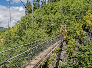
3.06.5 miStarting at the Lava Canyon Trailhead, you will walk on a paved trail down a few switchbacks until you reach the river, where you can go right or left. Either way takes you to the suspension bridge, but I recommend going right if you are following this guide. It will make more sense in a moment.A...Read more -
Ashford, Washington
Winter Camp at Glacier Vista
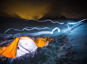
5.03 mi / 1000 ft gainIt's always a good idea to check the weather, but when it comes to getting a peak at Mt. Rainier you might be better off just showing up and hoping for a miracle. To do this from Seattle, you'll have a 2 hour 20 minute drive down I-5 and WA-167. After a couple turns here and there (you can follow...Read more -
Ashford, Washington
Skyline Loop in Mt. Rainier NP
4.55.65 mi / 1722 ft gainThe trailhead to Skyline Trail is located at the north side of the upper parking lot near the Visitor Center and Paradise Inn. You'll see that it breaks off into many other small trails if you want, as well. However, this 5.5 mile hike alongside Nisqually Glacier is classified by the rangers at...Read more

