Port Angeles, Washington
Top Spots in and near Port Angeles
-
Victoria, British Columbia
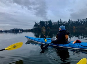
Paddle Victoria Harbour's Waterways
Victoria Harbor located on the southwestern tip of Vancouver Island, British Columbia is the southernmost port in Canada. Enjoying a moderate climate year round, one will quickly see why it is also known as Canada's busiest port. Pleasure boats, water taxis, large car and passenger ferries, tugbo...Read more -
Port Angeles, Washington
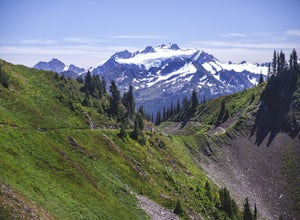
High Divide and 7 Lakes Basin
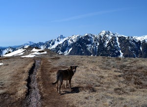
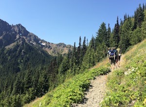
5.019.93 mi / 5056 ft gainA day spent plying the trails of the High Divide in Olympic National Park changes an outdoorsman. This moderate to strenuous loop boasts the best views on the peninsula, a chance to see foraging black bears and abundant deer, stunning waterfalls and marvelous old growth forests. By the time you f...Read more -
Port Angeles, Washington
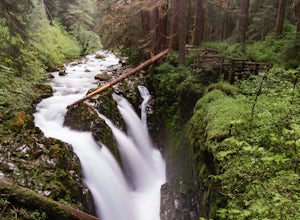
Sol Duc Falls and Deer Lake
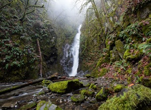
4.67.17 mi / 1729 ft gainThe hike to Sol Duc Falls is a simple 0.8 mile walk to a roaring falls on the Sol Duc River. If you’re up for more of a hike, continue on the trail to Deer Lake from Sol Duc Falls. At the fork in the trail, turn left and hike up away from the Lover's Lane Trail. The trail steepens and the rocky ...Read more -
Port Angeles, Washington
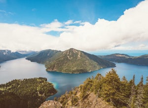
Camp at Fairholme Campground
3.0The campground is right at the very north end of Lake Crescent. It has bathroom and potable water, and for just $20 a night I think it is well worth it. Each campsite is equipped with a table and firepit (bring firewood). Open between May and October; first come first serve. As for activities, t...Read more -
Port Angeles, Washington
Ancient Groves
5.00.49 mi / 105 ft gainGreat little hike to explore while in the Sol Duc area. I would strongly recommend doing this hike near sunset as the sun will stream through the trees and light everything up in a beautiful glow. The hike will take you to a cliff edge to walk along and get views of the Sol Duc river below. Ver...Read more -
Sooke, British Columbia
Hike Mount Manuel Quimper
The Sooke Hills is a geographic region of low hills with elevations between 350m (Mt. Wells) to a high of 682m (Mt. Empress), located in the area bounded on three sides by Highway 1 to the east, Highway 14 to the south and the Sooke River to the west. Though heavily logged 100+ years ago, in the ...Read more -
Victoria, British Columbia
Hike around Thetis Lake
4.51.9 mi / 196.9 ft gainTake Highway 1 west from Victoria. Turn onto Exit 10 (View Royal/Colwood) and continue on the Island Highway. Turn right at Six Mile Road, which leads straight to Thetis Lake Regional Park.Note that this park is also accessible by bike via the Galloping Goose Trail.With minimal elevation (~60m) a...Read more -
Sooke, British Columbia
Hike and Swim at Sooke Potholes
4.2The Sooke Potholes seem to have something for everyone. Those seeking quick and easy beach access can enjoy short, well-groomed trails that lead straight to the pebble beaches from each of this spot’s multiple parking lots. There are also a number of paths leading to viewpoints overlooking the ri...Read more -
Langford, British Columbia
Hiking the Goldmine Trail
4.52.2 mi / 295.3 ft gainGoldstream Provincial Park is just a short drive from Victoria. Within 20 minutes of leaving the city center, you can be immersed in an old growth temperate rain forest.From Victoria, take the Trans-Canada highway to the start of the Malahat. The Goldstream day use area is well marked. Stop here ...Read more -
Quilcene, Washington
Mount Townsend
8.59 mi / 2949 ft gainThere are four trailheads that guide you to the top of Mount Townsend, but the most popular choice is to begin at the Upper Trailhead Trail #839 (snow permitting). The trail gradually climbs while traversing through forested area. While walking through the fir and hemlock trees, you pass three ...Read more -
Langford, British Columbia
Hiking Mt. Finlayson
4.0Mount Finlayson in Goldstream Provincial Park is 19 km north of Victoria on Hwy 1. The trail takes you up to a scenic lookout of Victoria. For the majority, this trail is quite easy, however, it gets slightly more challenging toward the end when the terrain gets steeper.Park at Goldstream Provinc...Read more -
Quilcene, Washington
Marmot Pass via Big Quilcene Trail
5.010.5 mi / 3481 ft gainThis trail has a nice, steady climb that's perfect for beginner or intermediate backpackers. The first 2.5 miles follow a forest trail along the Big Quilcene River. For the next 3 miles, the trail flows in and out of shaded trees, over a small talus field, and through a meadow before the final ac...Read more -
Quilcene, Washington
Buckhorn Mountain
12.26 mi / 4429 ft gainThe climb to Buckhorn Mountain above Marmot Pass is a must see for every PNW adventurer with the endurance to tackle nearly 14 miles and 4,400 feet of gain. Listen to the rushing waters of the Big Quilcene River as the trail gently traverses up 5.5 miles to Marmot Pass. Be sure to filter water ...Read more -
Quilcene, Washington
Backpack to Marmot and Constance Passes
24 mi / 5200 ft gainThe secret to this trip: Marmot Pass and Boulder Shelter, where you can camp on National Forest Service land. Multiple excellent, large backpacking sites sit just on the edge of the National Park, giving you great access to Mt. Constance and Mt. Deception, two of the tallest peaks in the Olympics...Read more -
Forks, Washington
Backpack the Hoh River Trail
5.035.69 mi / 5948 ft gainGrab a permit on your way in at the Wilderness Information Center (WIC) in Port Angeles or at the Quinault USFS/NFS Recreation Information center before parking at the Hoh Rain Forest Visitor Center and use the wash station and rest room before you head out on the trail. The first five miles of...Read more -
Forks, Washington
Hike the Hoh River Trail to Five Mile Island
10.6 mi / 300 ft gainOlympic National Park was established to preserve “the finest example of primeval forest” and so the Hoh Valley remains much like it has for thousands of years. This is the best trail to experience the magic of Hoh Valley, the grandeur of its old growth trees, lush understory and iridescent glaci...Read more

