Randle, Washington
Looking for the best camping in Randle? We've got you covered with the top trails, trips, hiking, backpacking, camping and more around Randle. The detailed guides, photos, and reviews are all submitted by the Outbound community.
Top Camping Spots in and near Randle
-
Eatonville, Washington
Hike to Gobbler's Knob
4.05 mi / 1500 ft gainEntering the Park from the Southwest Entrance, bear left when you approach the forking Westside Rd. This road has been closed a few miles in due to massive rockfall. When you reach the road closure, just park along the side of the road. In Spring and Summer, you should be able to see plenty of ot...Read more -
Packwood, Washington
Snow Lake Trail
3.82.12 mi / 427 ft gainSnow Lake is a beautiful lake in Mount Rainier National Park in Washington. You can do the 2.6 mile roundtrip hike to the lake as either a day trip or as a backcountry camp. To camp at one of the two sites on the lake you must secure a permit from the permit office at Longmire. The hike to the s...Read more -
Ashford, Washington
Winter Camp at Glacier Vista
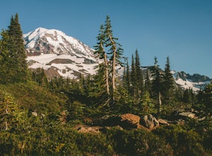
5.03 mi / 1000 ft gainIt's always a good idea to check the weather, but when it comes to getting a peak at Mt. Rainier you might be better off just showing up and hoping for a miracle. To do this from Seattle, you'll have a 2 hour 20 minute drive down I-5 and WA-167. After a couple turns here and there (you can follow...Read more -
Ashford, Washington
Skyline Loop in Mt. Rainier NP
4.55.65 mi / 1722 ft gainThe trailhead to Skyline Trail is located at the north side of the upper parking lot near the Visitor Center and Paradise Inn. You'll see that it breaks off into many other small trails if you want, as well. However, this 5.5 mile hike alongside Nisqually Glacier is classified by the rangers at...Read more -
Ashford, Washington
Backpack the Wonderland Trail
4.890 mi / 22000 ft gainPossibly one of the greatest loop hikes in the Lower 48, this trail sees a lot of use. You won't be alone out there, but opportunities for solitude are abundant with a little effort. The crowds show up for good reason - it's incredibly beautiful, relatively wild, and about as close to feeling l...Read more -
Ashford, Washington
Mt. Rainier via Disappointment Cleaver
4.314.9 mi / 8993 ft gainMt. Rainier is a technical climb on all routes and is covered with glaciers all four seasons. It is not a mountain to learn mountaineering unless you hire a guide service who will help guide you up the mountain. With good weather and previous mountaineering experience, Mt. Rainier's Disappointmen...Read more -
Randle, Washington
Goat Lake-Jordan Basin Loop
5.012.58 mi / 2703 ft gainThis is one of my favorite hikes for Washington State. Aside from the massive volcanoes hanging out down here, the southern region of the cascades is much more tame compared to areas further north. As I mentioned in my Old Snowy report, a jaw dropping side trip from the loop trail, the Goat Rocks...Read more -
Randle, Washington
Summit Old Snowy Mountain
5.017 mi / 3800 ft gainThe hike begins just outside of Packwood, Wa at the Berry Patch Trailhead Trail #96, sitting pretty at about 4200ft. The Goat Lake/Jordan Basin loop trail starts here, leading to Old Snowy. The magical Goat Rocks Wilderness area is just southeast of Mt. Rainier. It also lies right in the crosshai...Read more -
Lewis County, Washington
Hike Indian Bar - Cowlitz Divide via Box Canyon
14.64 mi / 4235 ft gainThere are multiple ways to access Indian Bar. This one starts at Box Canyon. From the parking area at Box Canyon walk across the road and follow the signs for Wonderland Trail. Head up the Wonderland trail through the trees to the split with the Cowlitz trail. Continue on the Wonderland Trail...Read more -
Toutle, Washington
Mount Margaret's Ridge Camp via Coldwater Trailhead
3.57.12 mi / 1634 ft gainThe hike is relatively easy. I'd say intermediate due to the incline at the beginning. Also intermediate due to it being an backpacking camp adventure. A friend of mine and I backpacked in to shoot the sunset and sunrise. We went a little early in the season so it was also to scout for future ad...Read more -
Toutle, Washington
Backpack to Snow Lake by Mt. Whittier
5.016 mi / 2700 ft gainThe Coldwater Lake Recreation Area has restrooms, telephones, and a picnic area. Make sure you have already acquired your permits for camping in the Mt. Margaret back country.Follow trail #211, which runs along the entire 4.5 mile length of Coldwater Lake. It is a beautiful and fairly flat hike w...Read more -
Randle, Washington
Hike to Goat Lake, Goat Rocks Wilderness
3.710.5 mi / 1400 ft gainThe trip to Goat Lake starts at the Walupt Lake campground parking lot. You will start on the Walupt Lake Trail (#101) and a short distance from the campground, take Trail #98 (Nannie Ridge) as it branches off and climbs steeply northeast onto an open, scenic ridge top.Continue on to Sheep Lake, ...Read more -
Skamania County, Washington
Camp at Takhlakh Lake
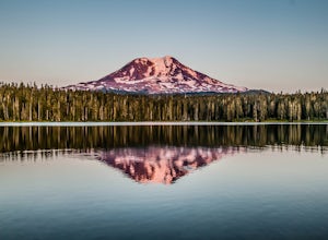
5.0Takhlakh Lake is located 7 miles NW of Mt Adams with a 53 site campground on the west side of the lake as well as a day use picnic area.The campground features a boat ramp and a wheelchair-accessible 1.1 mile flat trail, which encircles the lake, and accesses the Meadows Trail that climbs up to t...Read more -
Skamania County, Washington
Climb Mount Adams North Cleaver Route
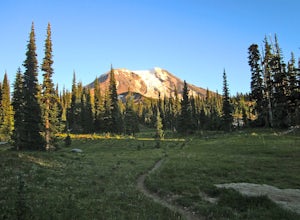
5.017 mi / 7800 ft gainMt Adams is the second tallest volcano in the Cascades and is one of the easiest to climb. There are two main nontechnical routes up Mt Adams, the well-known and crowded route on the south face, and the lesser traveled north cleaver route. The north cleaver offers solitude, views of Rainier, high...Read more -
Skamania County, Washington
Hike to Lewis River Falls
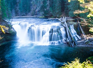
4.3Distance: 5.4 milesElevation Change: 500ftThis Lewis River hike starts at Lower Falls then follows the Lewis River Trail #31, detours up to Copper Creek, before returning back to the main trail for the magnificent Upper Falls. Enticing views of the crystalline water in the Lewis River will make y...Read more -
Ashford, Washington
Hike to Spray Park
5.07 miThe trailhead to Spray Park begins at the Mowich Lake Campground (4,929 ft). You'll begin descending quickly for the first 0.1 miles until you reach the Wonderland Trail junction. Head left and make your way up a steady climb for the next 1.7 miles. The first stop you'll come across is Eagle Clif...Read more

