Ronald, Washington
Looking for the best backpacking in Ronald? We've got you covered with the top trails, trips, hiking, backpacking, camping and more around Ronald. The detailed guides, photos, and reviews are all submitted by the Outbound community.
Top Backpacking Spots in and near Ronald
-
Ronald, Washington
Climb Mt. Daniel via the Southeast Ridge
5.016 mi / 6000 ft gainFar from the iconic skyline of Seattle, on King County's Eastern boundary, is a lesser known natural skyscraper named Mt. Daniel. At 7960 feet plus, Mt. Daniel's true summit effortlessly juts into the sky as King County's tallest point.From Roslyn, head North for roughly 15 miles on Salmon La Sac...Read more -
Ronald, Washington
Backpack to Circle Lake, Alpine Lakes Wilderness
16 mi / 2800 ft gainStart at the Cathedral Rock Trailhead and start to head up the long switchbacks. After running into the Trail Creek trail, keep right heading towards Cathedral Rock and Squaw Lake. There are a couple nice spots around Squaw Lake, about 2.5 miles in, to stop and have a snack. Now head around the l...Read more -
Ronald, Washington
Hike to Dip Top Gap
25 mi / 5000 ft gainThis is a great side trip from Backpacking to Marmot & Jade Lakes. Check out the Adventure linked above for directions on how to get as far as Jade Lake. I would recommend 2 nights at either Marmot or Jade to allow for a full day of exploration from your camp. From Jade what is described be...Read more -
Ronald, Washington
Winter Backpack to Jade Lake
4.022 mi / 4000 ft gainStarting at the Hyas Lake trailhead north of Cle Elum, it's a meandering easy hike through the woods for about 5.0 miles up to Deception Pass. You gain 1100 feet through this first five miles to the junction with the PCT. From here take a left to continue on the Lake Clarice Trail towards Marmot...Read more -
Leavenworth, Washington
The Enchantments: Stuart Lake Trailhead to Snow Lake Trailhead
5.018.02 mi / 4626 ft gainThere are a couple different ways to tackle this hike through the stunning Central Cascade region. I recommend checking out this handy resource for more detailed info. Bottom line: this is an absolutely amazing hike for people willing to take a little bit of an ass kicking. Aasgard Pass rises 1,...Read more -
Leavenworth, Washington
Scramble to the Summit of Dragontail Peak
16 mi / 7000 ft gainGetting There From Leavenworth, WA, drive Icicle Creek Road for 8.5 miles until you reach Bridge Creek Campground. Turn left here onto Forest Service Road #7601 signed for the Stuart Lake Trailhead. The pavements ends and the road gains elevation quickly as your car transports you high above the ...Read more -
Leavenworth, Washington
Hike to the Enchantments' Horseshoe Lake
1.016 mi / 6000 ft gainGetting There From Leavenworth, WA, drive Icicle Creek Road for 8.5 miles until you reach Bridge Creek Campground. Turn left here onto Forest Service Road #7601 signed for the Stuart Lake Trailhead. The pavements ends and the road gains elevation quickly as your car transports you high above the ...Read more -
Leavenworth, Washington
Climb to the Summit of Colchuck Peak
12.5 mi / 5300 ft gainGetting There: From US2 in Leavenworth, Washington, turn onto Icicle Creek Rd. Drive 8.2 miles and turn left on Forest Service Road 7601—you might be able to spot it more easily as the turnoff for the Bridge Creek Campground. In 3.7 miles, you'll arrive at the Stuart Lake Trailhead parking lot; w...Read more -
Leavenworth, Washington
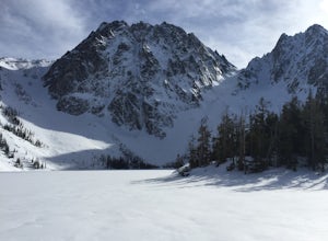
Snowshoe to Colchuck Lake
3.316 mi / 3000 ft gainFrom Leavenworth, head south on Icicle Creek rd for 8.2 miles until you reach USFS rd 7601. This road isn't plowed and is blocked by a locked gate about one quarter mile from where it intersects with Icicle Creek Road (usually from November to May), so parking at the intersection is probably your...Read more -
Leavenworth, Washington
Backpack to Ingalls Creek
3.011 mi / 1450 ft gainAs attempting to find a good overnight spot, I stumbled upon the mostly overlooked Ingalls Creek trail. Seemingly easy to get to, this seemed like a solid option for Spring camping. When we arrived, there were about four other cars in the parking lot, and my guess is that was about how many cars ...Read more -
Leavenworth, Washington
Backpack to Lake Caroline in the Enchantments
5.75 mi / 3100 ft gainFrom Leavenworth, WA head down Icicle Creek road and head to the Eightmile Lake Trailhead.The backpack starts at roughly 3270 feet of elevation and the highest point of the hike is 6300 feet. To start you will hike through a very beautiful and forested area for a while before getting into a burn ...Read more -
Leavenworth, Washington
Eightmile Lake
4.06.76 mi / 1496 ft gainBeginning at the trailhead, fill out a self-issued permit allowing you to stay overnight. Start your trek heading upwards at an elevation of 3300 feet. As you become adapted to the trail, you will start to realize it is maintained and well groomed. In addition, The 1300 feet of elevation gained t...Read more -
Enumclaw, Washington
Backpack Noble Knob via Greenwater Trail
16.9 mi / 3920 ft gainFrom Greenwater heading south: Pass the fire station to FR 70 on the left. Follow FR 70 for about nine miles to FR 7033. Take a right and follow the road to the trailhead. Northwest Forest Pass required. The trail is in good shape and mostly flat to Greenwater Lakes which is great for families a...Read more -
North Bend, Washington
Kaleetan Lake via Denny Creek Trail
If you want to visit multiple lakes, get a view of or tackle a peak at Kaleetan, Chair, and Bryant, campgrounds for overnight or weekend adventures, fish in the lakes, explore off the trail and natural waterslides and picnic area waterfalls, this is for you. Denny Creek Trail offers it all! Afte...Read more -
North Bend, Washington
Upper Wildcat Lake
1.014.43 mi / 4370 ft gainAlthough this hike is possible if you’re looking for an all-day training hike, it’s much more enjoyable if it’s an overnight backpacking trip. Head up the trail past Snow Lake toward Gem Lake. En route to Snow Lake will be a little crowded, but should lighten significantly as you continue hiking...Read more -
North Bend, Washington
Gem Lake and Wright Mountain
4.710.62 mi / 3107 ft gainThe trail to Gem Lake lies along the same trail that passes by the incredibly popular Snow Lake. While the masses typically stop the first place they can along the shores of Snow Lake, fewer make the short trek from there up to Gem Lake. Park at the giant lots at the end of the road to Alpental (...Read more

