Snoqualmie Pass, Washington
Looking for the best hiking in Snoqualmie Pass? We've got you covered with the top trails, trips, hiking, backpacking, camping and more around Snoqualmie Pass. The detailed guides, photos, and reviews are all submitted by the Outbound community.
Top Hiking Spots in and near Snoqualmie Pass
-
Seattle, Washington
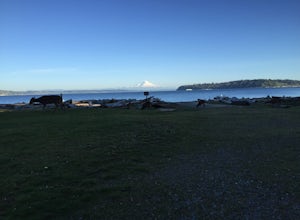
Camp on Blake Island
There are 2 ways to get to Blake Island: private boat or via the Argosy Cruises tour boat (or if you're ambitious, I guess you can swim there!). If traveling by private boat, there is a marina with limited dock space as well as buoy moorings around the island for a moorage fee. Blake Island is ...Read more -
Granite Falls, Washington
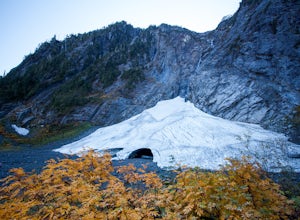
Big Four Ice Caves
4.32.38 mi / 289 ft gainDisclaimer: Hiking into the caves is extremely dangerous as there is potential for the ice to fall. We do not recommend hiking inside of them and if you choose to do so, you're doing it at your own risk. This is a short hike at just 2.3 miles roundtrip with little elevation change. The hike take...Read more -
Packwood, Washington
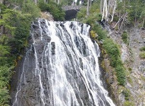
Carter & Narada Falls
3.05.81 mi / 1434 ft gainThis hike starts off with a bang! The first thing you do is walk out into a rocky riverbed and get an amazing view of Mt. Rainier. From there, you'll cross a long log bridge to get over the river and head into the woods. After 1.1 miles, you'll come across Carter Falls, and about 100 feet down t...Read more -
Ellensburg, Washington
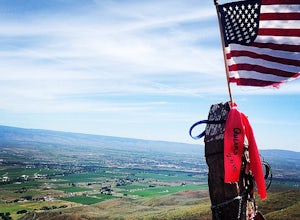
Hike Manastash Ridge
4 mi / 1700 ft gainManastash Ridge is a popular hike in Ellensburg, Washington, attracting many locals and students of Central Washington University. While attending school, I climbed the Ridge a handful of times, always with struggle. After making my resolution of 40 hikes in 2015, I decided to tackle this hike fo...Read more -
Darrington, Washington
Climb Sloan Peak via the Corkscrew Route
5.014 mi / 6035 ft gainYou'll start the approach to this climb at the Sloan Peak trailhead at 1800ft elevation. Moving south along the trail, you'll begin with a traverse through some marshlands and several water crossings along the Sauk River and its tributaries for the first mile and before gaining any elevation. It ...Read more -
Eatonville, Washington
Hike to Gobbler's Knob
4.05 mi / 1500 ft gainEntering the Park from the Southwest Entrance, bear left when you approach the forking Westside Rd. This road has been closed a few miles in due to massive rockfall. When you reach the road closure, just park along the side of the road. In Spring and Summer, you should be able to see plenty of ot...Read more -
Granite Falls, Washington
Dispersed Camp near Beaver Creek Group Camp, Mt. Baker Snoqualmie NF
This campsite is located along the Mountain Loop Highway. There are various options for dispersed camping around the area, as well as some you can reserve ahead of time such as the Coal Creek Campground and the Beaver Creek Group Campground. This campsite is located just before Beaver Creek grou...Read more -
Ashford, Washington
Snowshoe to Longmire Lookout
4.1 mi / 800 ft gainStarting at the Longmire Trailhead, cross the road and begin snowshoeing counter-clockwise on the Trail of Shadows. This first 0.5 miles begins the hike as a nice warm up where you can make sure your snowshoes are adjusted properly and stop from time to time to learn some facts from the interpre...Read more -
Ashford, Washington
Hike the Rampart Ridge Trail to Wonderland Trail Loop
6 mi / 1870 ft gainThis is a wonderful loop to do that avoids some of the crowds on the flatter trails and gives you an amazing view of the mountain. Park in the Longmire parking lot where the National Park Inn and Longmire Museum are. Walk across Paradise Rd E to join up with the Trail of the Shadows. Head north o...Read more -
Packwood, Washington
Hike Tatoosh Ridge from Tatoosh Trail #161
12 mi / 4100 ft gainAt the trailhead kiosk be sure to get one of the provided (and required) self-serve Wilderness Permit. Starting at the trailhead begin your initial accent following the marked trail on the side of the road. In the first two 2.5 miles you will climb 2,745 feet, it's hard but luckily a majority of ...Read more -
Wenatchee, Washington
Hike to Saddle Rock
3.02 mi / 920 ft gainStarting from the south end of Wenatchee, hike straight up the obvious wide trail to the south side of Saddle Rock. You'll wind around the iconic rock feature and approach it from the back. A short and steep hike will reward you with wide open views of the Wenatchee Valley as you crest the hill...Read more

