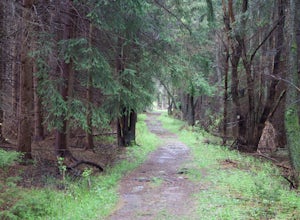
Lost City, West Virginia
Looking for the best photography in Lost City? We've got you covered with the top trails, trips, hiking, backpacking, camping and more around Lost City. The detailed guides, photos, and reviews are all submitted by the Outbound community.
Top Photography Spots in and near Lost City
-
Riverton, West Virginia
Spruce Knob Observation Tower
4.50.34 mi / 33 ft gainDriving to the top of Spruce Mountain is perhaps the most difficult part of the journey. Once at the top of Spruce Mountain, park and head south along a short, 0.2 mile long trail that leads to the official state highpoint of Spruce Knob. Be sure to find the USGS marker near the base of the obser...Read more -
Parsons, West Virginia
Hike Table Rock
4.71.2 mi / 200 ft gainThis hidden gem is located near Lindy Point and Blackwater Falls State Park. Unlike Lindy Point, which is very popular, hikers are usually able to enjoy the views from Table Rock all by themselves. The Table Rock trail head is located off of Canaan Loop Rd. I highly recommend driving to the tr...Read more -
Stanardsville, Virginia
Hike South River Falls
4.54.4 miThe trail head for the South River Falls Trail is located at mile marker 63 off of Skyline Drive via the South River Picnic Area. Loop around the picnic area until you reach the Eastern corner where you will find a sign and a map marking the beginning of the 4.2-mile trail. Over the first mile...Read more -
Madison, Virginia
Fly Fish on the Rapidan River
5.05 miPark at the Graves Mill Parking Area. From here you can easily follow the Rapidan River up the mountain. Fishing reports inform that the lowest concentration of brookies are at the lower boundaries of the park so take some time to enjoy the trail and hike up stream. At the lower boundaries you mi...Read more -
Front Royal, Virginia
Snowshoe the AT in G.R. Thompson
3 miThe G.R. Thompson is a piece of public land in Linden, VA, thats primarily used by hunters. The Appalachian Trail runs right through this section and visiting during a fresh snowfall can make for a great adventure. Only 60 minutes drive from greater Washington DC area, this is an easy adventure! ...Read more -
Whitmer, West Virginia
Spruce Knob Lake Loop
4.00.96 mi / 13 ft gainSpruce Knob Lake is located just below the peak of Spruce Knob at 3,840’, making it the highest lake in West Virginia. If you are not camping in the campground, there is a parking lot/boat launch located near the dam. If you are camped in the campground, there is a trail that leads from the campg...Read more -
Free Union, Virginia
Photograph Brown Mountain Overlook
At mile post 77 off of Skyline Drive, Brown Mountain Overlook offers photographers a western view of the Blue Ridge Mountains, Shenandoah National Park, and the Shenandoah Valley. At 2,840 feet, Brown Mountain Overlook is one of 72 beautiful overlooks that are on Skyline Drive located in the nort...Read more -
Delaplane, Virginia
Relax at Lake Thompson
Lake Thompson is a great spot for fishing, walking, or just exploring the area with your dog. I've never had a problem with parking, but you're unlikely to find yourself alone at the lake on a nice weekend day. Its a 10-acre lake, however, so you shouldn't have a problem carving out a little bit...Read more -
Marshall, Virginia
Hike to the Piedmont Overlook
5.00.61 mi / 400 ft gainIn just a .61 mile trail, Piedmont Overlook has so much to offer in terms of views and although it is fairly steep, anyone can do it! After arriving at Sky Meadows State Park start heading up to the white park office building, this is where the trail begins. To get to the trail head follow Bosto...Read more -
Oldtown, Maryland
Hike to Paw Paw Tunnel
3.82.4 miThis hike is short and sweet, with it only being 2.4 miles to the other side of the tunnel and back. It's easily accessible, located right off the highway at the Paw Paw Tunnel Campground on the Potamac River at the border of Maryland and West Virgina. The town of Paw Paw is on the West Virgina s...Read more -
Free Union, Virginia
Hike Frazier Discovery Trail
5.01.3 mi / 950 ft gainThere are two ways to the summit: the first is a 1.3 mile loop that starts at the Loft Mountain Wayside parking lot at mile marker 79.5 off of Skyline Drive in the southern district of Shenandoah National Park. The second way is a 3.7 mile hike out and back from the Loft Mountain Campground, but...Read more -
Crozet, Virginia
Hike to Doyles Falls
4.93.2 mi / 1190 ft gainFrom the parking lot at MP 81.1 on the Skyline Drive, take the trailhead to the left of the sign with the trail map. Immediately you'll cross over the Appalachian Trail-stay straight on the blue-blazed trail to Doyles Falls. The trail will descend rapidly for 1.3 miles to Upper Doyles Falls (28' ...Read more -
Appalachian Trail, Virginia
Blackrock Summit, Shenandoah NP
4.71.11 mi / 253 ft gainThere are two route options, both are under 2 miles and are suitable for hikers of all experience levels. The shortest option, a 1-mile circuit, follows the Appalachian Trail from the Blackrock Summit parking area, which is just north of mile marker 85 on Skyline Drive. With only 175-feet of ele...Read more -
Oakland, Maryland
Hike the Herrington Manor/Swallow Falls Trail
5.011 mi / 25 ft gainI began my adventure at the trailhead in Herrington Manor State Park. The parking lot was empty and the trail was very easy to access. From start to finish this trail varies in the width of its path. For the first mile I had a lot of foot room, but as I went deeper into the forest, the trail turn...Read more

