Wilson, Wyoming
Looking for the best hiking in Wilson? We've got you covered with the top trails, trips, hiking, backpacking, camping and more around Wilson. The detailed guides, photos, and reviews are all submitted by the Outbound community.
Top Hiking Spots in and near Wilson
-
Wilson, Wyoming
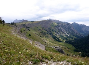
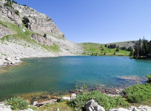
Hike to Ski Lake
4.34.4 mi / 455 ft gainThis is a great hike that is just a few minutes from Wilson, WY. This trail is used more by locals than visitors to the area, but is a great one to check out if you are nearby. The views are incredible and the lake at the top is pretty cool, too.There is easy access from Teton Village and Jackson...Read more -
Wilson, Wyoming
Hike Mt. Glory
5.02 mi / 1650 ft gainDepending on how old your vehicle is, this hike could be as difficult for your rig as it is for you. At the top of the Pass, there is a generously-sized parking area. The unmarked trail for Mt. Glory is on the opposite side of the road, and you can't miss it if you look for the yellow speed limit...Read more -
Alta, Wyoming
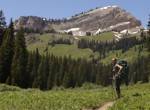
Hike Coal Creek Trail
Imagine hiking through the expansive valleys of wildflowers and evergreen forests with grand views of the Tetons. That is exactly what this trail provides. The coal creek trail is an access trail to many other great trails throughout the Bridger-Teton National Forest. This gives the adventurer th...Read more -
Alta, Wyoming
Taylor Mountain via Cole Creek
8.76 mi / 3261 ft gainThe Coal Creek Trailhead is at 7,250 feet. Follow the trail as it goes up Coal Canyon and through Coal Creek Meadows. Taylor mountain is the peak on the left side of the canyon as you climb. When you come to a fork at 2.5 miles (just after the meadow), take the left fork (toward the west) to begi...Read more -
Teton Village, Wyoming
Teton Crest Trail
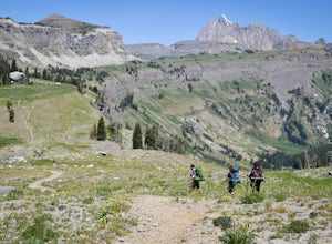
5.025.35 mi / 9681 ft gainThe Teton Crest Trail has several variations that allow the hiker to enter and exit through different canyons. The classic trail begins at the Phillips Pass Trailhead and comes to a close at Paintbrush Divide. Many hikers choose to take the Teton Village Tram up to Marion Lake and join up with th...Read more -
Jackson, Wyoming
Backpack to Marion Lake
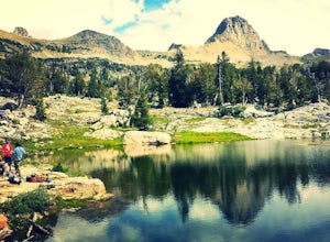
4.013.73 mi / 3409 ft gainMarion Lake is one of Grand Teton National Park’s many spectacular high altitude lakes. The lake sits above Granite Canyon, and next to sweeping meadows that are loaded with colorful wildflowers during July and August. Campsites at the lake may be available by obtaining a backcountry permit from ...Read more -
Teton Village, Wyoming
Hike the Granite Canyon Trail
3.013.14 mi / 1703 ft gainThe Granite Canyon Trail is located near Teton Village, Wyoming and is best for experienced hikers. The trail is typically trafficked from March until August. This hike can be shortened by taking the tram in Teton Village to the top of Rendezvous Mountain, and then hiking down to Marion Lake and ...Read more -
Jackson, Wyoming
Granite Canyon to Death Canyon Loop
4.525 mi / 4000 ft gainThis fairly easy 2-night backpacking trip in the Tetons can be started around noon, allowing you to finish around noon, 2 days later. From the visitor center, obtain a permit for 2 nights. Ask for a first night at Marion Lake (the Granite Canyon campsites are not my favorites), and for a second ...Read more -
Jackson, Wyoming
Hike the Rockefeller Preserve Loop
4.33 miThe Rockefeller Preserve loop starts from a gravel trail that begins in the parking lot. The gravel pathway leads to a meadow and then goes right up to the visitor center. From the visitor center the trail continues to a thick forest that parallels the scenic Lake Creek. The trail leads around th...Read more -
Teton County, Wyoming
Camp at Curtis Canyon Campgrond
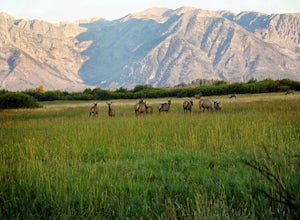
Enjoy a leisurely drive through the National Elk Refuge as you leave Jackson, Wyoming for Curtis Canyon Campground. A short walk from the campground provides epic views of the Teton Range and the National Elk Refuge. Pour a cup of coffee and enjoy! Curtis Canyon Campground is part of the Bridger-...Read more -
Alta, Wyoming
Death Canyon to Fox Creek Pass
5.018.15 miDay 1: This trip begins at the Death Canyon Trailhead. Try to arrive early, as it gets crowded and various groups day hike from here. After the first few miles, you’ll encounter Phelps Lake. You’ll have several opportunities for photos, and they will all be beautiful. As you continue on, be on t...Read more -
Alta, Wyoming
Hike to Phelps Lake
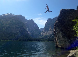
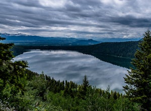
4.94.22 mi / 974 ft gainDon’t look down! You’re about to cliff jump 40 feet from a granite boulder into a lake cold with Glacier runoff. This short and beautiful hike, with a four hundred foot climb, will lead you to our favorite summertime activity…jumping and swimming! If you park at the Preserve trailhead, plan to g...Read more -
Alta, Wyoming
Patrol Cabin at Death Canyon via Death Canyon Trail
5.07.52 mi / 2000 ft gainYour adventure begins at 7,000 feet along lodge pole pines and small creeks. Just a few minutes into the hike, you will reach the Valley Trail Junction. Stay left and continue towards Death Canyon. The first mile of the trail climbs 400 feet through pine forests and aspen groves to the Phelps Lak...Read more -
Alta, Wyoming
Huckleberry Point via Death Canyon Trailhead
5.06.45 mi / 1401 ft gainGetting There: Coming from Jackson Hole, enter Grand Teton National Park and turn left onto Moose-Wilson Road. Continue southwest until you come to Death Canyon trailhead on your right. There is a large parking lot beside the trailhead, as well as bathrooms and picnic areas. The Trail: The ...Read more -
Alta, Wyoming
Backpack to Alaska Basin via Death Canyon
28.2 mi / 7500 ft gainDeath Canyon Trailhead is easily accessed by heading south on Moose-Wilson Rd. from Grand Teton National Park Headquarters for 3 miles. Once at the junction turn right onto an uneven dirt road and go north 0.7 miles to the parking area.Day 1: (8.3 miles) From Death Canyon Trailhead hike west for ...Read more -
Alta, Wyoming
Backpack to the Death Canyon Shelf
20 mi / 2700 ft gainIf you can snag a permit to camp at Death Canyon Shelf, consider yourself lucky. This backcountry camping zone holds some of the best sites in Grand Teton National Park. The shelf is a 3-mile stretch of the Teton Crest trail between Fox Creek Pass and Mount Meek Pass, and runs parallel to Death C...Read more
Top Activities
Let Adventure be your Destination in Wyoming
Wyoming’s wide-open spaces make it easy to get off the grid and on a trail, through a park, into a forest, up a mountain or down a river. During your journey through Wyoming’s Black to Yellow Region, discover geologic marvels, dense evergreen forests and sprawling prairielands.
Learn More

