
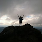
Mount Rogers via Appalachian Trail
Mouth of Wilson, Virginia
Details
Distance
9.1 miles
Elevation Gain
1549 ft
Route Type
Out-and-Back
Description
Added by Christin Healey
This trail is also the highest point in Virginia, and because of wildfires, it is all big skies and pine trees, making it feel like somewhere out west rather than Southern Virginia.
First of all, who doesn't love wild ponies! There are tons of ponies here, and although they are wild, they are not afraid of people and you can get pretty close (just don't feed them!).
Once you enter Grayson Highlands State Park, you will see a parking lot for Massie Gap a few miles in, park here. There is an obvious trail, the Rhododendron Trail, that you will follow for about .5 mile until you reach the AT. Turn left, follow the AT to Wilburn Ridge, go past the Thomas Knob Shelter until you reach the short spur that leads to the Mount Rogers summit. There are no real views at the summit, but plenty along the hike to get there. Round trip the hike is 10 miles.
In the springtime there are tons of rhododendron, blueberries in late summer, and fiery colors in the fall. To top it all off, there are plenty of great campsites and shelters as well as nearby water sources. Dogs are also welcome and from personal experience, love this hike :) This can also be done as a day hike if you don't want to camp.
Download the Outbound mobile app
Find adventures and camping on the go, share photos, use GPX tracks, and download maps for offline use.
Get the appFeatures
Mount Rogers via Appalachian Trail Reviews
This section of the AT is absolutely beautiful! I went during labor day weekend, the weather was perfect. I highly, highly recommend going to Scales (the old cattle ranch), and rather than camping directly at Scales, to walk up the horse trail, and camp up there. It is very secluded (minus the cows) and the camp overlooks the mountains, which makes for beautiful sunrises and sunsets. Also, take a look up at the sky at night, you won't be disappointed.
5.0

Hiked here for the first time in June 2015. I agree with review before me - good time to see all the foals out with their moms. Would love to camp next time, lots of well maintained areas as well as a shelter close to Mt. Rogers and surprisingly not that many people were out. We ended up doing this as a day hike and started a little bit later in the day (around 3). Had plenty of time to explore and complete the hike to be back at the car by dark. The weather is notorious here for changing quickly so always be prepared whether for just a hike or camping overnight (of course there is a huge sign at the park warning you of this as well). We finished this hike just in time before a huge summer storm moved in.
5.0
Did a very similar trip to this one (this section was incorporated into a longer backpacking trip) in late July. Many of the ponies had babies, and all were very inquisitive! We only met one other group of hikers making the experience all the more special. The views from the balds were simply spectacular, but hiking through the wooded sections also proved to be magnificent. Continuing along the AT to Buzzard Rock (great 360 views of surrounding ranges) would be a good addition to this hike.
5.0
Leave No Trace
Always practice Leave No Trace ethics on your adventures and follow local regulations. Please explore responsibly!
Nearby

Backpack the Grayson Highlands

Photograph Wild Horses at Grayson Highlands State Park

Hike and Fish Cabin Creek Trail

Rhododendron Trail to Rock Croppings

Wilburn Ridge and Massie Gap Loop

Twin Pinnacles via Big Pinnacles Trail
Community
Mobile Apps

© 2024 The Outbound Collective - Terms of Use - Privacy Policy