Hike Aravaipa Canyon
Winkelman, Arizona
Details
Distance
8 miles
Elevation Gain
200 ft
Route Type
Out-and-Back
Description
Added by Jeremy Meek
For a majestic wilderness canyon experience in Arizona without the hoards of people of Sedona or the Grand Canyon, look no farther than Aravaipa Canyon.
Welcome to the beauty of wilderness and serenity! Within the boundaries of Aravaipa Canyon, you will not find any designated trails, campsites, or facilities. This canyon is one of Arizona’s hidden gems, and it is not mentioned in many travel books or in international travel magazines – yet. The terrain is rugged so hikers should be in good condition to pass through dense, diverse vegetation of cacti, cottonwood, maples, reeds, sycamore and willow trees. From the west trailhead (2630′), hikers gain a gradual 430′ elevation over uneven, partly slippery terrain for about 11 miles to the east trailhead (3060′) - assuming you go the entire distance, which is only advisable if you are camping (not for day-use). No matter whether you plan to visit Aravaipa Canyon on a day trip or whether you choose to have some extended fun on a weekend backpacking trip, you will need a permit. You can buy them as early as 13 weeks in advance at www.recreation.gov. Get a permit as early as possible, especially for an over-nighter on the weekends because the number of daily visitors is limited, and permits will be fully committed quickly, particularly in peak season (autumn).
The 19,410-acre Aravaipa Canyon Wilderness is located about 120 miles southeast of Phoenix, in Pinal and Graham counties. Once you get close to Aravaipa, cell phone reception becomes spotty, and it is non-existent in the Canyon – the phone companies still have some work to do!
After you turn onto East Aravaipa Road, it is a 9 mile drive to the Brandenburg Ranger Station West and Campsite. After you get to the one-lane bridge, you’re only 2 miles from the trailhead. The pin on the below map marks the location of the trailhead parking area. Expect a 12-mile drive from highway 77 to the trailhead parking area, of which 8 miles is dirt road.
After about 10 minutes of hiking through some of the harsher elements of the desert from the trailhead, the tranquility of Aravaipa Creek and a canyon oasis will greet you. You can walk in the stream or on the footpaths alongside of it, take breaks and setup camp as you find opportunity. There is no way to get around walking through the creek at some point (you must get wet!). The pathways along the stream are lined with reeds and tall trees, which makes this an idyllic experience. Don’t forget that these are not maintained trails – which makes everything just a bit more adventurous!
When traversing the canyon, you may notice that a diverse group of people use this almost sanctuary-like location, including day hikers, campers, people meditating with drums/chimes, fathers and sons camping out by the creek, and photographers capturing the beauty of the autumn foliage. There were even a couple of birdwatchers observing the menagerie in this Sonoran Desert jewel. I encountered some hikers that were bushwhacking just to get through (they clearly were not familiar with Leave No Trace). This is actually not necessary, and if you find yourself needing to, you haven’t been keeping your eyes open for the informal trails and paths of least resistance.
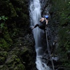
For a day trip, I recommend an 8-mile or so round trip without trying to explore any of the side canyons. If you have more time, especially if you want to spend a night or two in this serene nature, you can explore Virgin Canyon, or Horse Camp Canyon with its steep walls and stunning little waterfall. Climbing up towards the spring requires some skill, but it’s doable (BE CAREFUL!!!). Beware of dead, dry plants and loose rocks, which may make you slip.
For more detailed information, check out this post.
Download the Outbound mobile app
Find adventures and camping on the go, share photos, use GPX tracks, and download maps for offline use.
Get the appFeatures
Hike Aravaipa Canyon Reviews
Aravaipa Canyon is actually 12.5 miles from the West Trail head to the East trail head, not 8. There is no designated trail through the canyon as you are often walking in the water. However paths on the banks will often pop up on either side of the creek. I recommend backpacking in and camping to be able to explore more of the canyon
5.0
Leave No Trace
Always practice Leave No Trace ethics on your adventures and follow local regulations. Please explore responsibly!
Nearby
Hike Mint Springs Trail
Hike Incinerator Ridge to Leopold Point
Explore the Canyons and Caves of Red Knolls Amphitheater
Rock Climb the Hitchcock Pinnacle
Canyon Loop Trail in Catalina State Park
Romero Pools via Romero Canyon
Community
© 2024 The Outbound Collective - Terms of Use - Privacy Policy


