Landeck, Austria
Looking for the best hiking in Landeck? We've got you covered with the top trails, trips, hiking, backpacking, camping and more around Landeck. The detailed guides, photos, and reviews are all submitted by the Outbound community.
Top Hiking Spots in and near Landeck
-
Sankt Anton am Arlberg, Austria
Verwallsee St. Anton am Arlberg Loop
7.78 mi / 1020 ft gainStarting from central St Anton, head west and follow signs for the Rossanaweg. The gravel path will pass under two tunnels, and then continues up the river. Follow signs for Verwallsee. The path climbs at a reasonable grade up the valley, alternating between singletrack trail and gravel paths. Ev...Read more -
Sankt Anton am Arlberg, Austria
Maienweg Trail to St Christoph
3.85 mi / 1818 ft gainThis demanding, but scenic route ascends from St Anton to St Christoph. Begin in town, following the trail under the Galzigbahn to the Sennhütte. From here, the trail is a bit more gradual as it traverses the valley. Eventually, you'll take a sharp right turn and climb sharply up many switchbacks...Read more -
Sankt Anton am Arlberg, Austria
Arlenweg Loop
4.11 mi / 1165 ft gainArlenweg Loop, easily accessible from St Anton, has views aplenty. If you go counter-clockwise, you can start from anywhere in central St Anton and head towards Nasserein. Follow signs for the Arlenweg. The trail climbs through lush forest for a bit before leveling off to traverse the mountainsid...Read more -
Sankt Anton am Arlberg, Austria
Kaltenberghutte to Konstanzerhutte Loop
16.45 mi / 3389 ft gainI did this loop as a wonderful trail run, although it would also be possible to hike it in a long day, or split it up with a stay at Kaltenberghutte or Konstanzerhutte (book ahead). Starting at St Cristoph (a short bus from the center of St Anton), the trail climbs sharply before leveling out an...Read more -
Landeck, Austria
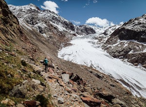
Hike to the Gepatschferner Glacier Tongue
4.2 mi / 1640.4 ft gainOnce you pass the toll station for the Kauntertal Glacier Road, you keep following the road past the reservoir and up to the waterfall and climbing garden. This is where you park the car and start the hike, following the signs for route 902 to the Rauhekopfhütte.For the first hour, your are mostl...Read more -
Bad Hindelang, Germany
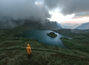
Hike up to Lake Schrecksee
5.010.6 mi / 4160.1 ft gainLake Schrecksee lies squeezed in the Bavarian Alps and is well signposted from the trailhead. Especially during summer this location is popular as a swim in the alpine lake will cool you off!To get there drive towards Hinterstein in the Allgaeu region. Follow the small main street until there is ...Read more -
Vaduz, Liechtenstein
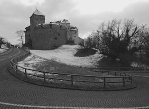
Visit the Vaduz Castle in Lichtenstein
4.01 mi / 450 ft gainWhile traveling through Germany and the Alps, we noticed a country barley visible on the map. The country of Lichtenstein is landlocked in the middle of the Alps. Although you may have never heard of this tiny country, they are famous for their winter sports, being the 6th smallest countries in t...Read more -
Gemeinde Reutte, Austria
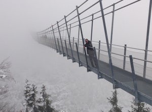
Hike along Highline179
1.2 mi / 400 ft gainHike to this amazing 376 foot high suspension bridge that spans 1329 feet across the a valley in the beautiful mountainous Tyrol region of the Austrian Alps. The bridge spans the B179 highway, connecting the old Roman Fort Claudia and the 700 year old Ehrenberg castle. This hike is breath taking ...Read more -
Schwangau, Germany
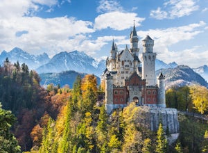
Hike up Pöllartschlucht to the Best Views of Schloss Neuschwanstein
5.01.2 mi / 656.2 ft gainStarting at the Castle of Neuschwanstein, you will hike up the Pöllartschlucht (it's a ravine with a creek) until the first big waterfall. You then go up a really steep mountainside fully overgrown with all kind of plants and trees. Hiking up the Pöllartschlucht is easy as you can follow a broad ...Read more -
Mutterbergalm, Austria
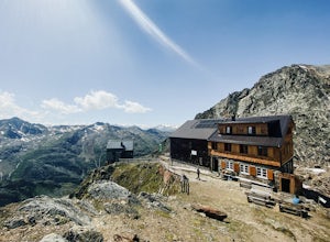
Hike to the Hildersheimer Hut on the Stubai Glacier
2.1 mi / 721.8 ft gainThis short hike is a great mini tour when you want to get up high without a whole lot of effort but enjoy some stunning glacier views. The hike to the Hildersheimer Hut is a high altitude tour on the Stubai glacier, that if done during the summer months from the top station of the Schaufeljochbah...Read more -
Neustift im Stubaital, Austria
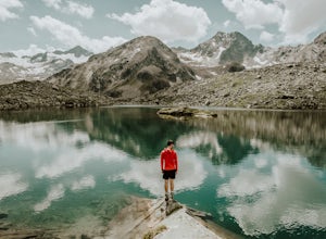
Hike to the Mutterberger See Lake in Stubai
5.3 mi / 2624.7 ft gainThe hike starts from the bottom of the Gamsgarten cable car lift station at the Stubai Glacier, so it's best to park in the highest car park. (Most cars park at the lower Eisgrat cable car so the upper car park should be fairly quiet). If you're arriving by bus, this is the very last bus stop on ...Read more -
Neustift im Stubaital, Austria
Hike to the Suzlenau Hut in the Stubai Valley
9.3 mi / 2168.6 ft gainThe Sulzenau Hut is a popular destination for hikers in the Stubai Valley in Tirol. There are a few different routes to approach the hut, but for this adventure, we took the route that follows the WildWater Trail (WilderWasser Weg). We started this route from the Grawa Alm at the foot of the Graw...Read more -
Neustift im Stubaital, Austria
Hike to the Franz Senn Hut
2.2 mi / 1322.2 ft gainThe hike from the Oberiss Alm mountain pastures to the Franz Senn Hut in the Stubai Valley in Tirol is a wonderful hike for the whole family. The hike starts from the Oberissalm, a remote farmhouse surrounded by alpine meadows. Here you'll find a paid parking area and working farmhouse serving f...Read more -
Neustift im Stubaital, Austria
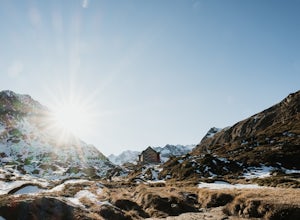
Stubai High Trail Section 4 - Hike from the Sulzenau Hut to the Dresdener Hut
2.5 mi / 1640.4 ft gainWe spent the night before this hike at the Sulzenau hut, and woke up early to watch the sunrise over the glacier, which I highly recommend. From the Sulzenau hut, follow the trail as it rises gradually up the valley floor towards the Sulzenau Ferner Glacier. On the route you'll follow a gushing s...Read more -
Quarten, Switzerland
Hike the Spitzmeilen
11.8 mi / 2887.1 ft gainMaschgenkamm (2019m) is the starting point of this hike, which can easily be reached by cable car from Flumserberg. You can get to Flumserberg either by car, by post car from Sargans or cable car from Unterterzen. It takes about 90 minutes from Zurich.First follow the yellow sign for Ziegerfurgle...Read more -
Grainau, Germany
Hike Höllental Gorge to Lake Eibsee via Riffelscharte Peaks
9.1 mi / 4757.2 ft gainThis trail starts out right where one of the paths lead up to Zugspitze (Germany's highest mountain) but we take the route via Riffelscharte down to Eibsee. The tour starts from Hammersbach (parking available) through the spectacular Höllentalklamm gorge. At the end of the gorge, you can rest, ea...Read more

