Bragg Creek, Alberta
Looking for the best hiking in Bragg Creek? We've got you covered with the top trails, trips, hiking, backpacking, camping and more around Bragg Creek. The detailed guides, photos, and reviews are all submitted by the Outbound community.
Top Hiking Spots in and near Bragg Creek
-
Kananaskis, Alberta
Hike Spencer Creek
2.5 mi / 1968.5 ft gainSouth of the Driftwood turnoff (approximately 4 km) on Spray/Smith-Dorrien Trail a large creek bed on the east of the road is the beginning of Spencer Creek. The trail is easy enough to find, just have to do a bit of looking.Once on the trail, you'll basically have no trouble at all. The trail it...Read more -
Kananaskis, Alberta
Scramble up Mount Sparrowhawk for Sunrise
7.5 mi / 4527.6 ft gainMount Sparrowhawk was the first mountain I ever fell in love with -- I knew it well, and I knew that the summit would still be accessible with a bit of snow on it in October. With waning daylight hours, it was a perfect option - albeit intense - for a sunrise hike.The trailhead is located on the ...Read more -
Turner Valley, Alberta
Mist Mountain Scramble
4.5This is a pretty big objective, but doesn't feature any technical climbing, so anyone who keeps a clear head and can put one foot in front of the other can do it.Mist Mountain is located in Highwood Pass - whose highway is only open between June and December, so scheduling Mist Mountain as a big ...Read more -
Kananaskis, Alberta
Hike up Windtower Mountain
5.06.2 mi / 3182.4 ft gainSpray Lakes is one of my favorite areas in Kananaskis, and the view of Spray Lakes from the summit is absolutely breathtaking.The trailhead is located along the Smith-Dorrien Trail (Spray Lakes Road) – look for a yellow sign on the eastern side of the road, about 1 mile (1.5 km) south of the Drif...Read more -
Kananaskis, Alberta
Hike Mount Indefatigable
4.5If you choose to do this hike, you'll find yourself at Kananaskis Lakes, one of my favourite spots in K-Country! Park your car at the Interlakes parking lot, have that one last bathroom break, and make your way north to get to the trailhead. The trailhead is impossible to miss as it's blocked off...Read more -
Canmore, Alberta
Hike Grotto Mountain
7.5 mi / 4429.1 ft gainFrom Highway 1A take the exit to the Alpine Club of Canada. Park near the woodpile as the actual parking lot is for Alpine Club customers. The trailhead about 30 metres up the road from the woodpile.The start of the trail is fairly relaxed but it quickly becomes a steep uphill battle. There are t...Read more -
Longview, Alberta
Backpack to Pickle Jar Lakes
4.05 mi / 1328.7 ft gainPark in the Lantern Creek Recreation Area across the street from the trailhead. Highway #40 is closed at the Upper Lakes and Highwood House Junction from Dec 1st to June 14th for wildlife preservation, so you will have to plan your trip here accordingly. Once you cross the street you will see the...Read more -
Kananaskis, Alberta
Backpack the Northover Ridge Loop
5.025 mi / 4000 ft gainWhile most people opt to hike this route as a 2 or 3 day trip, camping at Aster and Three Isle Lakes, this description is for a 1 day loop. This is NOT an easy hike to do in 1 day, however, and the ridge is no pushover for any length trip. Exercise caution and don't be afraid to backtrack if weat...Read more -
Kananaskis, Alberta
Rawson Lake & Sarrail Ridge
4.06.8 mi / 2427.8 ft gainTake Hwy. 40 to Kananaskis Lakes Trail. Continue on this road until you reach a turn off for Upper Kananaskis Lake Day Use Area. This is your trail head. Follow the trail along west side of the lake. After about 1 km you will reach Sarrail Falls. Shortly after crossing the bridge, take the trail ...Read more -
Kananaskis, Alberta
Rawson Lake
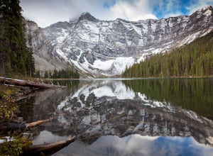
4.55 miGetting There From Highway 1, Take Highway 40 South to Kananaskis Lakes Trail, and turn left at Upper Kananaskis Lakes Drive. The Trail The trail to Rawson Lake starts at the end of the "Day Use Area" at Upper Kananaskis Lake. The lake gently laps the shoreline to the right and moss carpets the...Read more -
Kananaskis, Alberta
Hike the Aster Lake Trail in Kananaskis Provincial Park
7.5 mi / 1969 ft gainA long day hike or perfect backpack trip, this alpine lake surrounded by high peaks, starts out relatively easy from the upper Kananaskis Lake parking lot, at the far end of the south side of the lake, with a short tour around the east side of Hidden Lake, you start, what at some points will seem...Read more -
Kananaskis, Alberta
Scramble the Fortress
Have you ever done a hike where you just don't want the day to end? Scramble the Fortress and you'll know the feeling. The thing that drew me to the Fortress was its summit elevation of 3000 masl, as well as its blocky, fortress-like profile when viewed from the north. It's so much more than that...Read more -
Kananaskis, Alberta
Backpack the Fortress Cirque
5.012.19 mi / 3507 ft gainNo better way to watch the stars with friends than huddled up in your sleeping bag on top of a 3000m summit. This describes the bivy at The Fortress. Starting at the Chester Lake Trailhead, take the unmarked trail on the right side of the parking lot. These winter cross-country ski trails take y...Read more -
Kananaskis, Alberta
Hike from Headwall Lakes to Chester Lake
5.010.6 mi / 2650.9 ft gainThe hike starts at the Chester Lake trailhead along the Smith Dorian road in Kananaskis. The first few kilometers follow the old logging roads, now used as cross country skiing trails. Find the beginning of the trail at the upper right end of the parking lot, and continue to follow parallel to t...Read more -
Kananaskis, Alberta
Hike to Chester Lake
5.06.2 mi / 984.3 ft gainChester Lake was officially one of my favorite hikes of 2016. It's a short & sweet 5 km's to the lake, with outstanding views in every direction. Fall colors were just starting to peak through and the sky looked amazing. From what I understand, this is one of the more popular hikes in the are...Read more -
Kananaskis, Alberta
Exploring Burstall Pass
5.0Head to the northwest corner of the parking lot to find the trail. For the first 5.5 km the trail is quite easy, with only modest elevation increase. At 5.5 km you will arrive at what is known as the gravel flats. Depending on the time of year the gravel flats can be either quite dry or a wide, s...Read more

