Canmore, Alberta
Looking for the best photography in Canmore? We've got you covered with the top trails, trips, hiking, backpacking, camping and more around Canmore. The detailed guides, photos, and reviews are all submitted by the Outbound community.
Top Photography Spots in and near Canmore
-
Banff, Alberta
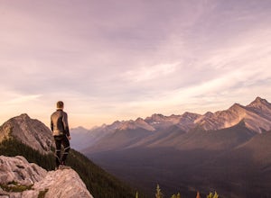
Dawn to Dusk in Banff National Park
5.06.8 miThis is a micro adventure in one of the world’s most desired National Parks. The common excuse for those who tend to skip the great outdoors is lack of time. This one day adventure is an example that you can cram a lot into a day! Dawn: Sunrise hike up to South Ridge in Banff. Start at the famous...Read more -
Banff, Alberta
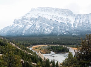
Hike to the Hoodoos, Banff
5.03 mi / 295.3 ft gainThe beginning of this hike is easily accessed from the town center of Banff by the Bow river. Perfect for those without a car! Follow the trail on the side closest to town as it leads up the Bow River and into the forest following the signs for Hoodoos Loop.The hike is 4.8km one way, leading arou...Read more -
Improvement District No. 9, Alberta
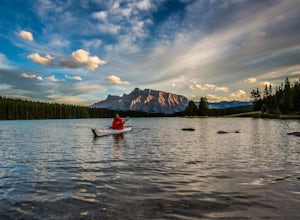
Kayak Two Jack Lake
4.2Of all the lakes in the Banff area, this was one of my favorites to get out on the water. Don't expect the bright blue glacial waters of some of the other lakes in the Canadian Rockies, but the water is pristine and it was one of the few places I went where it felt like it was all locals hanging...Read more -
Improvement District No. 9, Alberta
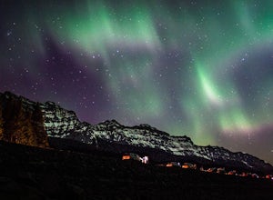
Explore Lake Minnewanka
4.2Head up to Lake Minnewanka on a high alert night to get the perfect view of the Canadian Northern Lights. You can go online to get updates on the best times to go and where they will be the brightest. While the dam at the lake may be overrun with people, explore around and you can find a nice emp...Read more -
Banff, Alberta
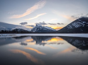
Explore Vermillion Lakes in Banff National Park
4.7Vermillion Lakes is one of the best spot's in Banff to catch a sunrise or sunset depending on the season. Although it's one of the most popular locations for photographers, there are so many different areas around the lakes that you'll never feel like it's too crowded. Mount Rundle can be photogr...Read more -
Improvement District No. 9, Alberta
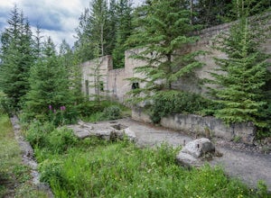
Explore Bankhead Ghost Town
5.00.81 mi / 37 ft gainBankhead is a ghost town which flanks Cascade Mountain and lies just south of Lake Minnewanka in Banff National Park. The main portion of the ghost town is located in Lower Bankhead, which can be reach by traveling North on Range Rd 1158 (closed Nov - Apr), following the signs to Lake Minnewanka....Read more -
Banff, Alberta
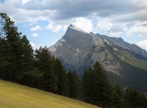
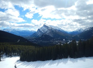
Take in the View at the Mount Norquay Green Spot
3.5The "Green Spot" is a beautiful grassy slope that opens up to sweeping views of downtown Banff and the surrounding area. It's a great spot for photography, especially capturing the peak of Mt. Rundle. There's also a set of chairs conveniently placed on the slope so you can kick back and enjoy t...Read more -
Banff, Alberta
Snowshoe Mt. Norquay
2.2 mi / 1000 ft gainFrom Banff:Take the shuttle from the town lot to Mt. Norquay Ski Lodge, it is $10 CAD one way or $15 roundtrip, but you may want to walk back. If you decide to walk back there are two options; the road or the beautiful mountain trail. The trail head can be easily picked up in the parking lot, hik...Read more -
Turner Valley, Alberta
Hike to the Top of the Wasootch Ridge
4.08.7 mi / 3280 ft gainThe start to this hike is located about 45 minutes west of Calgary and about the same East of Banff. Off the Trans Canada Highway take the highway 40 exit into Kananaskis and continue until you reach the Wasootch Creek area. There is ample parking, however during spring and summer months it can b...Read more -
Kananaskis, Alberta
Ribbon Falls
3.812.4 mi / 1148.3 ft gainRibbon Creek trail is accessible via Highway 40 at the turn off for Nakiska Mountain Resort. From there take a left at Centennial Drive and then a right onto Ribbon Creek Road. The hike begins at the far end of the Ribbon Creek Trailhead parking lot. There is an old coal mining cart at the start...Read more -
Kananaskis, Alberta
Hike Centennial Ridge
9.9 mi / 4592 ft gainThis hike can be done as a full traverse, starting at the Ribbon Creek Trailhead and taking you to Dead Man's Flats, just off of the Trans Canada Highway. Starting at the trailhead in the Ribbon Creek parking lot, go north on Hidden Trail. You will be on this trail for ~ 200 m before you need to ...Read more -
Kananaskis, Alberta
Winter Climb Mount Allan
5.08.7 mi / 4429.1 ft gainMount Allan is a 14 km hike that gains 1400 metres of elevation and was one of my favourite hikes when I first moved to Calgary. On a recent snowshoe, a couple I crossed paths with mentioned they had just done Mount Allan in December, so I knew I had to put it on my winter list!The trail begins a...Read more -
Turner Valley, Alberta
Scramble up to Wasootch Peak
Wasootch Peak is for people who's inner scrambler is screaming to push on when they're on Wasootch Ridge. This description will be focusing on the trail to the summit from the main cairn on Wasootch Ridge. For an excellent description on how to get to that cairn, check out Hike to the Top of Waso...Read more -
Turner Valley, Alberta
Snowshoe to Midnight Peak
7.5 mi / 3120 ft gainWhen exploring, sometimes the best days are when you bite off a bit more than you can chew and push your limits. On a summer day without a cloud in the sky, Midnight Peak would be challenging, but in winter it's a difficult test to be attempted by the prepared and able.The trail to Midnight Peak ...Read more -
Turner Valley, Alberta
Hike Porcupine Ridge
5.9 mi / 2231 ft gainThis trail was really easy to find and follow, unfortunately that means the description will be short.Park your car at Porcupine Creek on Highway 40 and take off to the southeast! The path follows the creek and requires a couple of creek crossings on makeshift bridges, but once the creek forks yo...Read more -
Kananaskis, Alberta
HIke to Barrier Lake Lookout
3.3From the parking lot, cross the dam, heading west onto the trail, with the lake on your left. Once you reach the forest, you will come to a 'Y' intersection, from which point you have two options:6.7 miles (10.8 km), 4 hours roundtrip, out-and-back For a shorter hike, go right at the 'Y' intersec...Read more

