Edgewater, British Columbia
Top Spots in and near Edgewater
-
Improvement District No. 9, Alberta
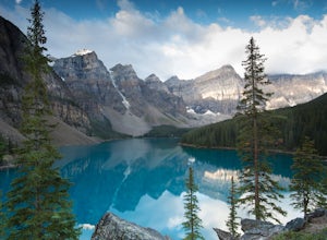
Showing up at Moraine Lake before dawn is a must as to avoid the multitude of tours busses. The morning sun is subtle and magical. The lake, being glacially fed, does not reach its crest until mid to late June. When it is full, it reflects a distinct shade of blue. The color is due to the refract...
Read more
-
East Kootenay F, British Columbia
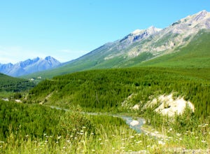
The park offers vehicle accessible campsites on a first-come, first-served basis. There are 114 campsites located at five campgrounds. Alces lake is the closest to the Lussier hot springs and the first campsite in the park. With sunny lakeside sites it is frequently the busiest. At $23/night with...
Read more
-
Bighorn No. 8, Alberta
To get to the trailhead, take Highway 1 and take the Seebe exit (Highway 1X). Continue north on Highway 1X and take a left at Highway 1A. A few kilometres after the town of Exshaw, turn into the parking lot marked by the Grotto Pond sign.The trailhead is well marked and follow the trail until the...
Read more
-
51.064574,-115.203550
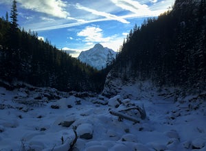
This is a great hike that could be a quick 2 hour sprint or stretch into a full day affair. The trailhead is located just off Highway 1A at a fishing pond with outhouses and ample parking. The trail is well signed and in a quick kilometre, hikers will be at the actual creek bed. In summer, hike...
Read more
-
Bighorn No. 8, Alberta
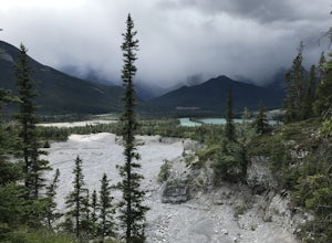
Between Pigeon Mountain and Mount McGilliveray, pull off the road and slow down until you see a little dirt road turn off to the large parking area.Follow the trail heading south- don't take the transcanada trail- further up you will find another small trail that takes you to the creek bed. Follo...
Read more
-
Bighorn No. 8, Alberta
Morningside RouteLocated on the North side of Mount McGillivray5.7 Sport Route- 4 PitchesWalk off or RappelGetting there: Located across from Lac Des Arc. Theres a small gravel road turn off just before McGillivray Ponds- easy to miss! Then follow a small trail on the right side that leads up to ...
Read more
-
Bighorn No. 8, Alberta
A bit of a jaunt is required to get to the start of the scramble - follow the Heart Creek Trail, and after crossing the creek, look for a yellow sign that marks the scramble route. There will be exposure as well as use of hands, but it is totally do-able as long as you keep your head right!After ...
Read more
-
Turner Valley, Alberta
4.0
8.7 mi
/ 3280 ft gain
The start to this hike is located about 45 minutes west of Calgary and about the same East of Banff. Off the Trans Canada Highway take the highway 40 exit into Kananaskis and continue until you reach the Wasootch Creek area. There is ample parking, however during spring and summer months it can b...
Read more
-
Turner Valley, Alberta
Park at Wasootch Creek, Walk 2kms past the practice slabs5.7 Mixed- North RidgeFollowing the drainage on the right side that leads to the base of the esthetic tower. Then hike up the faint forested trail to the beginning of the climb.I found this to be a fun- easy scrambling route with quite a fe...
Read more
-
Turner Valley, Alberta
Wasootch Peak is for people who's inner scrambler is screaming to push on when they're on Wasootch Ridge. This description will be focusing on the trail to the summit from the main cairn on Wasootch Ridge. For an excellent description on how to get to that cairn, check out Hike to the Top of Waso...
Read more
-
Turner Valley, Alberta
This trail was really easy to find and follow, unfortunately that means the description will be short.Park your car at Porcupine Creek on Highway 40 and take off to the southeast! The path follows the creek and requires a couple of creek crossings on makeshift bridges, but once the creek forks yo...
Read more
-
Lake Louise, Alberta
4.6
8.96 mi
/ 1565 ft gain
Starting from the parking lot on the east end of Lake Louise, there are a few options you can take to get to the Plain of Six Glaciers. One is to head directly along the lakeshore trail, and in about 7 km (4.2 miles) you will be at the lookout offering the best vantage point of the glacier field....
Read more
-
Lake Louise, Alberta
4.8
4.58 mi
/ 1260 ft gain
Towering peaks, glaciated valleys, and crystal clear water draw thousands of visitors a year to the shores of Lake Louise in Banff National Park. A short hike takes you beyond the crowds up to Lake Agnes, a beautiful valley surrounded by jagged peaks and golden Larch trees.
At the foot of Lake ...
Read more
-
Lake Louise, Alberta
Fairview Mountain is a non-technical objective alpine summit located on the south side of Lake Louise. It's trailhead is accessed from the Lake Louise parking lot. The trail is well established and well marked throughout. You can expect a distance of about 11km return and elevation gain of 1000m,...
Read more
-
Lake Louise, Alberta
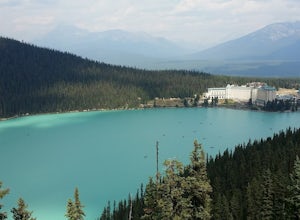
From the TransCanada Highway take the exit for the Fairmont Chateau Lake Louise. Just before you arrive at the hotel there will be a large parking lot on the left. It's best to arrive early as a lot of tourists and locals alike use this parking area for hikes and visiting the the lake.From the pa...
Read more
-
Lake Louise, Alberta
This is a fairly steep, short hike that gives you a great view of Lake Louise. The hike begins right behind the canoe rental shop on the South side of the lake. The trail is very easy to follow and there are quite a few people that hike it. The hike is an hour and half round trip.
The hike leads...
Read more

