White Rock, British Columbia
Top Spots in and near White Rock
-
Olga, Washington
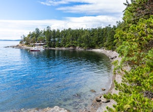
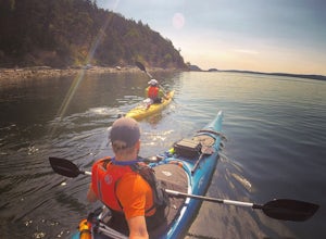
Obstruction Pass State Park is something of a hidden gem on Orcas Island given that its nearby neighbor, Moran State Park, gets most of the tourist attention. What this means is that you can find solitude and quiet, *and* make a visit to the only publicly owned beach on the island.
There are seve...
Read more
-
Olga, Washington
The nine primitive campsites and one Cascadia Marine Trail campsite of Obstruction Pass State Park are the only first come, first serve campsites available on Orcas Island. The campsites themselves overlook a fantastic (and accessible beach) and Obstruction Pass itself.
There are four composting ...
Read more
-
Bellingham, Washington
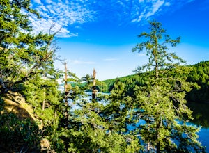
Take Chuckanut Drive to the trailhead which is located directly across from the entrance to Larrabee State Park. A small lot in front of the trail has space for 8-10 cars, or you can park at the State Park and walk across the road (carefully!) to reach the trailhead. Either way you will need a Di...
Read more
-
Friday Harbor, Washington
The northwestern-most point of the San Juan Islands, Stuart Island, is arguably the most gorgeous island to circumnavigate. Unfortunately, as Stuart Island is 16 miles away from the closest ferry port, there is no simple way to get there in one day. A couple of options to get there include:1) Onc...
Read more
-
Friday Harbor, Washington
This hike is only doable if you are already on Stuart Island! There is no public transportation to Stuart Island, so you must already be there or have a plan to be there in order to complete this hike.I frequent this island during the summer months and it is one of my favorites. I always stay in ...
Read more
-
Blakely Island, Washington
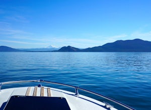
From Washington Park in Anacortes, Washington we launched our 19' Beachcraft with a deep hull into Puget Sound on a beautiful blue sky morning. The weather and water was favorable for an overnight adventure to Blakely Island!
We made our way across Rosario Straight and toward James Island (20 mi...
Read more
-
West Vancouver, British Columbia
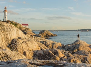
To get to Lighthouse Park, head westbound along Marine Drive in West Vancouver. As Marine Drive continues past little shops and businesses, it will begin to narrow and the road will wind around the coastline. Continue past Caufield Cove Marina and watch for the Lighthouse Park sign on your left. ...
Read more
-
West Vancouver, British Columbia
Drive the the end of Woodgreen Pl in West Vancouver, and you will pass the tennis courts on your right. You will see a little dirt road that heads up into the woods on your left - drive up this road ~30 feet into the parking lot. From the Parking lot, hike up the trail beside cypress creek (this ...
Read more
-
West Vancouver, British Columbia
Park in the Hollyburn cross country parking lot and start your hike up the under the powerlines. After about 15 mins the trail will flatten out and you will arrive at the warming hut. Take a left and follow the orange markers as it slowly weaves its way through a series of trees and valleys.Event...
Read more
-
West Vancouver, British Columbia
4.4
6.45 mi
/ 1801 ft gain
From the Cypress Mountain downhill parking lot, head north toward the nearby chairlift and look for the Howe Sound Crest Trail sign. The trail follows alongside the several ski runs until a sign that points to the right to the Howe Sound Crest Trail. Follow this trail uphill until it merges onto ...
Read more
-
West Vancouver, British Columbia
Distance: 18 miles / 29 kms.Duration: 1 - 3 DaysElevation Gain: 6000 ft. / 1800 m.Magnesia Meadows: 49.483708, -123.190377The Howe Sound Crest Trail (HSCT) is one of the most epic hiking trips one can do in the Vancouver area. The trail is entirely located within the Cypress Mountain Provincial P...
Read more
-
West Vancouver, British Columbia
If you are looking for the perfect snowshoe adventure you've found the right place. St. Marks is located on Cypress Mountain. It is more difficult than the nearby Hollyburn, and sometimes inaccessible due to heavy snow. For those two reasons makes it the most secluded hike just minutes from downt...
Read more
-
Bowen Island, British Columbia
5.0
5 mi
/ 1148.3 ft gain
Start at the Cypress Mountain ski area and walk towards the first chairlift. You will see a giant sign showing the ski trails and you go to the right of that. You will then see a post that lists which direction to go for each hike.To start this trail, walk towards the previously mentioned chair ...
Read more
-
Bowen Island, British Columbia
4.0
3.7 mi
/ 1804.5 ft gain
On November 23, 1963, the world was faltered by the news of John F. Kennedy’s assassination (the previous day). Vancouver was dealing with it's own tragedy; a military plane crash in the North Shore Mountains. The hike to Mt. Strachan gives you the opportunity to visit the crash site.The Mount St...
Read more
-
West Vancouver, British Columbia
4.0
2.48 mi
/ 443 ft gain
The trailhead is located just off the Cypress Mountain lodge. It winds past old growth forest, and the Yew Lake Meadows.
After passing these features the trail turns into a series of switchbacks, gaining the elevation in the last 850m of trail.
Before you know it you are rewarded with a beautif...
Read more

