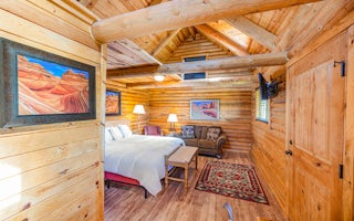
Podunk Guard Station
Book this listing through our partner Recreation Gov
About Podunk Guard Station
Overview
Podunk Guard Station is located next to the East Fork Sevier River, in the Dixie National Forest in southern Utah. The cabin was constructed in 1928 and has been used by generations of Forest Service employees.Guests enjoy exploring local trails on foot, horseback, mountain bike and off-road vehicle. The river offers fishing and swimming opportunities.
Recreation
Recreational opportunities in the area include hiking, mountain biking, off-roading and fishing. The Paunsaugunt, Fremont and Great Western OHV Trail Systems can be accessed easily from the guard station.Facilities
The two-room cabin can sleep six people on two, twin-size bunk beds located in the bedroom, and a double-size futon in the living room. No linens or bedding are provided.The kitchen is equipped with a propane stove and oven, a table and chairs. No pots, pans, dishes or utensils are available. Guests must bring their own cooking and eating euipment. A wood stove is provided for heat. The cabin does not have running water.
A vault toilet, picnic table and campfire ring are located outside.
Natural Features
The cabin sits in a narrow mountain valley just above the meandering East Fork Sevier River. The meadow is surrounded by mature spruce trees, and grasses and willow thickets line the riverbanks.Average summer temperatures range from 74 degrees during the day to 42 degrees at night. September temperatures range from 68 to 37 degrees; October temperatures range from 57 to 27 degrees.
Nearby Attractions
Tropic Reservoir is 8.5 miles north of the cabin. Boating, canoeing and fishing are popular activities. Anglers fish for brook, rainbow, brown and cutthroat trout. A boat ramp is located on the west side of the reservoir.Podunk Guard Station Reviews
Have you stayed here? Be the first to leave a review!
Top Spots in or near Kanab
Hike Bryce Canyon's Riggs Spring Loop
37.475289,-112.240302
5.0
8.71 mi
/ 2044 ft gain
Bryce Canyon National Park in Utah is a spectacular place. It really has to be seen to be believed. Some of the most scenic parts of Bryce are easily accessible by the average visitor via car-accessible overlooks. However, if you're not into crowds or want to hike/backpack in Bryce...there are some wonderful trails and campsites! I recently did the Riggs Spring loop at the southern end of the p...
Run the Bryce Canyon Traverse
Kane County, Utah
1.0
30.3 mi
/ 6600 ft gain
The Bryce Canyon Traverse is a point-to-point run covering over 30 miles from Rainbow Point at the southern end of the park to Sunrise Point at the North. The majority of the run is on the remote Under-the-Rim Trail where you might pass the occasional backpacker, but won't find a tourist group for miles. To coordinate this run, you'll need to work in a group to stage cars at the start and fini...
Hike the Bristlecone Loop Trail
37.475264,-112.239586
3.0
0.98 mi
/ 180 ft gain
The trail begins from the South side of the parking lot and is well marked with signs and information placards. Walk for approximately 5 minutes before reaching the intersection where the two ends of the loop come together. This loop can be done in either direction so you can take your pick. The trail has several small ups and downs but is generally very easy and doable for people of all ski...
Bull Valley Gorge Trail
Kanab, Utah
0.89 mi
/ 49 ft gain
Bull Valley Gorge Trail is an out-and-back trail that takes you by a river located near Cannonville, Utah.
Hike WIllis Creek Slot Canyon
Kanab, Utah
4.7
Willis Creek Slot Canyon begins at the Willis Creek Trailhead, located in Grand Staircase Escalante National Monument. The trail is very easy to find and follow. It begins winding through junipers for several hundred feet before dropping gradually into a wash, at which point it meets up with Willis Creek. Be ready to get your feet wet, because the creek and the trail are interwoven for the rest...
Hat Shop via Under the Rim Trail
Bryce, Utah
5.0
3.99 mi
/ 1093 ft gain
Hat Shop via Under the Rim Trail is an out-and-back trail where you may see local wildlife located near Bryce, Utah.
Camping and Lodging in Kanab
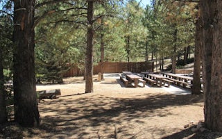
Hatch, Utah
Kings Creek
Overview
Kings Creek Campground is located on the west side of Tropic Reservoir, high on the Colorado Plateau at an elevation of 8,000 fe...
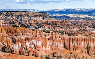
The Lodge at Bryce Canyon, Utah
Bryce Canyon Lodge (Bryce Canyon NP)
Explore the Hoodoo Magic of Bryce Canyon
From $330 / night
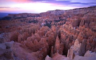
Bryce, Utah
North Campground
Overview
North Campground is located in the beautiful and unique Bryce Canyon National Park. Known for its colorful rock spires and grand...
Bryce, Utah
Sunset Campground
Overview
Sunset Campground is located in beautiful and unique Bryce Canyon National Park. Known for its colorful rock spires and grand vi...
Duck Creek Village, Utah
Duck Creek
Overview
Duck Creek Campground is located 25 miles east of Cedar City, Utah. Visitors enjoy fishing in Duck Creek Pond and nearby Navajo...
Unfortunately, we don't have up-to date pricing data for this listing, but you can check pricing through Recreation Gov.
Book NowAdd your business today to reach The Outbound's audience of adventurous travelers.
Community
© 2024 The Outbound Collective - Terms of Use - Privacy Policy


