
Michael Youngblood
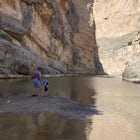
I have hiked this trail several times and I always look forward to it. The drive along the Cades Cove Loop to the trailhead is beautiful and wildlife can usually be spotted as well. I would rate this hike between easy and moderate as there is some elevation gain but not in one continuous climb. Abrams Creek parallels the trail for a significant portion and there are plenty of access points along the creek to take a break or just enjoy the scenery. As mentioned in almost every post…the crowds. We last went during Memorial Day weekend and the crowds were unbearable. It wasn’t the crowds along the trail or at the falls that bothered me. It was the drive along Cades Cove Loop. We moved at a snail’s pace as it was bumper to bumper and also one-way. I would heed the advice and start early. Also heed the warnings regarding swimming at the pool near the base of the falls. This is a powerful waterfall and the current is very strong, not to mention the amount of debris that is likely to reside at the bottom. With all that being said, do not let the crowds be a deterrent. This is a beautiful waterfall and a great hike in a gorgeous area of the park.
5.0
The power of the sea is on full display here and the views of Maui’s rugged northern coast are quite spectacular. We must have had good timing when we visited the blowhole as we witnessed some impressive blasts…very hypnotizing. There are two parking areas for the blowhole and each has a different route. Route 1 has a parking area located at mile marker 38, which is the location listed in the posted Adventure. From the parking area, head towards the light beacon near the coastline. It is visible from the parking area. From the light beacon you will basically meaner along the coastline for approximately 500-600 yards until you reach the blowhole. You may see some ladders that lead down the cliff; these are not part of the route. The area between the light beacon and the Nakalele Blowhole has been dubbed the ‘Acid War Zone’ due to the barren landscape and unique erosion of the rocks. Route 2 has a parking area near mile 38.5 and also has a shorter, more direct hike to the blowhole. You will be able to see the blowhole from the top of the trail. Also, neither of these routes have marked trails, just beaten paths that lead to the destination. I will reiterate the warnings posted in the Adventure. Wear appropriate footwear. You are walking on volcanic rock. If you fall it will be like falling on glass. Second. People have been killed here. Use common sense when viewing the blowhole. Don’t be the next Darwin Award recipient. Third. I also advise against taking Highway 340 (Kahekili Highway) to the east of the blowhole. We did so naively and it was not that fun of an experience, albeit gorgeous. At about 4 miles east of the blowhole, the highway becomes a one-lane highway for about 10 miles with shear cliffs, no guardrails, hairpin turns, and pull-outs few and far between. We were fortunate and didn’t have any vehicles approaching from the opposite direction during our trek. Plus, if you have a rental vehicle, I believe this section of highway will void your agreement.
4.0
The ‘Road to Hana is a gorgeous journey along the wilder coast of Maui. Yes it is a bit touristy and yes it can be quite busy but there are just too many sights to see that you will not want to miss. There are numerous overlooks and waterfalls, the black sand beach at Wai’anapanapa State Park, Hana Lava Tube, the red sand beach at Kaihalulu Beach, Seven Sacred Pools at Ohe’o Gulch, fruit stands, and more. It’s a full day adventure. So leave early, fill up with gas, pack a picnic lunch, and hit the road. Be forewarned about the road though. It is winding and narrow with a plethora of hairpin turns and many one-lane bridges. If you continue past Hana (about 4 miles) the road necks down to a one-lane road with many blind curves. If you plan on taking the Hana Highway and connecting with the Piilani Highway to drive all the way around the southern portion island, the section of one-lane highway lasts about 20 miles but there is section of highway sandwiched in here that is extremely narrow and is a pothole paradise. It lasts about 8 miles and varies between deteriorated, potholed asphalt and gravel. The southern portion of the island is very remote and transitions from the lush rain forest to a more arid climate. It’s beautiful in its own right plus you can escape the crowds. If you do decide to drive this rugged section of the island and have a rental vehicle, check your agreement as you might be voiding it.
4.0
This is an absolute must-do if you find yourself on Maui. Out of all of the sights I saw when I was on the island, the memory of seeing the sunrise at the summit sticks out the most to me. Just an amazing sight. As Lucas mentioned in the adventure post, bring some layers. It was incredibly cold and windy at the summit. I didn’t plan ahead because, well because you are in Hawaii, a tropical paradise, and the last thing on my mind was packing warm clothes. I was lucky enough to have packed a hoodie but I still ended up freezing. As of February 2017, the NPS has implemented a reservation system in order to view the sunrise in the Summit District of the park. The reservation fee is only $1.50 per car but you will need to secure a reservation to enter and park in the Summit District between 3:00 am and 7:00 am. Reservations can be made up to 60 days in advance but I’m not sure how quickly they sell out. This system wasn’t in place when I visited Haleakala…so plan ahead.
5.0
Just park at the Paw Paw Tunnel Campground and head over to the historic Chesapeake and Ohio Canal Towpath Trail which lies on the western side of the campground. No worries on parking at the campground. It’s a public campground managed by the National Park Service and has plenty of parking available. The family had a great time on this hike. Really neat experience walking through the tunnel which was further heightened considering it was constructed over 150 years ago. However, I did get the sense that the tunnel was unending and that I would never get through it but that was probably because my 2-year old would stop at every weep hole and shine his flashlight in it. If you take the Tunnel Hill Trail back, just be aware you are hiking up the rather large hill the tunnel was constructed through. Interesting fact…the tunnel was constructed to bypass the Paw Paw Bends which was a six-mile stretch of the Potomac River that consisted of five horseshoe-shaped bends. Construction of the tunnel took 14 years (1836 – 1850) to complete and cost $600,000. Please note that the tunnel is currently closed due to a rock scaling project. The NPS website states the project will be complete in late-October 2017.
4.0
I’ll echo all of the sentiments in the reviews. This is a beautiful waterfall with some great photo opportunities. We hiked from the Stanford House to Brandywine Falls via the Stanford Trail which connects to the Brandywine Gorge Loop Trail, total of about 4 miles. Overall this was a really nice and easy hike (a few short sections of incline) through some grassy fields and woods. If you are pressed for time there is a parking lot near the falls with a short 0.1 mile walk on the boardwalk to the waterfall viewing area.
5.0
This is one of my favorite trails in CVNP. It is a gorgeous canopied hike through some awesome sandstone cliffs and formations…lots of nooks to explore as well. The trail is relatively easy and short and also readily accessible and, therefore, makes it a very popular destination…so don’t expect any solitude. If you are in the Cleveland area, definitely check it out or make it a weekend trip. There is plenty to see in CVNP.
5.0
I had a blast on this trail during a recent vacation out to the Black Hills. The views at the top of Little Devil’s Tower were absolutely spectacular. As the Adventure post alluded to, the last few hundred feet of the final ascent is a rock scramble which I didn’t find difficult but that is just my perspective. I combined the Cathedral Spires trail into this hike but I started at the Cathedral Spires trailhead not the Little Devil’s Tower trailhead and parking lot. Near the end of the Cathedral Spires trail there a short connector trail (and signs) to Trail #4. Once you reach Trail #4 head west until you reach the Little Devil’s Tower spur trail. I think the roundtrip mileage ended up being near 3.0 miles. The trail was all uphill at a moderate rate but it made for an easy hike back. Also the route is mostly exposed with little shade.
5.0
This was a fun hike we completed with our boys (3, 7, and 9). The hike to Blue Hen Falls is approximately a 0.5 mile roundtrip. The official trail ends at a few benches with a nice vantage point of the falls and is also marked by a sign stating “End of Trail”. There is an unofficial trail past the “End of Trail” sign that is well defined and will lead you to Buttermilk Falls which is not shown on the National Park map. The trail essentially follows the stream but you do have 2-3 stream crossings to complete which were easy enough with fallen trees and rocks in the stream. The hike to Buttermilk Falls will add another mile onto your roundtrip total. We had a great time on this hike exploring the falls. Two things I would like to note. As stated in the Adventure posting, please exercise caution if you are exploring near the top of the waterfall. We almost witnessed someone fall from the top due to slipping on the rocks. And finally, if you have any valuables in your vehicle hide them out of plain sight and lock your vehicle. There was a park ranger at the trailhead that informed us that there have been several vehicle break-ins throughout the park where a vehicle’s window was smashed and pursues, etc. were stolen.
5.0
Community
Mobile Apps

© 2024 The Outbound Collective - Terms of Use - Privacy Policy