
Cone Peak in Big Sur (Sea to Sky Backpacking Route)
Big Sur, California
Details
Distance
19.72 miles
Elevation Gain
7484 ft
Route Type
Out-and-Back
Description
Added by Josiah Roe
Cone Peak is the most spectacular coastal mountain in the Lower 48 States. At 5,155' high and less than 3 miles from the ocean, the average gradient from summit to sea is 33%, which is steeper than Mt. Whitney to Owens Valley.
While you can make a day-hike out of it by driving up the gorgeous Sur-Nacimiento Road from Highway 1 to the Coast Ridge Road and take a 2 mile trail to the summit with 1300' of elevation gain (4 miles roundtrip), the more adventurous types do a Sea to Sky, starting at Kirk Creek Campground and up Vicente Flat Trail (23 miles roundtrip). You can camp at Vicente Flat 5 miles in. Another 2.5 miles up and you'll connect with the Coast Ridge Road, take a left and then up the Cone Peak trail to the summit.
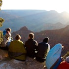
You can camp on the summit if you like, near the old fire lookout. Unless you're during the week or in winter, don't expect to be alone for the hike.
For current fire closures and conditions, check http://calfireinformation.weeb... and http://calfire.ca.gov/. Illegally entering the area during closures can result in large fines.
Download the Outbound mobile app
Find adventures and camping on the go, share photos, use GPX tracks, and download maps for offline use.
Get the appFeatures
Cone Peak in Big Sur (Sea to Sky Backpacking Route) Reviews
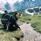
I backpacked from Kirk Creek Campground to Cone Peak for a weekend (2/10/2018-2/11/2018). The trail is in great condition, aside from a few fallen trees along the Kirk Creek Trail and Vicente Flat Trail. From the Kirk Creek Campground entrance there’s a trailhead right across Highway 1, and it’s 11 miles up to Cone Peak from there. I hiked to the summit in one day and my legs felt demolished during the last mile as it had been a long hike with another 1000+ ft of elevation gain left. The views and stargazing were definitely worth it though. The ascent took me 7.5 hours and the descent the next morning only took me about 5 hours. Be sure to fill up on water at Vicente Flat as the closest Creek to Cone Peak is about 5 miles away. The view from Cone Peak is beautiful, though I didn’t think much of Vicente Flat Trail was that majestic. I do recommend this hike if you’re looking for a lengthy hike with a good elevation gain challenge. Also the solitude factor was a solid 9/10. I didn’t run into many hikers along the trail and much my time hiking was nice and quiet. There were only 5 other people camping at Cone Peak with me for the night and we were able to spread ourselves out a bit. There isn’t a ton of space to camp up there so it’s nice to secure your spot early on if possible.
4.0
Did the trip in two days and camped atop Cone Peak. Beautiful sunset and sunrise included. Only saw a few other hikers, but our trip in late December had no water above Vicente Flat. Be sure to fill up there and remember to LEAVE NO TRACE.
5.0

I drove up to the cone peak trailhead, where you will find a freshly cleared (10-28-17) and moderately difficult trail up to the summit. The road up from the main road is something to behold, just wide enough for a standard car and in very good shape as of 10-28-17. Took me 1 hr up and 45 min down from the trailhead. Very cool spot.
4.0
We took a group of students here last spring. Everyone was so amazed at the views that they (momentarily) forgot about the steep incline! We did screen participants to make sure that the entire group would be able to handle the physical exertion. The elevation gain is not for the faint of heart.
5.0
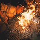
Cone Peak (& the Big Sur coast in general) have become incredibly popular & as such, Leave No Trace principle are of utmost importance here. On our last visit to Cone Peak, we packed out pounds of trash & abandoned gear. Someone had permanently scarred the summit rocks with a campfire, others had short-cutted switchbacks & vandalized the lookout tower. Orange peels & pistachio shells (which take decades to biodegrade) marred the scenery. When we returned to the trailhead, a group had left a large bag of trash & recycling, as if they expected a clean-up crew to pack it out for them!?! If you go, bring a bag to pack out trash (yours & other's) & spread the word about LNT. If you camp up top, pack in plenty of water & PLEASE skip the campfire, it's just not appropriate here. It's up to us to leave sensitive places like Cone Peak better than we found them & it's up to social media to be more responsible in reporting (or sometimes showing restraint by not reporting) them. For interactive trail conditions for the Kirk Creek, Vicente Flat, Cone Peak & other Ventana Wilderness trails, visit- http://www.ventanawild.org/trails/trailconditions.html Prayers for the land, Leave No Trace!
4.0
I decided to make this a day hike and bike. Drove up to top of Nacimiento, then biked the 6 miles on Coastal Ridge Rd (dirt road) to the beginning of the Cone Peak trail and hiked the rest to the top. This made the relatively flat Coastal Ridge Rd much more fun. Also, do bring bug spray and something to cover your upper body and neck with... The bugs are brutal and all around you.
5.0
Leave No Trace
Always practice Leave No Trace ethics on your adventures and follow local regulations. Please explore responsibly!
Nearby

Hike from Kirk Creek Campground to Vicente Flat Trail

Clifftop Camping & Hot Springs in Big Sur

Surf Willow Creek

Camping at Limekiln State Park

3 Branches of the Limekiln

Goat Camp via Twitchwell Flat Use Trail
Community
Mobile Apps

© 2024 The Outbound Collective - Terms of Use - Privacy Policy