Black Canyon City, Arizona
Top Spots in and near Black Canyon City
-
Pine, Arizona
There is a fee to enter this area. It was $7 when we went. There are 4 trails with many viewpoints from the parking lot, all of which are out and back. We followed the recommendation of the ranger working at the visitor's center and took the Gowan Trail down to the observation deck located in the...
Read more
-
Phoenix, Arizona
This trail begins from the parking lot on the west side of Galvin Parkway. To the east of the parking lot is a single track, dirt trail that heads north towards the big buttes. It continues counterclockwise around the big butte and heads south around the smaller butte. It continues west around th...
Read more
-
Phoenix, Arizona
3.6
0.27 mi
/ 200 ft gain
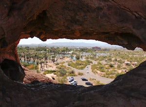
Papago Park is located right next to the Phoenix Zoo. The park is known for its rock formations and short hiking / running trails.
The main attraction, the Hole in the Rock, at the top of the short trail, is a great place to take pictures as it is one of the highest points in the area and it off...
Read more
-
Prescott, Arizona
Giant Alligator Juniper Trail is an out-and-back trail that takes you past scenic surroundings located near Prescott, Arizona.
Read more
-
Pine, Arizona
The building was built in the early 1900’s by the first settlers of Pine, the farm was turned into a lavender farm. There’s a little shop, and the owner also does cooking classes! Wonderful way to spend some time in the northern Arizona sunshine.
For more information and a calendar of events, p...
Read more
-
Tempe, Arizona
Last year I went to Phoenix for a few days for work. I googled lots of places to shoot pictures around Phoenix, but the majority of them were in neighboring areas, and I only had an hour or two after work and couldn't drive an hour to a better photography spot. One place that kept coming up was...
Read more
-
Yavapai County, Arizona
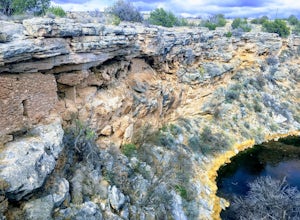
This trail takes you to the rim of Montezuma Well, a massive collapsed limestone sinkhole. The springs at the bottom of the sinkhole feed a large pond which supports a unique aquatic habitat in this dry landscape. Scientists are still baffled as to the origin headwaters of the water within this c...
Read more
-
Fort McDowell, Arizona
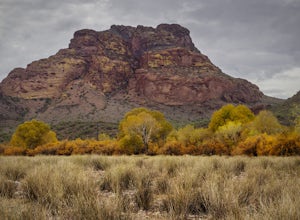
This scenic loop offers views of Four Peaks, the Salt River & Verde River, and a desert landscape with plenty of wildlife. Keep an eye out for eagles, wild horses, and other wildlife while you're on the trail. This trail starts from the Phon D Sutton Recreation site, which is located at the...
Read more
-
Mesa, Arizona
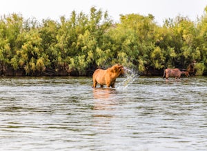
Wild horses have roamed the banks of the lower Salt River since long before the Tonto National Forest was created in 1902. It is thought that these wild horses have descended from a herd brought to the area by a Spanish missionary in the 1600's.
In 2015 the United States Forest Service had pu...
Read more
-
Buckeye, Arizona
The Valley Vista trail is a short hike in Skyline Regional Park, located in the southern region of the White Tank Mountains west of Phoenix. From the top you'll have a great view of the Estrella Mountain Range and the southwest valley. For the most direct route, take the Turnbuckle trail. This...
Read more
-
Maricopa County, Arizona
A Tonto Day Pass is required for this hike as you will park your vehicle at the Blue Point Picnic Area. The trail starts North of the restrooms which are located at the backside of the parking lot. The trail takes you through a mesquite filled area alongside large rock faces. Be sure too look for...
Read more
-
-
Clarkdale, Arizona
Spend a couple of hours to discover the incredible legacy of an ancient people at Tuzigoot National Monument.
Start at the Visitor Center, then take a self-guided, half mile loop trail that will lead around and through an incredible 110 room pueblo. The large building was home to the Sinagua peo...
Read more
-
Phoenix, Arizona
4.0
3.63 mi
/ 873 ft gain
This is a great spot for an afternoon hike near Phoenix. There are some beautiful rock formations, nice trails, and pretty stunning views of the city and desert beyond. It's open year round and is dog friendly so if you've got a pup, definitely bring it along. It gets super hot in the summer and ...
Read more
-
Phoenix, Arizona
Hidden Valley Trail Via Mormon Trail is a loop trail that takes you by a river located near Phoenix, Arizona.
Read more
-
Phoenix, Arizona
Acer Summit Via Mormon Trail is an out-and-back trail where you may see wildflowers located near Phoenix, Arizona.
Read more

