Cave Creek, Arizona
Top Spots in and near Cave Creek
-
Waddell, Arizona
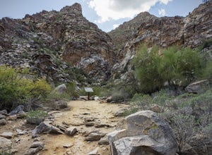
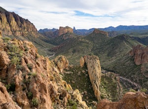
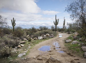
Hike to Waterfall Canyon
4.02 mi / 200 ft gainSo to fully enjoy the theme of this hike, make sure to try and go right after a rain. But also know that since this is a pretty easy hike, you will won't be the only one there. This is also a great hike/ waterfall to do with someone that is new to desert hiking, since it is relatively easy and th...Read more -
Waddell, Arizona
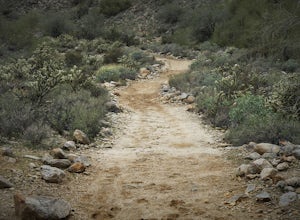
Hike Mesquite Canyon Trail
13 mi / 1394 ft gainThis is a great place to begin your hike in the White Tank Mountains. From the Ramada Way area, the trail begins to lead steadily into a small canyon. As you get further up, the trail will begin get more steep. After a short time it leads up to the first saddle and wraps around a ridge and bec...Read more -
Tonto Basin, Arizona
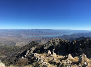
Hike to Brown's Peak
5.06 mi / 1957 ft gainStarting at the trailhead you will begin hiking through oak trees and forest. At numerous times throughout the hike Roosevelt Lake can be seen to the northwest. Approximately 3 miles into your hike you will reach a small campsite in the saddle of the mountain. This is your turnaround point if you...Read more -
Mayer, Arizona
Verde Rim Loop Trail
14.32 mi / 2631 ft gainVerde Rim Loop Trail is a loop trail where you may see beautiful wildflowers located near Camp Verde, Arizona.Read more -
Apache Junction, Arizona
Hike the Boulder Canyon Trail
4.010 mi / 1500 ft gainParking for the trailhead is actually in the same lot as the marina. There is a restaurant, campground, and restrooms all in the vicinity of the parking lot. The actual trailhead is on the other side of the street opposite the parking lot entrance road. The hike begins an uphill climb. In a c...Read more -
Apache Junction, Arizona
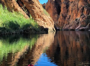
Kayak Canyon Lake Reservoir
4.5Canyon Lake is located in a National Recreation Area. It was created by the damming of the Salt River, in Arizona, specifically by the Morman Flat Dam. The lake sits at an elevation of 1,660' and has a mean depth of 130', and an area of 1.484 mi². We launched our kayaks from the boat launch area ...Read more -
Waddell, Arizona
Hike Goat Camp Trail
16 miThis is one of the less traveled trails in White Tank Mountain Regional Park. If you're looking for a solid day hike in the west valley, try this one. It isn't a loop, but it ultimately connects with some of the other long trails so if you're up for a long hike, you have options. This starts f...Read more -
Apache Junction, Arizona
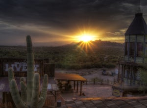
Catch a Sunset at Goldfield Ranch
4.0Although a tourist trap, Goldfield Ghost Town is a place any visitor might like stopping for a little food and a drink if they're hiking in the Superstition Mountains at the nearby Lost Dutchman State Park. It's certainly a place that has plentiful opportunities for some photography.While there y...Read more -
Apache Junction, Arizona
Drive Through The Apache Trail
4.8Its about a 40 minute drive to the beginning of the trail from Phoenix, and the trail itself is close to a two hour drive, if you don't plan on stopping along the way. The beginning of the trail really begins at the Superstition Mountains, you'll see a sign that says you are entering the Tonto Na...Read more -
Apache Junction, Arizona
Camp at Lost Dutchman State Park
4.8Lost Dutchman State Park is located near the Superstition Mountains in central Phoenix, about 40 miles from Phoenix. There is a $7 day use fee to enter the park, which is waived if you’re camping ($15/night). The park offers 134 campsites, each with a picnic table, barbeque grill, and fire pit, a...Read more -
Apache Junction, Arizona
Treasure Loop via Jacob's Crosscut Trail
3.78 mi / 620 ft gainStarting Treasure Loop from Jacob's Crosscut offers a slight variation on Treasure Loop as well as ~1.5 miles if you're looking for a little extra distance. This trail is dog friendly on-leash and is used by hikers and runners.Read more -
Apache Junction, Arizona
Hike Massacre Grounds Trail to Massacre Falls
5.05.5 mi / 1125 ft gainThere are many legends of a lost gold and buried treasures within the Superstition Mountains of Arizona. The most famous is the story of the Lost Dutchman Gold Mine. In the 1840's, the Peralta family from Northern Mexico mined rich gold ore from the area. In 1848 during one of the families exp...Read more -
Apache Junction, Arizona
Siphon Draw to Flatiron Summit
4.95.6 mi / 3415 ft gainFlatiron is one of the most popular day hikes in the Superstition Wilderness, just outside of Phoenix, AZ. The hike begins at Lost Dutchman State Park in Apache Junction. Once inside the park, drive to the last parking area and look for a sign for the Siphon Draw Trailhead. The Siphon Draw Trail ...Read more -
Apache Junction, Arizona
Treasure Loop Trail
4.82.34 mi / 571 ft gainLocated about 40 miles east of Phoenix right off AZ-88 E/N Apache Trail. The initial trail begins at an elevation of 2000 feet within the Sonoran Desert. The trail can be accessed via the Cholla (northern side) Day-use Area or the Saguaro (southern) Day-use Area. Once you're on the trail you wil...Read more -
Apache Junction, Arizona
Photograph Cactus Blooms at Lost Dutchman
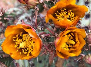
4.5And there is no better place to experience this beautiful display than at Lost Dutchman State Park. The State Park website shares that visitors can find "chuparosas, poppies, fiddle necks, globe mallow, chuparosa, brittle bush, desert evening primrose, lupine, ocotillo, chicory, scorpion weed, sk...Read more -
Apache Junction, Arizona
Hike to Praying Hands in Lost Dutchman State Park
4.04.3 mi / 954 ft gainBegin your hike in the Cholla parking lot, and start Treasure Loop Trail (this is the north side of the loop, heading east). Once you get to the base of the main cliffs, and the trail starts to veer to the right, this is where you branch off. Instead of veering right, go straight and off to the...Read more

