Arizona
Looking for the best hiking in Arizona? We've got you covered with the top trails, trips, hiking, backpacking, camping and more around Arizona. The detailed guides, photos, and reviews are all submitted by the Outbound community.
Top Hiking Spots in and near Arizona
-
North Rim, Arizona
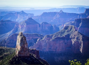
Hike Point Imperial Trail
5.38 miPoint Imperial is the highest point in the Grand Canyon, lying in the North Rim, at 8800ft and offering incredible views of staggered mountains. The trail itself is relatively easy. If you're not acclimated to the elevation you'll feel short of breath, but beyond that it mostly takes you through...Read more -
Grand Canyon Village, Arizona
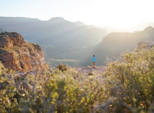
Cremation Canyon via South Kaibab Trailhead
10.43 mi / 3973 ft gainThe Grand Canyon is over 277 miles long and is full of unique geological formations in all sorts of colors. One of the most striking aspects of the Grand Canyon is its immense scale and the dynamic landscapes it has to offer. There's something about it that makes it extremely difficult to fully c...Read more -
Grand Canyon Village, Arizona
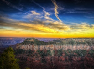
Photograph a Sunset from the North Rim Lodge
0.5 miI've read that only approximately 10% of Grand Canyon National Park visitors spend time at the North Rim, meaning the crowds are smaller in the most beautiful areas you can immerse yourself in without having to backpack to the bottom.This isn't so much of an adventure as it is the perfect way to ...Read more -
Sedona, Arizona
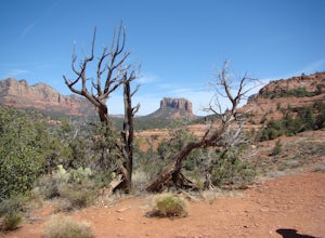
Templeton Trail to Oak Creek
5.02.05 mi / 358 ft gainBeginning at the Cathedral Rock trailhead down Back O' Beyond Rd., this path at the base of the Cathedral Rock climb takes the hiker down into a lush, tree covered area perfect for swimming and enjoying the views of red rock above and all around. Start by heading up the main trail, and as you eme...Read more -
Sedona, Arizona
Hike the Cockscomb Trail
1.5 mi / 330 ft gainThis is a wonderful less traveled trail that is fairly easy hiking, at least until you reach the base of the Cockscomb. It does not have much shade. I recommend hiking this trail late afternoon into sunset as the trail weaves between Doe Mountain and the Cockscomb on the west side. The setting su...Read more -
Morristown, Arizona
Hike the Pipeline Canyon Trail
4.84 mi / -220 ft gainStarting at a little below 2,000 feet this hike takes about two hours out and back over a two-mile stretch. There is a parking lot with bathrooms at either end.For those with small members of your hiking party and two vehicles you could easily leave a car at either end of the trail. There are als...Read more -
Maricopa County, Arizona
Hike the Goldfield Ovens Loop
7.5 mi / 575 ft gainA Tonto Day Pass is required for this hike as you will park your vehicle at the Blue Point Picnic Area. The trail starts North of the restrooms which are located at the backside of the parking lot. The trail takes you through a mesquite filled area alongside large rock faces. Be sure too look for...Read more -
Cave Creek, Arizona
Hike the Go John Trail
5.05.6 mi / 804 ft gainAs you park at the trailhead, you have the option to take this trail in either direction. I recommend that you travel north, which will immediately provide 0.75 miles of elevation gain. You will then reach a pass with panoramic views of the Tonto National Forest. A bench in this area provides the...Read more -
Glendale, Arizona
Deem Hills Loop
3.55 miLocated in north Phoenix, the Deem Hills recreation area features a dog park, playground, soccer field, and trailhead leading into the neighboring hills. To begin your hike, get around the dog park by starting at the Circumference trailhead on the north side of the parking lot. To complete th...Read more -
Phoenix, Arizona
Freedom Trail Loop
5.03.8 mi / 1093 ft gainAs the third longest trail in the Phoenix Mountain Preserve, the Freedom Trail provides a great option for those looking for a longer hike, which can also be made even a bit longer by bolting on the Piestewa Summit hike along the way (adds 1.2 miles additional and a view from the top!). Many look...Read more -
Morristown, Arizona
Hike the Wild Burro Trail
4 mi / 112 ft gainHike along the shoreline of beautiful Lake Pleasant. This 4.0 mile out-and-back trail is worth its weight in beautiful views. The path is well maintained and perfect for beginner hikers who enjoy leisurely hikes while looking for wild burros. The Wild Burro trail starts with a small descent from ...Read more -
Apache Junction, Arizona
Hike the Dutchman's Second Canyon Loop
5.016 miTo get to the trail head, drive past Lost Dutchman State Park on the 88 and then take the dirt road (on your right) with arrows leading you to First Water Trail Head. There is an outhouse at the trailhead, so I suggest visiting it before you begin this hike. I also started this hike about an ho...Read more -
GRAND CANYON, Arizona
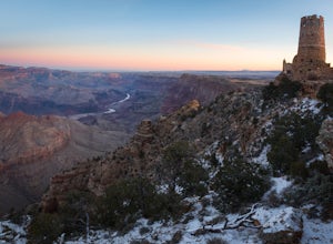
Photograph Desert View Watchtower
5.0Desert View Watchtower is a 70-foot high stone tower located on the South Rim of the Grand Canyon. Once you cross into the park through the east entrance look for the sign for Desert View, it's the first real lookout point in the park and there is plenty of parking.The tower was constructed in th...Read more -
Tucson, Arizona
Hike the Hugh Norris Trail, Saguaro National Park
4.09.5 mi / 2000 ft gainNamed for a Native American police chief, the Hugh Norris trail takes you from lush (by desert standards) Saguaro and cholla forests to the top of rugged Wasson Peak. On top of the peak, you'll have sweeping views of the city of Tucson, as well as the surrounding mountain ranges. Depending on y...Read more -
Grand Canyon Village, Arizona
Backpack the Bright Angel Trailhead to Indian Garden Campground
4.08.98 mi / 3060 ft gainThe trail begins just outside of the Grand Canyon village at the Bright Angel Trailhead. The hike begins to descend immediately in continuous switchbacks. The trail can get very icy so shoe traction devices, while not necessary, are very useful. Along the trail there are rest houses at the 1/3 an...Read more -
Chambers, Arizona
Blue Forest Trail
4.72.55 mi / 243 ft gainAlthough short, the Blue Forest Trail is one of the most unexpectedly coolest hikes I've been on. It's kind of strange to hike in what used to be a dense forest/swamp area that is now a barren desert full of petrified wood. Parking for this trail is just north of the Blue Mesa Loop in a pullout...Read more

