Arizona
Find local adventures, unique places to stay, and local adventure tours in iconic destinations like The Grand Canyon, Sonoran desert, Phoenix, and more. Discover desert adventures across the state like, hiking, backpacking, rafting, and more.
Top Spots in and near Arizona
-
Grand Canyon Village, Arizona
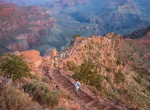
Run Rim-to-Rim-to-Rim in the Grand Canyon
5.040.79 mi / 11000 ft gainThis run is an extreme adventure and requires lots of planning and training. The risk for injury or heat related illness is high, so take precautions and don't run alone. Group sizes of 12-30 require a $175 permit from the NPS. These trails are popular with runners, hikers, and backpackers; pl...Read more -
Gold Canyon, Arizona
Peak 5057 via Hieroglyphic Trail
5.07.45 mi / 3045 ft gainTo get to the trailhead from US60, turn north onto Kings Ranch Road where you will begin the winding path through the neighborhoods. From Kings Ranch Road, turn east on Baseline Ave, north on Mohican Road, west on Valley View Drive, north on Whitetail Road, and east on Cloudview Ave until it com...Read more -
Fort McDowell, Arizona
Hike the Lower Salt River Nature Trail
2.52.4 miThis scenic loop offers views of Four Peaks, the Salt River & Verde River, and a desert landscape with plenty of wildlife. Keep an eye out for eagles, wild horses, and other wildlife while you're on the trail. This trail starts from the Phon D Sutton Recreation site, which is located at the...Read more -
Picacho, Arizona
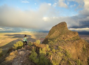
Hike Picacho Peak's Hunter Trail
5.04 mi / 1400 ft gainIf you've ever done the drive on highway10 from Phoenix to Tucson, you've definitely noticed an intriguing looking mountain peak about an hour into the drive. It broadly rises from the earth and tapers off into a point at the top, appearing like an illustration straight out of a Dr. Seuss book. ...Read more -
Sedona, Arizona
Hike or Bike the Hiline Trail in Sedona
5.08 mi / 480 ft gainStart this incredible hike by parking at the Yavapai Point parking lot. Start the short hike (0.13 miles) on the Kaibab Trail which will run into Yavapai Vista Trail (0.27 miles) towards the Slim Shady Trail. Here you will have an incredible view of Bell Rock and Courthouse Vista an excellent pla...Read more -
Flagstaff, Arizona
Bike along the San Francisco Peaks on Waterline Road
4.020 mi / 3000 ft gainWaterline Road is a closed service road that follows along the southern and eastern slopes of the San Francisco Peaks of Flagstaff, AZ. You will pass through several miles of charred ponderosa pine as well as expansive groves of aspen trees as you make your way to the Inner Basin.The road follows...Read more -
Grand Canyon Village, Arizona
Bright Angel Trail to Indian Garden and Bright Angel Campgrounds
5.018.26 mi / 4314 ft gainThe Bright Angel Trail is considered the park’s premier hiking trail. Well maintained, graded for stock, with regular drinking water and covered rest-houses, it is without question the safest trail in Grand Canyon National Park. There is a ranger station located at the trail’s halfway point (Indi...Read more -
Sedona, Arizona
Hike to Bear Mountain
5.06 mi / 2000 ft gainBear Mountain is one of the more difficult hikes in Sedona but has very easy access. There is a parking area between Doe Mountain and Bear Mountain. The trailhead is across the street and the initial approach is very flat. The red rock bluff you first see on the approach is only part of B...Read more -
Gold Canyon, Arizona
Fremont Saddle via Peralta Canyon Trail
4.74.53 mi / 1378 ft gainAfter taking Peralta Road all the way to the end, park your car in the parking lot and you'll see the sign for the trail head. Sign in at the register and then begin our hike on Peralta Trail. This trail winds through the canyon and then takes you up switch backs until you reach the saddle. The ...Read more -
Greer, Arizona
Backpack East Baldy Trail #95
13 mi / 1900 ft gainFrom the trailhead you start your hike with views over the East Fork of the Little Colorado River as it winds through grassy meadows filled with summer wildflowers. About 1.5 miles in the trail heads into the forest, on your left before you enter the forest is a nice primitive campsite where we s...Read more -
Sells, Arizona
Visit the Kitt Peak National Observatory
5.00.5 mi / 100 ft gainKitt Peak National Observatory (KPNO) is home to the most diverse collection of astronomical observatories on Earth for nighttime optical and infrared astronomy and daytime study of our sun. With 26 telescopes on the premises and partnerships with world-leading institutions such as the Massachuse...Read more -
Phoenix, Arizona
Mojave Trail #200
4.51.88 mi / 430 ft gainThe entrance for the Piestewa Peak area is located at 2701 E. Squaw Peak Drive. The Mojave Picnic Area & Trailhead is the first parking area on the right. This is a very popular trail when the outside temps drop a bit so get there early for sunset hikes to ease parking. The trail begins on t...Read more -
Tucson, Arizona
Catch The Sunset on Gates Pass
4.0Get on E Speedway Blvd, and follow it West until it turns into W Gates Pass rd. Follow this for 3 miles and the parking lot will be at the top of the pass. There are a few viewing platforms that offer shade from the desert heat. There are numerous trails that you can follow to get whatever view y...Read more -
Flagstaff, Arizona
Camp in the Coconino National Forest
3.8The free camping in the Coconino (as well as the many other national forests) is generally along the old Fire Roads, and old Forest Service Roads. You can tell if a road is one of these by a brown sign with an FS 123 or any other number, FS meaning Forest Service Road. There are many of these roa...Read more -
Willow Beach, Arizona
Canoe Black Canyon on the Colorado River
5.020 miThis 10-mile canoe trip starts at Willow Beach and reaches all the way to the Hoover Dam, giving you front row seats to beautiful canyon walls, waterfalls, hot springs, (sauna) caves, hiking trails, and much more. There are multiple campsites along the river but not all have pit toilets so bring ...Read more -
Prescott, Arizona
Kayak at Watson Lake
5.0Watson lake is relatively small so it makes a great place for beginners to kayak. One end of the lake is surrounded by large granite dells. Depending on the water levels you can kayak around and in between many of them. We kayaked around for about 2 hours before we felt like we had seen everythin...Read more

