Aguanga, California
A top choice for outdoor adventures in Aguanga, California is the Pacific Crest Trail. This must-visit hiking trail spans a significant portion of the state, offering scenic views of the diverse California landscape. Hikers can enjoy views of the nearby Lake Riverside and the Cahuilla Creek Casino, both located within Aguanga. The trail is moderately difficult, making it suitable for most hikers. Unique features of the trail include the vast array of rock formations and the opportunity to spot local wildlife. The Pacific Crest Trail is one of the best trails and outdoor activities in Aguanga, California. It's an ideal spot for those seeking to explore the great outdoors and enjoy the natural beauty of the area. Whether you're a seasoned hiker or a beginner, this trail has something to offer everyone.
Top Spots in and near Aguanga
-
Forest Falls, California
Vivian Creek Trail to San Gorgonio Peak
17.83 mi / 5627 ft gainVivian Creek Trail to San Gorgonio Peak is an out-and-back trail that takes you by a waterfall located near Forest Falls, California.Read more -
San Diego, California
Black's Beach via the Gliderport
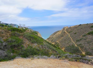
4.30.7 mi / 269 ft gainPark at the Torrey Pines Gliderport, which is conveniently empty before sunrise. The hike down to Black's Beach features a steep hike down a winding path of natural and manmade steps along the cliff face, but stay left and cruise the bluff for endless opportunities to observe, reflect and explor...Read more -
San Diego, California
Hike the Rose Canyon Trail
3.58.9 mi / 725 ft gainThis hike is open year-round but is especially beautiful in the spring when the wildflowers are blooming and the spring is running. This trail offers good entry level mountain biking, with mostly flat well maintained trails and a couple of challenging but doable hills.Read more -
San Diego, California
Mission Trails 5 Peaks
15 miThe 15-ish mile route we took made it a great workout, but it didn’t crush us. We left the apartment at 6 am and were back home with plenty of time to prep cook and eat a big dinner before 5 pm. Although I completed the hike in 1 day(and I highly recommend it)many people completed each hike indi...Read more -
San Diego, California
South Fortuna Mountain
5.04.59 mi / 997 ft gainHiking at sunset/night is a great way to beat both the heat and the crowds. On a clear day, you can see from Mexico to Catalina Island! If you stay long enough, you can see all of San Diego's city lights turn on, or the marine layer fog creeps into the canyons. South Fortuna Peak is part of Miss...Read more -
San Diego, California
Black's Beach via the Ho Chi Minh Trail
4.30.61 mi / 259 ft gainFinding the actual trail is 80% of the adventure. Once you turn down La Jolla Farms Road you will follow it for about 3/4 of a mile and there won't be anything too apparent that you are there, except a few cars parked along the street. Make sure to plug in the directions from the map so you know ...Read more -
San Diego, California
Visitor Center Loop Trail
5.01.46 mi / 148 ft gainThe Visitor Center Loop Trail is a 1.4 mile hike in San Diego that features river views and allows dogs.The Visitor Center Loop Trail is a well maintained, quick hike with shady spots scattered along the path and open year-round. This trail is great for kids and dog owners. There is a great netwo...Read more -
San Diego, California
Surfing at Black's Beach via the Main Gate
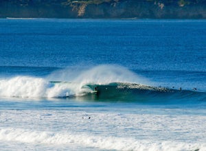
5.01 mi / 650 ft gainWith arguably some of San Diego’s best waves, Black’s Beach can be found in the vicinity of the University of California San Diego campus, at the southern end of Torrey Pines State Beach and north of La Jolla Shores. Stately eight-figure mansions now line the bluffs where pastures and the Black f...Read more -
San Diego, California
Pyles Peak
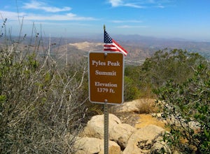
5.06.03 mi / 1706 ft gainMost people who live in San Diego have heard of, if not hiked, Cowles Mountain. At 1591 ft., Cowles is the highest peak in the city of San Diego. It's a hugely popular destination for day hikers and trail runners looking to get in a little trail time and take in the 360 degree views the summit h...Read more -
Riverside, California
Hike Two Trees Trail
2.5 mi / 977 ft gainParking is free at the trailhead, but there is only room for approximately five cars. The trailhead is on the edge of a neighborhood, so you can park there if needed. From the parking lot, head west, and immediately veer right and across the bridge. If you go left at the first fork, you can stay ...Read more -
Morongo Valley, California
Big Morongo Canyon Trail
11.65 mi / 1401 ft gainBig Morongo Canyon Trail is a loop trail where you may see wildflowers located near Morongo Valley, California.Read more -
Redlands, California
Run the Carriage Trail
3.52.5 mi / 300 ft gainThere is room to park just off San Timoteo Road. On the other side of the trail is more parking off Alessandro. You can park your car on either side and start your run/walk/bike ride. This is a nice little "get away" trail to take a break from suburbia.Read more -
San Diego, California
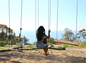
Swing on the La Jolla Tree Swings
3.0From Torrey Pines Rd, turn left onto La Jolla Shores Drive. After about 1/4 of a mile down start to look for parking preferably near UCSD Coastal Apartments. Once parked walk along the UCSD apartments until you see Discovery way. Make a left at Discovery where you will then cross the street. You ...Read more -
Borrego Springs, California
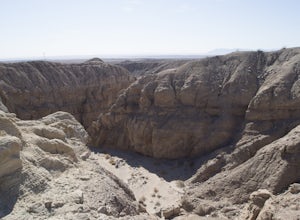
Hike the Calcite Mine Trail in the Anza-Borrego Desert
4 mi / 830 ft gainOpen from March until October - but I would not particularly recommend this hike in the summer months, unless you started in the wee almost dark hours. This is the desert and it gets hot early and quickly.This is a former calcite mine with slot canyons, great rock formations and some shady areas ...Read more -
San Diego County, California
Photograph Scripp's Pier
4.9Parking is easy, there are tons of random street you can park on just a little walk away. Be sure to arrive on scene at least an hour before sunset. Make sure to look up the sunset time and the weather forecast. Clouds will make for the most dramatic images with the most color from the sunset. Ex...Read more -
Silverado, California
Bedford Peak Trail
5.06.78 mi / 1972 ft gainThe Bedford Peak Trail in Silverado, California is a challenging hike that offers a variety of natural features. The trail spans 6.78 miles round trip and has an elevation gain of 1,972 feet. It is rated as difficult due to its steep inclines and rocky terrain. The trail begins in a dense oak w...Read more


