Big Bear, California
Looking for the best hiking in Big Bear? We've got you covered with the top trails, trips, hiking, backpacking, camping and more around Big Bear. The detailed guides, photos, and reviews are all submitted by the Outbound community.
Top Hiking Spots in and near Big Bear
-
Riverside, California
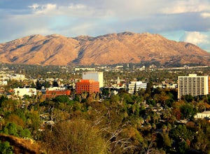
Hike Mt. Rubidoux
4.32.7 mi / 500 ft gainFeaturing over 161 acres and over 3.5 miles of combined paved and dirt trails, Mount Rubidoux Park in Riverside, CA is a beautiful natural environment and adventure location. Although some say this is just a "hill", this Inland Empire gem offers a quick escape from the pace of city life. Just m...Read more -
Palm Springs, California
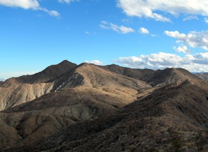
Araby and Berns Trail Loop
4.76 mi / 1293 ft gainAraby and Berns Trail Loop is a loop trail that takes you past scenic surroundings located near Palm Springs, California.Read more -
Palm Springs, California
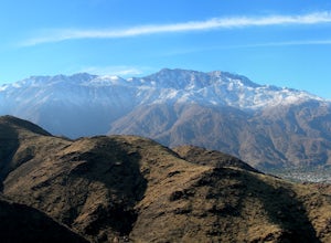
Murray Hill via Araby Trail
5.08.85 mi / 2844 ft gainMurray Hill is the highest point in the surrounding trail system. You can access it from Araby Trail or anyone of the others in the area. It's about 9 miles round-trip and a healthy 2,850 vertical feet gain. From the top of the Shannon Trail bear right until you reach the Wildhorse Trailhead. Go...Read more -
Palm Springs, California
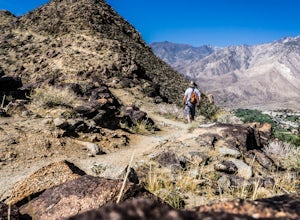
Araby Trail
4.58 mi / 1545 ft gainThis hike takes you up to Bob Hope’s massive mushroom shaped house. The neighborhood also includes a house where Steve McQueen lived and the Elrod House featured in the James Bond film “Diamonds are Forever”. It’s a fairly easy hike up to Bob’s but really climbs after you pass the estate. You c...Read more -
Palm Springs, California
Earl Henderson and Shannon Trail Loop
4.31 mi / 1257 ft gainThis is a short but sweet trail close to the Araby and Garstin Trails. Great views of Palm Springs and the San Jacinto Mountains. Parking area is off of Lansdale Street. From here, head down the Earl Henderson Trail and you will see where in connects with the Shannon Trail. You can choose to swit...Read more -
Palm Springs, California
Murray Hill Loop
8.16 mi / 2260 ft gainMurray Hill Loop is a loop trail that takes you past scenic surroundings located near Palm Springs, California.Read more -
Palm Springs, California
Andreas Canyon
5.01.03 mi / 154 ft gainAndreas Canyon in Indian Canyons is located very close to Palm Springs in the Agua Caliente band of Cahuilla Indians Reservation. It is one of the few places with abundant shade and running fresh water in an otherwise dry desert landscape. Enjoy a longer hike to a waterfall (Seven Falls) or stay ...Read more -
Palm Springs, California
Seven Falls via Murray Canyon Trail
4.01 mi / 587 ft gainA very scenic 4-mile round trip with a rewarding waterfall after a 2.5-mile hike/stroll. Lucky visitors may catch a glimpse of the Peninsula Big Horn Sheep (an endangered species), mule deer or other wild animals still roaming the high ground above the canyon. Less visited, Murray Canyon has its ...Read more -
Palm Springs, California
Coffman Trail from Andreas Canyon Rd
3.56 mi / 525 ft gainCoffman Trail, located in Palm Springs, California, is a popular hiking destination. The trail is approximately 3.56 miles long and is rated as moderate in difficulty. It begins at Andreas Canyon Road and winds its way up the mountainside, offering panoramic views of the surrounding desert landsc...Read more -
Hemet, California
Hike South Fork Trail
5.4 mi / 1056 ft gainBegin by following the unsigned but visible trail on the south side of the turnout. You climb steadily through bushes and past granite boulders. At half a mile, you pass over to the western slope of the hill where the trail bends southeast, providing your first look of the river valley far below....Read more -
Palm Springs, California
Indian Potrero Loop Trail
8.67 mi / 1247 ft gainIndian Potrero Loop Trail is a strenuous loop trail located near Palm Springs, California.Read more -
Palm Springs, California
Indian Canyon West Fork Trail
5.3 mi / 1545 ft gainIndian Canyon West Fork Trail is a strenuous out-and-back trail located near Palm Springs, California.Read more -
Palm Springs, California
Palm Canyon Trail
4.51.94 mi / 308 ft gainThe fifteen mile long Palm Canyon, one of the Indian Canyons, is among the most beautiful natural sites in Western North America. Its indigenous flora and fauna, expertly used by the Cahuilla people, and its abundant Washingtonia Filifera (California Fan Palm) stand in breathtaking contrast to th...Read more -
Twentynine Palms, California
Canyoneer Joshua Tree's Rattlesnake Slot Canyon
The trailhead is located at the end of Indian Cove road. From Indian Cove Campground, take the road to the east about a mile to a picnic area where there is parking at the mouth of the canyon.From the picnic area hike up the Canyon in a south to south-east direction. After a few hundred yards a d...Read more -
Mountain Center, California
Apache Peak Trail
9.4 mi / 2966 ft gainApache Peak Trail is an out-and-back trail where you may see wildflowers located near Mountain Center, California.Read more -
Twentynine Palms, California
Willow Hole Trail in Joshua Tree National Park
6.8 mi / 341 ft gainThe Willow Hole hike begins at Boy Scout trailhead and winds past and through the Wonderland of Rocks to a marshy stand of willows. The trail is flat, but with little shade so be sure to bring lots of water! As you leave the parking lot you'll enter an expansive stand of Joshua Trees that grows...Read more

