Big Pine, California
Looking for the best hiking in Big Pine? We've got you covered with the top trails, trips, hiking, backpacking, camping and more around Big Pine. The detailed guides, photos, and reviews are all submitted by the Outbound community.
Top Hiking Spots in and near Big Pine
-
Bishop, California
Baboon Lakes via Sabrina Basin
8.53 mi / 2165 ft gainGorgeous and sizable alpine lakes beyond Blue Lake via Sabrina Basin trail. There are some very confusing descriptions on the internet for this so hopefully this can help. Hike for 3 miles to get to Blue Lake, which is huge and a popular camping spot for backpackers. Continue past the lake (it ...Read more -
Bishop, California
Sailor Lake Backpack & Climb of Mt. Haeckel
5.013 mi / 2500 ft gainThe basic part of this adventure is a backpack to Sailor Lake. From there you can enjoy small dayhikes to the nearby lakes or waterfalls, go fishing, enjoy some photography or just lounge in camp and gaze at the beautiful scenery. Although Sailor Lake looks smaller than the nearby lakes it stil...Read more -
Bishop, California
Backpack the Piute Pass Trail in the John Muir Wilderness
21 mi / 2000 ft gainWith so many famous hiking trails in the Sierras, its hard to find a trail as isolated as the Piute Pass Trail. This trail allows you to hike in the John Muir Wilderness, Inyo National Forest, and Sierra National Forest in one 20 mile section of trail. You will encounter amazing wilderness, spect...Read more -
Bishop, California
Backpack Across Mt. Humphreys Basin
30 mi / 3375 ft gainBefore heading out, you will need to get a backpacking permit to stay overnight in this area. You can buy one here to pick up in town at the Bishop, CA Ranger Station, in the morning.The trailhead begins at North Lake campground (9,345'), in a beautiful lush area, with streams and aspen groves. A...Read more -
Bishop, California
Backpack to Upper Lamarck Lake
5.05.8 mi / 1562 ft gainStarting out at North Lake Campground, the trail to Lamarck Lakes is a fairly gradual ascent. After climbing out of the meadows near the trailhead, you will find yourself on a ridge with few trees to block the great views of Grass Lake and the valley below. Lake Sabrina is on the other side of ...Read more -
Bishop, California
Photography in the ButterMilks
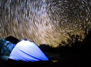
5.0The Eastern Sierras have some of the most spectacular views in the world. This area in particular is known for its rock climbing. It also has amazing opportunities for photographers.The nights during a new moon are incredibly dark and create great astro photography shots. During the day, the l...Read more -
Bishop, California
Bouldering In The Buttermilks
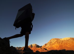
5.0The Buttermilks is a historical climbing area that is home to some of the worlds most famous rock climbs. It is located at the base of the Eastern Sierras near Bishop, CA. In this region there are 3 main bouldering areas: The Happies, The Sads, and The Buttermilks.The Buttermilks are massive gr...Read more -
Bishop, California
Patriarch Grove Trail
0.44 mi / 95 ft gainPatriarch Grove Trail is a loop trail where you may see wildflowers located near Bishop, California.Read more -
Bishop, California
Hike Pine Creek Pass to Lower Pine Lake
10 mi / 2500 ft gainThe Pine Creek Pass is usable for day hiking and overnight adventures. If you'd like to spend the night, be sure to pickup a wilderness permit! If you plan to bring a four legged friend, make sure to indicate that on your wilderness permit request. There are several lakes you can stop at througho...Read more -
Independence, California
Charlotte Lake via Kearsarge Pass
4.016.38 mi / 4078 ft gainThis adventure begins at Onion Valley Campground outside of Independence, CA. The parking is abundant and the road is snow dependent. Snow will be plowed as long as it is not currently being hit with a massive storm. Dogs are allowed on trail up to Kearsarge Pass (4.5 miles from the trailhead). H...Read more -
Independence, California
Rae Lakes via Glen and Kearsarge Passes
5.026.02 mi / 7106 ft gainThe hike starts at Onion Valley campground and includes a good deal of elevation (two passes around 12,000 feet). You start climbing at the outset, and keep climbing for the first couple of hours before hitting Kearsarge Pass. Here you begin a long descent, then traverse above some beautiful lake...Read more -
Independence, California
Summit Mt. Gould
9 mi / 3812 ft gainStarting at 9,200 feet at Onion Valley Campground, take Kearsarge Pass Trail. The hike begins immediately with a substantial increase in elevation, switchbacking up the mountain. On the way up rest and enjoy the beautiful alpine lakes, which include Gilbert, Flower, Heart and Big Pothole Lake. Fl...Read more -
Independence, California
Onion Valley to Mt. Whitney
47.35 mi / 11745 ft gainTrip Guide ***Please note, all images after the first one are arranged in chronological order of the trip so you can easily follow along Day 1 Depending on where you are coming from your day one is most likely going to be setting up your car shuttle from Whitney Portal to Onion Valley. Our fi...Read more -
Independence, California
Flower Lake from Onion Valley
5.04 mi / 1352 ft gainMake sure to obtain an overnight permit up to 6 months in advance. You will have to pick up your permit at one of the Inyo National Forest Visitor Centers (here) before you begin. Once you have your permit in hand, drive to the Onion Valley Trailhead (see map), which is about 15 miles west of th...Read more -
Bishop, California
Climb White Mountain Peak
4.314 mi / 2000 ft gainNot surprisingly, White Mountain Peak is the apex of the White Mountains, which rise out of the desert floor just north of Death Valley. The White Mountains were aptly named as they are frequently covered in snow.The trailhead starts at 12,000ft and winds it's way over a few hills before the fina...Read more -
Seven Pines, California
Mt. Williamson via Shepherd Pass
5.026.66 mi / 10653 ft gainThis trail starts at the lowest, and generally regarded hardest, trailhead in the Southern Sierras. You quickly gain elevation in what many describe as manageable but relentless. The first section of the hike has nice shade and adequate water access. Very enjoyable company to boot! Once you cros...Read more

