Bridgeport, California
Looking for the best camping in Bridgeport? We've got you covered with the top trails, trips, hiking, backpacking, camping and more around Bridgeport. The detailed guides, photos, and reviews are all submitted by the Outbound community.
Top Camping Spots in and near Bridgeport
-
YOSEMITE NATIONAL PARK, California
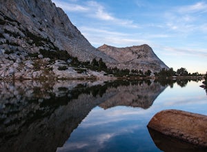
Fletcher Lake and Vogelsang Peak
19.03 mi / 2887 ft gainBefore you head out for the trip, you’ll need to get a wilderness permit. You can get one online from the Yosemite website or pick one up at the Tuolumne Meadows Wilderness Center or from the Wilderness Center in Yosemite Valley. Go to Yosemite and take Highway 120 up to Tuolumne Meadows. You ca...Read more -
Tuolumne County, California
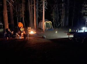
Camp at Tuolumne Meadows Campground
5.0Tuolumne Meadows is on Tioga road northeast of Yosemite Valley, at elevation 8,600 feet. Sites are available July-September at $26. Dogs are allowed but be sure to pack the leash! More info: https://www.nps.gov/yose/plany...Read more -
Tuolumne County, California
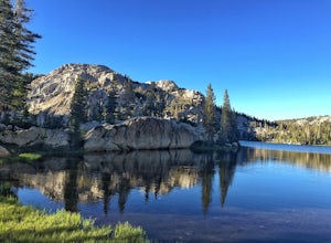
Backpack to Boothe Lake
5.016.6 mi / 1400 ft gainStarting at the Tuolomne Meadows Visitor Center you will head south to jump on the John Muir Trail, move east for 2.8 miles on the JMT until the trail intersects with the Vogelsang High Sierra trailhead, you head south when you reach this trail. Once you hit the Vogelsang trail you are 5.5 miles ...Read more -
Wawona, California
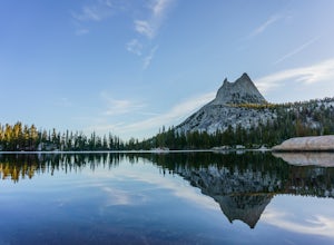
Cathedral Lakes
4.89.04 mi / 1100 ft gainStarting at the Cathedral Lakes Trailhead near the Tuolumne Meadows parking lot (if parking is full at the TH), this trail wanders through the classic High Sierra forest with large white granite boulders and pine trees. After approximately 4 miles of quiet solitude in the forest, you will reach ...Read more -
Cathedral Lakes Trailhead
Tuolumne Meadows to Yosemite Valley
5.030.82 mi / 6109 ft gainYosemite is an iconic park, and if you are looking for isolation with spectacular views of the backcountry this trip is for you. The trail itself is approximately 33 miles and can be done in 3-4 days, but I recommend a 6 day hike to enjoy the scenery and to have the opportunity to soak in each lo...Read more -
Tuolumne County, California
Backpack to Nelson Lake
17 mi / 1000 ft gainHead to any Yosemite wilderness station for a map, bear canister, and permit for Nelson Lake. The trail itself starts in the Tuolumne Campground at Elizabeth Lake trailhead. Follow the trail 2.2 miles up to Elizabeth Lake and remember the lake itself is in a no-camping zone, so you must continue ...Read more -
Pinecrest, California
Lower & Upper Relief Valleys and the East Flange Rock
21.6 mi / 3600 ft gainThe Lower and Upper Relief Valleys are beautiful alpine valleys cut by Relief Creek in the heart of the Emigrant Wilderness and are an excellent alternative to Yosemite National Park if you're looking for solitude and no crowds. The East Flange Rock juts prominently over Lower Relief and is an ea...Read more -
Pinecrest, California
Climb Granite Dome via Lower & Upper Lewis Lakes
25 mi / 5000 ft gainGranite Dome is the signature peak in the Emigrant Wilderness, with fantastic views north to the Carson-Iceberg Wilderness, east to the Hoover Wilderness (Sawtooth Ridge), and south to Yosemite including, on a clear day, Cathedral Peak and the Cathedral Range.There are several routes up Granite D...Read more -
Pinecrest, California
Camp at Baker Campground
5.0/ 6224 ft gainBaker Campground is a first come, first serve campground. Each site is equipped with a fire ring, picnic table, and bear boxes. The cost for a single family site is $20 per night and a double family site is $40 per night. The campground provides bathrooms and potable water. The campground is typi...Read more -
Mariposa County, California
Hike to Tuolumne Peak Plateau
11.7 mi / 1800 ft gainThe most direct route begins at Murphy Creek trailhead, on the north side of Tioga Road near Tenaya Lake. Walk north on Murphy Creek trail for 2.5 miles with minimal elevation gain. Polly Dome Lakes are a great side trip via the social trail on the right side of the trail before the first junctio...Read more -
Mariposa County, California
Sunrise Lakes to Clouds Rest
4.718.93 mi / 1775 ft gainStart out at the Tenaya Lake Trailhead, where you can head directly onto the trail for Clouds Rest or you can branch off after 2.7 miles to Sunrise Lakes. This allows you to break up the hike, spend a night relaxing and help you have an early start back on the trail. Once re-connected to the Clo...Read more -
Mariposa County, California
May Lake Trail
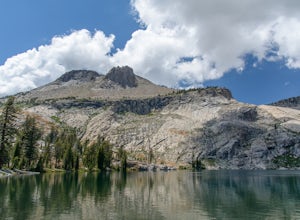
4.02.34 mi / 489 ft gainMay Lake is a stunning, serene subalpine lake that rests at the base of Mt. Hoffmann. The May Lake turnoff is located four miles past Tenaya Lake. From the turnoff, it's 1.8 miles to the trailhead parking lot. During summer time, I will recommend getting to the parking area early to get a spot ...Read more -
Mariposa County, California
Mt. Hoffman via May Lake Trailhead
5.55 mi / 2140 ft gainThe May Lake trailhead is at the end of a 2-mile unpaved road leading north from Tioga Road. The trailhead has pit toilets and bear lockers. (Please be sure to store any food, garbage, scented items, and empty coolers in these lockers while hiking!) After hiking an easy 1.3 miles, you'll arrive ...Read more -
Bishop, California
Camp at Oh Ridge Campground on June Lake
5.0Nestled along the shores of picturesque June Lake, is the Oh Ridge campground. Oh Ridge has access to the beach of June Lake via Pine Cliff Road, and the town of June lake as well as Gull Lake, Silver Lake, and Grant Lake are all within a short driving distance along the June Lake Loop. Mammoth ...Read more -
Mariposa County, California
Grant Lake via Ten Lakes Trailhead
4.012.24 mi / 2000 ft gainThe trail begins at the Ten Lakes trailhead (7600 ft) right beside Yosemite Creek. The first 4 miles start you on the ascent through the wooded forest, however there are portions of the trail that will take you through granite rock valleys marked with only cairns so keep your eyes peeled througho...Read more -
June Lake, California
Explore June Lake
4.7June Lake is a hidden gem in the Eastern Sierra, just north of Mammoth Lakes. June Lake is a quaint little lake with spectacular views. The neighboring town of the same name also boasts a brewery with tasty brews. For a truly unforgettable sunset, grab some brews and walk over to June Lake for th...Read more

