Calabasas, California
Looking for the best photography in Calabasas? We've got you covered with the top trails, trips, hiking, backpacking, camping and more around Calabasas. The detailed guides, photos, and reviews are all submitted by the Outbound community.
Top Photography Spots in and near Calabasas
-
Malibu, California
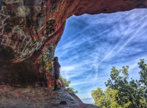
Jim Morrison Cave
3.21.2 mi / 600 ft gainNote: Jim Morrison Cave is closed indefinitely. The bright colors of the Jim Morrison Cave are something to not be missed, and is appreciated by people of all ages. The cave also provides a beautiful outlook of the Malibu canyon, Malibu State Park and the Pacific Ocean. There is a ton of rock ho...Read more -
Los Angeles, California
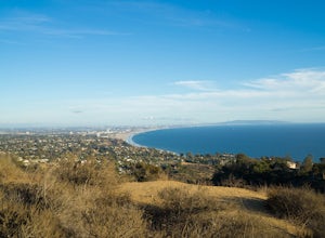
Parker Mesa Overlook via Paseo Miramar
4.25.32 mi / 1099 ft gainThis 5.4-mile out-and back trail takes off from the end of the residential area of Paseo Miramar. Once you hike a little less than a quarter mile in, you'll connect with Los Liones Canyon Trail. Continue on Paseo Miramar Trail, which in another 2.5 miles, will connect you with the Parker Mesa Ove...Read more -
Malibu, California
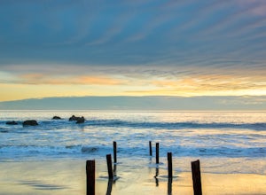
Ratner Beach
4.5Unlike most beaches in Los Angeles, this tiny little stretch of beach is usually empty, and is a little gem! It is the perfect place to get an unobstructed view of the sunset, and the sticks in the ground make for a picturesque sunset picture! Just be warned, this beach is right on PCH, so expect...Read more -
Los Angeles, California
Temescal Canyon Loop
3.93.76 mi / 810 ft gainThere are a couple of different ways that you can hike in Temescal Canyon. For this one, the loop begins from Temescal Canyon Trail at Sunset Boulevard and is approximately 3.76 miles. This loop is not dog friendly. Additional Options for Hiking Temescal Canyon: The basic loop – 2.6 milesTh...Read more -
Los Angeles, California
Inspiration Point Loop Trail
2.36 mi / 486 ft gainThe Inspiration Point 2.3 mile loop hike in Will Rogers State Park is a family-friendly hike or after-work run near Los Angeles, California. It’s a great dirt trail for all skill levels and features scenic views and beautifully budding wildflowers. You’ll get to escape the city and take in the br...Read more -
1501 Will Rogers State Park Road, California
Backbone Trail via Will Rogers State Park
5.03.02 mi / 656 ft gainYou'll make your way up Will Rogers State Park Road, located just minutes from Santa Monica, Brentwood, Westwood, Malibu, Palisades, and much of west Los Angeles. Once on the road, head all the way to the top and you'll dead end into the parking lot. Always worth supporting State Parks with the p...Read more -
Malibu, California
Hike the Backbone East from Latigo Canyon
3.8 mi / 780 ft gainStarting in a dusty, generally empty parking lot, at about 2,000' ASL, you'll go immediately due north, up a few more feet before you drop down into another canyon covered in live oaks (and poison oak), thistles, ferns, and wildflowers. There's only one trail. It's windy, it's not hilly, it just ...Read more -
Los Angeles, California
Reseda Point
4.00.2 mi / 30 ft gainFrom the 118 FWY, exit Reseda and head north until you pass by Calle Vista Circle. Once passed, make a U-turn and park on the side of the street. Here you will find the trailhead for the Palisades Trail Hike. To get to the scenic lookout, simply walk up the short trail leading up the hill, and h...Read more -
Malibu, California
Newton & Zuma Canyon Falls
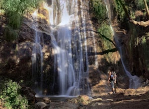
4.32 mi / -600 ft gainThree waterfalls in one short hike?!...I'll take it! That's what you'll get if you make the visit to these falls in the Santa Monica mountains in Malibu. The trailhead starts on Kanan Dume road, which is also where the Backbone trail meets. Park in the designated (free) parking area and take the ...Read more -
Malibu, California
Escondido Falls Trail
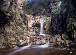
4.33.74 mi / 699 ft gainThis 3.8 mile out-and-back hike takes place on a very easy to use trail. The first 0.75 miles on Winding Way are paved, leading you up to Escondido Canyon Trail. As you head up Winding Way, it’s safest to stay on the side of the road on the dirt. You’ll take this paved road up roughly 200 feet be...Read more -
Santa Monica, California
Spend a Day at the Santa Monica Pier
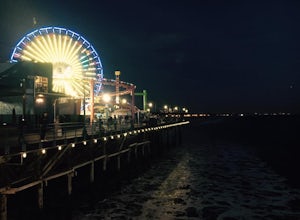
4.2*Unlimited photography options with the ferris wheel, beach, ocean, and sunsets *Abundant people watching opportunities *Plenty of ways to get a workout in including swimming, volleyball courts, running, or riding a bike There is a bike and walking path that runs along the coast. One of my favo...Read more -
Malibu, California
Point Dume
4.80.95 mi / 141 ft gainFrom the parking lot, make your way towards Point Dume. You will find the entrance to the trail at the end of the lot. The trail is a bit sandy, but fairly easy. Be careful of the cactus plants along the trail! Make your way up towards the cliff and you'll notice ropes hanging on the edge. Don't...Read more -
Malibu, California
Paradise Cove via Point Dume
5.04.74 mi / 338 ft gainYou will start your beach-hiking to Paradise Cove from Point Dume which is located 20 miles north of Santa Monica on Pacific Coast Highway (PCH). On PCH, take left on Westward Beach Road and follow it to the end. Try to park as close to the end of the paid parking lot. You can use the automated m...Read more -
Stevenson Ranch, California
Hike the Towsley Canyon Loop
4.75.1 mi / 1340 ft gainThe Towsley Canyon Loop can be done in either a clockwise or counter-clockwise loop. The clockwise path starts with a gradual ascent through Wiley Canyon and steep descent into the Towsley Gorge while a counter-clockwise route starts with a steep climb out of Towsley Canyon and a gradual descent ...Read more -
San Fernando, California
Pacoima Park Natural Wash Park
0.54 mi / 13 ft gainPacoima Park Natural Wash Park makes for a wonderful & pleasant walk. The entrance to the park is located at the corner of Newton St and 8th St and runs up to Foothill Blvd in San Fernando California. The park is ADA accessible and allows for dogs on leash. There are also picnic tables and dr...Read more -
Thousand Oaks, California
Hiking Wildwood Regional Park
3.8Wildwood Regional Park is open year-round, easily accessible, and offers great routes for hiking, running, biking, and even horseback riding. There are also two waterfalls inside the park—the larger of the two, Paradise Falls, cascades 40 feet into a large pool. To catch some beautiful views of t...Read more

