Coleville, California
Looking for the best camping in Coleville? We've got you covered with the top trails, trips, hiking, backpacking, camping and more around Coleville. The detailed guides, photos, and reviews are all submitted by the Outbound community.
Top Camping Spots in and near Coleville
-
Zephyr Cove, Nevada
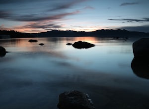
Photograph Zephyr Cove at Sunset
5.0After pulling into the parking it is only a a few minute walk right down to the beach. This place is incredible for sunrise and and sunset. The water is so calm because its tucked back in the cove which gives awesome reflections of the sky in the water. Make sure to bring a tripod and neutral den...Read more -
Glenbrook, Nevada
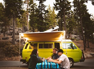
Camp at Zephyr Cove
Zephyr Cove on the eastern shore of Lake Tahoe is a fantastic starting point for a host of water sports and outdoor activities, from wake surfing to backpacking to trail running on the Tahoe Rim Trail. The Zephyr Cove Resort campground has 47 walk-in campsites and 10 drive-in campsites in additio...Read more -
South Lake Tahoe, California
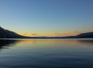
Camp at Fallen Leaf Lake
5.0Fallen Leaf Lake is truly one of the more beautiful places in California. Separated from Lake Tahoe by just a one-mile strip of land, it feels worlds away from the crowds and fuss. The campground has over 200 sites that can be reserved here. There are endless hikes nearby including Mount Tallac a...Read more -
Lee Vining, California
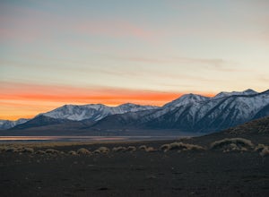
Camp at Mono Lake
5.0Many people visit Mono Lake for a quick photo opportunity of the South Tufa. When I discovered camping was allowed on the North side of the lake, I knew I had to experience it and share.You head East on Cemetery Rd. just North of Lee Vining. This road turns into a dirt road, which will require yo...Read more -
South Lake Tahoe, California
Backpack to Eagle Lake and Dick's Lake
4.513 mi / 1500 ft gainGet ready to get your lake on! This backpacking trip will take you 13+ miles through awesome scenery to several alpine lakes.Starting at the Bayview Campground, off of HWY 89, this hike follows the Granite Lake Trail along a difficult climb. Don't let the climb discourage you! As you climb, the v...Read more -
South Lake Tahoe, California
Hike to Snow Lake in Desolation Wilderness
5.05 miThis wonderful alpine lake is a relatively short hike in Desolation Wilderness and is a perfect introduction to off trail exploration. This area lacks the crowds that other lakes in Desolation garner because most maps don't show the trail leading to the lake. Although there is a rough trail, the ...Read more -
South Lake Tahoe, California
Lower, Middle, and Upper Velma Lakes
3.010.14 mi / 2316 ft gainThe hike starts at Bayview Trailhead (Latitude: 38.938619 | Longitude: -120.14197). A wooden sign points right to "Desolation" and left to Cascade Falls. Follow the sign towards Desolation. The first 3/4 mile is comprised of switch-backs that lead to a high point with a spectacular view of Lake T...Read more -
Lee Vining, California
Junction Campground, Mono County
Junction campground is by far one of my favorite campsites when I am visiting the High Sierra and Tuolumne Meadows. The only downside is, you can only camp certain months; usually from June through October when highway 120 is open. The Junction campground is far away from the crowds of Yosemite...Read more -
South Lake Tahoe, California
Camp at Bayview Campground
5.0Bayview is a first come, first serve campground in South Lake Tahoe, halfway between Emerald Bay and Cascade Lake. You can catch an amazing sunrise over Emerald Bay! Large pine trees provide ample shade, and each site is equipped with a picnic table, grill, and bear boxes. Bring plenty of water -...Read more -
South Lake Tahoe, California
Middle Velma Lake via Eagle Falls Trailhead
4.59.18 mi / 2251 ft gainHiking or backpacking to the Velma Lakes area is a must do if you want to explore and escape the summer crowds of South Tahoe. There are 3 lakes, Upper, Middle, and Lower Velma Lake. The trek out to Middle Velma is 9+ miles roundtrip, but you can add to it depending on how many other lakes you wa...Read more -
Groveland, California
Hetch Hetchy to Rancheria Falls
4.812.55 mi / 2500 ft gainSituated in the northwest portion of Yosemite National Park, Hetch Hetchy is is a not often visited treasure of the Central Sierra Nevada. In 1913, in an extremely controversial move, work on the O’Shaughnessy Dam was started to provide water to the growing population of San Francisco. Today, Het...Read more -
Kyburz, California
Hike Pyramid Peak
5.0Although it stands only slightly higher than its neighbors, Pyramid Peak nonetheless dominates the Crystal Range atop which it sits. Great views from the summit make this a must-do.The Route: The route is fairly straightforward to Lake Sylvia (see map). Simply follow the well-defined Lyons Cr...Read more -
Kyburz, California
Hike the Grouse, Hemlock, and Smith Lake Trail
5.0Starting from the Wright's Lake parking area, walk past the service gate to find the loop trail. Follow the loop trail to the signed trail for Twin, Grouse, Island, and Hemlock Lakes heading toward the right. You will begin an approximate 150 foot ascend before coming to a saddle. Another 150 foo...Read more -
Kyburz, California
Twin and Island Lakes
5.06.26 mi / 1237 ft gainThe Twin Lakes trail starts winding through a pine forest, with a couple of bridge crossings over crystal clear trout-filled streams. The marsh-like water is very slow-moving, and even though it is indeed beautiful, it is also a prime location for pesky mosquitoes in the summertime. Be sure to ...Read more -
Kyburz, California
Backpack Desolation's Primitive Western Edge through Rockbound Pass
4.426.28 mi / 5151 ft gainThis 26 mile loop meanders through some of the most primitive trails in Desolation Wilderness. Starting from Wrights Lake, the route proceeds over Rockbound Pass, loops around several lakes, and returns to Wrights Lake. Not many hikers venture past the steep and rocky Rockbound Pass to enter this...Read more -
Tuolumne County, California
Lyell Loop
35.88 mi / 5541 ft gainStart the hike at the Mono pass trail. You'll eventually take the fork towards Parker Pass a couple miles in. We tackled the trail in late spring, and it quickly became clear that there was still enough snow to make our lives difficult. As we climbed out of the Parker drainage, the trail essenti...Read more

