Mad River, California
Top Spots in and near Mad River
-
Platina, California
Hike to Massacre Natural Bridge
5.01 miNatural Bridge is a historic/geologic site located near Hayfork, CA off Wildwood Road near Chanchelulla Peak in the Shasta-Trinity National Forest. To get there take Hwy 36 or 299 to Hwy 3/Hayfork, then take Wildwood Road to Forest Service Road 31N19 (unpaved)- Natural Bridge is a mile or two off...Read more -
Redcrest, California
Hike through the Founder's Grove in Humboldt Redwoods State Park
5.01.3 miThe Founder's Grove is easily accessed from Highway 101 in northern California. The grove is also on the Avenue of the Giants Scenic Highway. This area, named after the founders of the Save the Redwoods League, is flat and has a relatively open understory making it one of the most picturesque gro...Read more -
Garberville, California
Explore the Avenue of the Giants
5.0The Avenue of the Giants is a scenic 31 mile long highway that is surrounded by 51,222 acres of giant redwood trees in the Humboldt Redwoods State Park. This road offers amazing views of the redwoods. The Avenue of the Giants runs through many small towns that offer tons of tourist attractions.Th...Read more -
Humboldt County, California
Hike the Humboldt Redwoods River Trail
3.4 mi / 450 ft gainYou probably won't find as many people along this trail (which I like!) as it's unmarked and sits just south of Rockefeller Loop which draws a good number of visitors, primarily because it has the tallest trees (also definitely worth a visit!). The River Trail is a relatively short, flat hike wit...Read more -
Humboldt County, California
Hike the Rockefeller Forest Loop
0.7 mi / 20 ft gainFrom the Avenue of the Giants turn west onto Mattole Road. Continue 1.5 miles to the Rockefeller Forest trailhead.Rockefeller Forest is a less well known grove in Humboldt Redwoods State Park. It's distance from the main road shelters the forest from traffic noise. The trail is wide and smooth, ...Read more -
Junction City, California
Camp at Junction City Campground
3.0Junction City Campground is home to 22 tent/trailer campsites, paved loop road, vault toilets, potable water, fire rings, and picnic tables. MAX trailer length is 40 feet. The campground is located 1.5 miles west of Junction City on State Highway 299.Dogs are welcome in the campground -- please k...Read more -
Junction City, California
Fly Fish the Trinity River
The Trinity River is one that is rarely visited by your typical Bay Area resident. In fact, much of true Northern California is "untouched" in the eyes of those who live in The City, which is what drew me to this place to begin with. After a five hour journey from San Francisco, we made it to our...Read more -
Douglas City, California
Camp at Douglas City Campground
The campground amenities include 20 tent/trailer campsites, group picnic area, picnic tables, telephone, beach, paved loop road, flush and vault toilets, potable water, and fire rings. MAX trailer length is 28 feet.Douglas City is located along the Trinity River. Follow State Highway 299 to Dougl...Read more -
Douglas City, California
Camp at Steel Bridge Campground
Steel Bridge is located along the Trinity River. About three miles east of Douglas City on State Highway 299, turn north onto Steel Bridge Road and go about 2 miles to the campground.This campground is open from Mid-May until winter weather forces closure. The campground is home to 12 camping s...Read more -
Garberville, California
King's Peak via Lightning Trailhead
5.04.79 mi / 1942 ft gainKing's Peak is the tallest peak in the King Range, the home of the famous and spectacular "Lost Coast". At an elevation of 4,000' and less than 3 miles from the ocean, King's Peak provides stunning views in all directions: of canyons, beaches, foggy valleys, and the many greenhouses that dot the ...Read more -
Junction City, California
Canyon Creek Lakes
4.314.35 mi / 2605 ft gainNumerous starting points with over 550 miles of trail and easily 50+ different featured trails depending on length and what type of activity you are are looking for. One of the more popular trails, and rightfully so, is Canyon Creek Lakes Trail. This 16 mile roundtrip hike has an overall elevatio...Read more -
Junction City, California
Backcountry Camp in the Canyon Creek Drainage
9 mi / 2600 ft gainThe first half of the Canyon Creek Drainage is one of the most popular destinations within the Trinity Alps, but the second half goes largely unexplored and uninhabited by sojourners. Four peaks – Thompson Peak, Wedding Cake, Mt. Hilton, and Sawtooth Peak – surround the basin and offer adventurer...Read more -
Junction City, California
Scramble Thompson Peak
4.022.7 mi / 6100 ft gainThis adventure begins at the Canyon Creek Lakes in the Trinity Alps wilderness. Park at the Canyon Creek Trailhead near Junction City and hike the well-maintained and easy-to-follow trail for 8 miles. Once you reach the Canyon Creek Lakes, your off-trail adventure officially begins. I’d recommend...Read more -
Whitethorn, California
Chinquapin Loop on The Lost Coast
4.07.87 mi / 2159 ft gainI did this hike the day before setting out on a backpacking trip along the northern section of The Lost Coast Trail and it was a fantastic warm up hike. The Chinquapin Loop is a loop off of The Lost Coast Trail along Chemise Mountain, near the start of the southern section of the LCT. You can st...Read more -
Whitethorn, California
Black Sands Beach on the Lost Coast
5.00.5 miBlack Sands Beach and all of the Lost Coast is almost indescribable in its ruggedness and beauty. Black Sands Beach sits along the southern portion of of the famous Lost Coast Trail, and is accessible by one of the two roads that go across the King Range to the ocean. From 101 in Garberville, hea...Read more -
Whitethorn, California
King's Peak from Shelter Cove
2.030.85 mi / 6204 ft gainAfter parking at Shelter Cove and securing a camping permit ($3 per night in the backcountry) follow the bear prints down the coastline for 5 miles, keeping in mind that the tide devours the beach every 12 hours. Parts of the beach become impassable at high tide. Camp overnight at Buck Creek, th...Read more
Top Activities
Camping and Lodging in Mad River
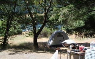
1S51
Fir Cove Campground
Overview
Fir Cove Campground is located on beautiful Ruth Lake, a 13,800-acre jewel situated in the thickly forested mountains of norther...
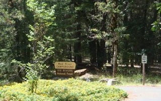
Lower Mad River Road
Mad River Campground
Overview
Mad River Campground is located on banks of its namesake river, about two miles south of Ruth Lake in the thickly forested mount...
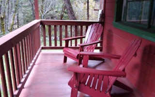
Summer Home Road
Forest Glen Guard Station
Overview
This historic guard station offers a unique stay in the oldest Forest Service building on the Shasta-Trinity National Forest. Th...
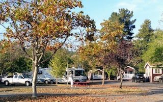
Humboldt County, California
Benbow KOA Holiday
Mountain views and some of the tallest redwood trees in the world will wow visitors to the Lost Coast of Northern California - and so wil...
Junction City, California
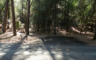
Junction City Campground
Camp on the edge of the Trinity River in one of 22 tent/trailer campsites. Popular for fishing and pleasure boating alike, this clear, ...
Platina, California
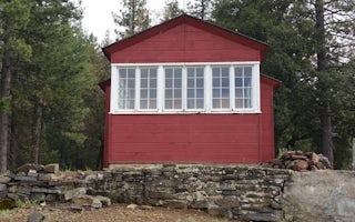
Post Creek Guard Station
Overview
Post Creek Guard Station was built in 1934 by the Civilian Conservation Corps for use as a wildfire lookout. It is now available...


