Santa Clarita, California
The best Trails and Outdoor Activities in Santa Clarita, California, offer a diverse range of scenic outdoor adventures. The Placerita Canyon Nature Center, a must-visit, has trails that wind through oak woodland and chaparral, leading to a striking waterfall and the unique "Oak of the Golden Dream." For a more challenging hike, the 5-mile Towsley Canyon Loop offers panoramic views of the Santa Clarita Valley and fascinating rock formations. For those interested in bird-watching and fishing, Castaic Lake is a top choice. The Santa Clara River and the Pacific Crest Trail also provide opportunities for hiking, horseback riding, and mountain biking. Santa Clarita indeed offers some of the best outdoor activities and attractions for everyone.
Top Spots in and near Santa Clarita
-
Pearblossom, California
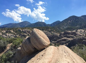
Devil's Punchbowl and Devil's Chair
4.57.37 mi / 1870 ft gainWhat a hidden gem! A martian landscape full of faultline desert rock formations and joshua trees against a mountainous backdrop of the San Gabriels. Devil's Punchbowl Natural Area features a 1 mile well-marked, well-maintained single track loop trail inside the Punchbowl (great for kids) and a 7 ...Read more -
Ojai, California
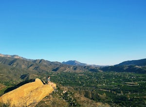
Couch Rock
3.51.3 mi / 627 ft gainDriving up Gridley Road away from Ojai you’ll come upon a small parking lot on your left and a gate barring the way to a dirt road. Park here, as close to the mountainside as possible and head onto the trail. Follow the trail until you see pass a bench, and start heading downhill. Keep your eye...Read more -
Los Angeles County, California
Mt. Williamson via Islip Saddle
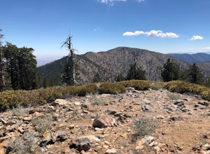
4.16 mi / 1519 ft gainThe trailhead is immediately off of Angeles Crest Highway CA-2 at Islip Saddle. It's just a touch over 2 miles to reach the summit, through which you'll be hiking among the pine tree forest practically the entire way up (part of this trail doubles as the Pacific Crest Trail). The summit is larg...Read more -
Ventura, California
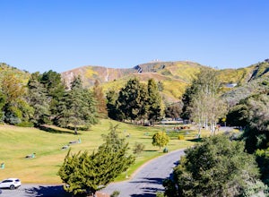
Hike Arroyo Verde Park
3.5 mi / 800 ft gainArroyo Verde Park is a small parked tucked in the hills above Ventura, California, and has a network of trails running up and down the hills surrounding the valley in the center of the park. The entrance to the park is at the intersection of Foothill Road Day Road, east of downtown Ventura. There...Read more -
Whittier, California
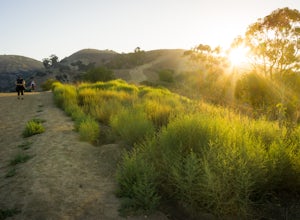
Hellman Park Trail
3.04 mi / 850 ft gainThis trail is great if you're looking for a quick, but intense workout. The hike itself is only 4 miles out- and-back and can be easily completed within a couple of hours. However, be prepared for a steep and steady incline for the first 1.5 miles. The trail itself is pretty wide, and if you sho...Read more -
Azusa, California
Little Jimmy Trail Camp
4.33.36 mi / 607 ft gainTake Hwy 2 out of La Canada north along Angeles Crest Highway. Follow this for quite some time enjoying the fine views in all directions. After traveling through two consecutive tunnels continue to the Islip Saddle parking lot (on left). There will be a vault toilet & a picnic table. Display ...Read more -
Azusa, California
Smith Mountain Trail
6.69 mi / 3189 ft gainSmith Mountain Trail is an awesome day hike located near Glendora, California. This out-and-back trail offers great views of the Los Angeles National Forest and the potential for continuation to Bear Creek for even more variety of scenery. Smith Mountain is a moderately strenuous hike with an el...Read more -
Ojai, California
Rock Climb at Foothill Crag
2 miFrom downtown Ojai, head north on N Signal Street. Head up the hill and turn left onto a gravel road next to a chainlink fence once you get to the top.(There should be a sign that points to "Pratt/Foothill Trailhead.") Continue past a water tank on the right to a trailhead parking area. I've gon...Read more -
Azusa, California
Lewis Falls
1 mi / 732 ft gainLocated deep in the Angeles National Forest above Azusa, this short but at times challenging hike rewards you with a beautiful fifty-foot waterfall. The base of the waterfall is only a foot at its deepest, so I wouldn't rush to bring a bathing suit with you. Protected by the heavy forestry around...Read more -
Palos Verdes Estates, California
Bluff Cove
4.40.56 mi / 144 ft gainParking for Bluff Cove is located along the sides of the street of Paseo Del Mar, and the trailhead is located right next to the street. Bluff Cove is one of those unique locations in that there are a variety of activities you can do here. It is a great location for surfing, paddle boarding, bod...Read more -
Dawson Saddle, California
Hike to Throop Peak, Mt. Hawkins, and Mt. Burnham
8 mi / 2000 ft gainThe trailhead, or pair of trailheads actually, is at a location on the Angeles Crest Highway (CA-2) called Dawson's Saddle. There are a couple of parking areas along the side of the highway, and each of the pair of trailheads begins at either end of this parking area. The trailheads aren't mark...Read more -
Ventura, California
Stand Up Paddleboard the Ventura Harbor
The Ventura Harbor provides a protected entry/exit to the Pacific Ocean and is a great place to start a paddleboarding adventure. Marina Park, at the end of Pierpont Boulevard, has a ton of parking, a free public launch, and there are boards to rent along the harbor. From the launch you can head...Read more -
Ventura, California
Backpack to Del Norte Campground on Santa Cruz Island
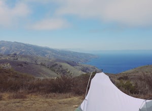
5.07 mi / 700 ft gainDel Norte Backcountry Campground is located on Santa Cruz Island, one of the islands that makes up Channel Islands National Park. It is California's largest island and is almost three times the size of Manhattan. The easiest way to get to the island is to take Island Packers, a ferry service that...Read more -
Ojai, California
Climb at Wheeler Gorge
Grab a dozen quick draws, your 60m rope, and head up Highway 33 out of Ojai for 7 miles (One of the routes here describes the crag perfectly, a Riparian Daydream). Drive through one tunnel, and continue on for another mile or two until you reach two tunnels in quick succession. The crag is in bet...Read more -
Ventura, California
Bike the Sulphur Mountain Loop
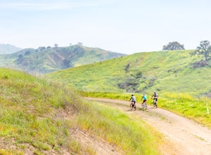
28.6 mi / 2884 ft gainThe Sulphur Mountain Loop is a 28 mile cycling and mountain biking loop that begins in Ventura Canyon at the Sulphur Mountain Trailhead and loops through Ojai Valley. Beginning at the Sulphur Mountain Road trailhead off Highway 33, follow the road up and over Sulphur Mountain and down until it co...Read more -
Ventura, California
Bike the Ventura Promenade
0.5 mi / 0 ft gainThe Ventura Promenade is a .5 mile long biking and walking trail that runs from the Ventura Pier to Sufer's Point, eventually connecting to the Ventura River & Ojai Bike Trail. It is also part of the the larger "Omer Rains Trail" which runs some 3.5 miles to the south through Buenaventura Sta...Read more

