Soledad, California
The best Trails and Outdoor Activities in Soledad, California, are a must-visit for those who relish outdoor adventures. The Pinnacles National Park offers one of the top hiking trails with its unique rock formations and the scenic High Peaks trail. It's a moderately difficult hike, but the panoramic views at the top are rewarding. The park is also home to the beautiful Bear Gulch Reservoir. For a more relaxed activity, the Soledad Mission is a historic site that offers a quiet stroll through its vineyards. Nearby, the Salinas River is perfect for river rafting and fishing. These outdoor attractions in and near Soledad make it an ideal spot for those seeking memorable, scenic adventures.
Top Spots in and near Soledad
-
Carmel-by-the-Sea, California
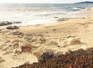
Hike along the Carmel River Beach Trail
1 mi / 100 ft gainKnown as "Ribera Beach" by locals, this stretch of land nestled between Carmel River State Beach and Monastery Beach is not to be missed! The trails are easy to get to and can be accessed by 4 locations. The first entrance is on Highway 1 at the Bay School (between Ribera Road and Monastery Beach...Read more -
Carmel-by-the-Sea, California
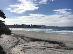
Surf Carmel River State Beach
5.0Carmel State beach is located in Monterey county. It's your typical beach break with both lefts and rights. One thing that is super unique about Carmel is that the water is some of the clearest in all of California. Depending on the sandbars, this can be a really fun wave! It's also a great p...Read more -
Carmel, California
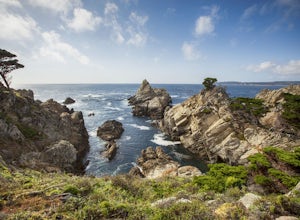
Point Lobos Natural Preserve Loop
4.77.14 mi / 640 ft gainPoint Lobos contains headlands, coves and rolling meadows, and its offshore area forms one of the richest underwater habitats in the world, popular with divers. Wildlife includes seals, sea lions, sea otters, migrating gray whales (from December to May), and thousands of seabirds, who also make t...Read more -
Carmel-by-the-Sea, California
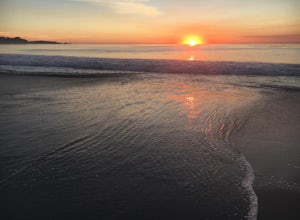
Catch a Sunset at Carmel Beach
4.7It’s a dream of mine to live in Carmel-by-the-Sea. You might recognize Carmel because Clint Eastwood was the mayor from 1986 to 1988. An idiosyncrasy you may not know about Carmel is the fact that there are no street addresses on any house in Carmel. Everyone gets their mail at the post office...Read more -
Del Monte Forest, California
17-Mile Drive to Carmel Road Ride
5.07.75 mi / 312 ft gain17-Mile Drive to Carmel Road Ride is a point-to-point trail where you may see wildflowers located near Carmel-by-the-Sea, California.Read more -
Carmel-by-the-Sea, California
Whalers Cove Loop
4.31.42 mi / 253 ft gainPoint Lobos is one of the hidden gems of the California coast. Located just off of Route 1 right after Monterey, Point Lobos is a state park on the coast. The cost to explore inside is ten dollars, but so worth it. As you explore, be sure to hike around Whalers Cove, which is incredible at sunse...Read more -
Carmel-by-the-Sea, California
Cypress Grove Trail via South Shore Trail
5.01.72 mi / 121 ft gainCypress Grove Trail via South Shore Trail is a family-friendly loop hiking trail located near Carmel-by-the-Sea, California. Along this hike in Point Lobos State Natural Reserve, you'll get a chance to see beautiful coastal views with rugged cliffs, views across Monterey Bay, and Cypress trees as...Read more -
Pacific Grove, California
Relax at Lover's Point Beach
4.8Getting there: Drive to the bottom of Ocean View Boulevard in Pacific Grove, California. You will reach a small parking lot. Unfortunately, the parking here is limited. On the bright side, this means the crowds never get too big! The ocean has open swells for surfers, diverse marine-life for snor...Read more -
Pacific Grove, California
Explore Lovers Point
5.0LOVERS POINT PARK AND BEACH:According to local legend, this park was originally called "Lovers of Jesus Point," back in the era when Pacific Grove was a Methodist retreat camp. Since the late 1800s, the beach at Lovers Point in Pacific Grove has been a popular spot for boating and swimming, and o...Read more -
Pacific Grove, California
Paddle Lover's Point
Lover's Point is great place to SUP or kayak. There are tons of jellyfish in the water (so be careful). This beach is also popular for scuba diving and snorkeling. There are rocks surround a small sandy beach and a place to rent kayaks and sups on the beach. There is a small parking lot as well a...Read more -
Big Sur, California
Sand Dollar Beach
4.80.35 mi / 82 ft gainHead into Big Sur and get a campsite at Plaskett Creek. You can either make a reservation through recreation.gov or show up and hope to luck out on one of the first-come, first-serve campsites. The campground is much more crowded during the prime summer months, so if you want to get better surf ...Read more -
Big Sur, California
Hike down to Jade Cove
2.00.3 mi / 65 ft gainThe entrance to jade cove is off the side of the road on Hwy 1. There is lots of side parking available. You go down a short unmarked trail and keep left. You'll find yourself at the top of a cliff/mountain side that uses 2 ropes to get down. The first rope is short and not super difficult. ...Read more -
Pacific Grove, California
Visit the Monarch Grove Butterfly Sanctuary
1 miThousands of monarchs can be found here October through February. It's a small park with a path through the center. Park near the Monarch Grove hotel at the sign that says "Caution: Butterflies present", and cross the street to walk down the short path (pink houses will be on your right) and to t...Read more -
Pacific Grove, California
Spanish Bay Trail
5.02.8 mi / 78 ft gainSpanish Bay Trail is an out and back trail that takes you past scenic views located near Monterey, California.Read more -
Pacific Grove, California
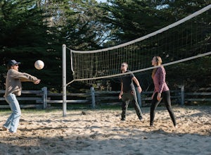
Play Volleyball at Asilomar Conference Grounds
Asilomar translates to “refuge by the sea,” a phrase that accurately depicts the Asilomar Conference Grounds. The area started as a YWCA women’s empowerment camp in 1913 and has since transitioned into a well-preserved state beach. It is located in the beautiful Monterey Peninsula. If you find y...Read more -
Pacific Grove, California
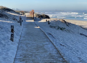
Exploring Asilomar's Ancient Sand Dunes
4.0Asilomar State Beach covers 107 acres of land. It is home to a delicate ecosystem that has been sustained through the years after it was almost destroyed. The intricate dunes at Asilomar are what have survived after the over-grazing back in the early 1900's that damaged about 480 acres of dunes. ...Read more

