Three Rivers, California
Looking for the best hiking in Three Rivers? We've got you covered with the top trails, trips, hiking, backpacking, camping and more around Three Rivers. The detailed guides, photos, and reviews are all submitted by the Outbound community.
Top Hiking Spots in and near Three Rivers
-
Three Rivers, California
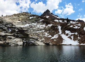
Hike to Lower Monarch Lake
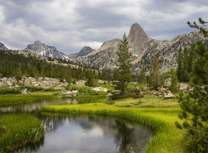
5.08.4 miThe drive takes about 90 minutes to get to the trailhead from Three Rivers, CA so plan accordingly and make sure you get there early. Lower Mineral Lake is located below Sawtooth Peak in Sequoia National Park.Once you're parked and ready to jump on the trail, head to the Sawtooth Trailhead. You'l...Read more -
Tulare County, California
Hike to the Summit of Big Baldy, Kings Canyon National Park
4.55 mi / 650 ft gainThis short and easy trail to the summit of Big Baldy in Kings Canyon National Park is not to be missed if you are in the area.The trail winds through forest and boulders as it climbs the north shoulder of Big Baldy. When you think you have reached the end, and you see people sitting down with the...Read more -
Tulare County, California
Hike the Sugar Bowl Loop in Kings Canyon NP
4.56.5 mi / 1480 ft gainFirst and foremost, to get to this trailhead you need to drive down a 2-mile, one lane dirt road that is quite steep. It is highly recommended you do this in an AWD or 4WD vehicle, especially since the road can be muddy from snowmelt or after a recent rain. We have a 2WD car but used chains for e...Read more -
Tulare County, California
Jennie Lake via Fox Meadows
4.510.71 mi / 1929 ft gainJennie Lake is a beautiful subalpine lake located in the Jennie Lakes Wilderness just outside of Sequoia National Park. There are no backpacking quota restrictions making this a perfect trip that requires little planning. Your journey starts at the Fox Meadows trailhead on paved Forest Service R...Read more -
Hume, California
Big Stump Loop Trail
5.01.71 mi / 305 ft gainBig Stump Loop Trail is a loop trail where you may see wildflowers located near Dunlap, California.Read more -
Tulare County, California
Backpack to Weaver Lake, CA
7 mi / 1075 ft gainThe hike to Weaver Lake begins at the Big Meadows trailhead in Sequoia National Forest (elevation: 7,633 ft.). There is roadside parking at the beginning of the trailhead and more parking available just inside the gate. At the trailhead, there is a vault toilet, trash receptacle, and map of the a...Read more -
Hume, California
General Grant Loop Trail
0.58 mi / 171 ft gainGeneral Grant Loop Trail is a loop trail that takes you by a river located near Cedar Grove, California.Read more -
Hume, California
Walk the General Grant Tree Trail
5.00.5 miThe trailhead starts at the back of the parking area, a sign will direct you.This short yet beautiful walk will lead you past amazing sights. Starting counter clockwise you will quickly pass the Fallen Monarch. Feel free to walk inside this massive fallen tree. As you continue you soon reach G...Read more -
Hume, California
Hike and Fish Hume Lake
2.73.5 mi / 100 ft gainThis spot is less than four hours from the Bay Area and offers everything you would ever want to do in the outdoors. The interesting thing about Hume Lake is that it is actually a Middle School and High School camp in the Summer and Winter. That being said, it is not the place to go if you are lo...Read more -
Fresno County, California
Hike to Lookout Peak
12 miYou'll want an early start to this hike so consider camping in the park the night before. If you enter the park via CA-180 and follow it for a ways (passing Kings Canyon Visitor Center, Kings Canyon Lodge, and eventually the Cedar Grove Visitor Center) you'll come up to two campsites on the left-...Read more -
Fresno County, California
Explore Zumwalt Meadow and Roaring River Falls
4.54.1 mi / 475 ft gainThe Zumwalt Meadow and Roaring River Falls Trail is a 4.1 mile hike in Kings Canyon National Park. You feel remote, even with a road nearby. The minimal elevation change makes this a scenic hike for all skill levels. Bring bug spray and wear long sleeve hiking clothing in August, as the bugs are ...Read more -
Sierra, California
Hike to Mist Falls
4.59 mi / 600 ft gainThe trailhead starts at Roads' End (the end of Hwy 180). Take the Bubbs Creek/Kanawyer Loop Trail and hike east. For the first three miles the trail is relatively flat through an open pine forest. Make sure to look up as there are some great views of the valley. The granite walls on both sides of...Read more -
Sierra, California
Rae Lakes Loop
5.039.08 mi / 7316 ft gainDay one: After checking in with the park ranger and getting your required permits you will start your hike along a 1.8 mile stretch along the south fork of the Kings River. At this point, people typically go clockwise toward Paradise Valley but you can also go counterclockwise along Bubbs Creek. ...Read more -
Porterville, California
Trail of 100 Giants
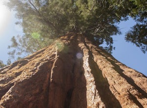
1.44 mi / 226 ft gainLocated off the M-90 (closed from Nov.-May) in the Sequoia National Forest, the Trail of 100 Giants provides a perfect stroll for nearby campers or a quick 30-minute stop for families driving by to get a glimpse of some truly awe-inspiring, overhead views. $5 day parking and restrooms can be fo...Read more -
Porterville, California
Camp at Redwood Meadow
Situated right across the street from the stunning Trail of 100 Giants, Redwood Meadows features 13 spacious campsites adjacent to a picturesque meadow. There are picnic tables, fire rings, and six yurt sites available for those who wish to bring some of the great indoors outside. Pit toilets ar...Read more -
Inyo County, California
Summit of Mt. Whitney
5.020.85 mi / 6100 ft gainMt. Whitney is the highest peak in the contiguous United States. It stands over 14,500ft high at its peak (elevation gain of 6100') and it sure feels like it when you are up there. Getting There Located just West of Lone Pine, CA you take Whitney Portal Road West for 13 miles all the way to its...Read more

