Castle Rock, Colorado
Looking for the best hiking in Castle Rock? We've got you covered with the top trails, trips, hiking, backpacking, camping and more around Castle Rock. The detailed guides, photos, and reviews are all submitted by the Outbound community.
Top Hiking Spots in and near Castle Rock
-
Morrison, Colorado
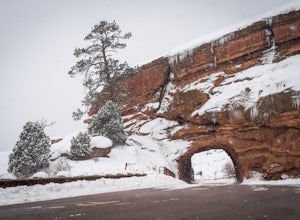
Explore Red Rocks Park in Winter
4.3Red Rocks is a bustling park in the summer when its famous amphitheater is filled with concerts. In winter though, the park dies down and becomes even more quiet when snow is falling. Grab your camera and head to the park during a winter storm to truly enjoy the beautiful red sandstone formations...Read more -
Morrison, Colorado
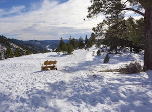
Hike Mount Falcon
4.03.7 miJust a short drive from Denver up US-285 sits Mount Falcon Park, a 2,248 acre open space park managed by Jefferson County. With over 12 miles of hiking trails and stunning views of Denver and the Front Range, this park is perfect for getting in a quick adventure when you don’t feel like driving t...Read more -
Morrison, Colorado
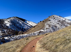
Hike the Red Rocks Trail
4.06 miWhile this is a 6 mile hike, it is relatively easy to add mileage to it and tailor it to fit your needs. Instead of simply doing the Red Rocks Trail/Morrison Slide loop, you can head all the way to the Village Walk trail in Matthews-Winters. You can also park along Red Rocks Trail Road and elimin...Read more -
Morrison, Colorado
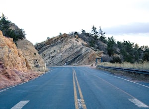
Hike Dinosaur Ridge
4.02 mi / 50 ft gainThe hiking trail starts at the parking lot located across from the Dinosaur Ridge Discovery center (which you should totally go check out!). Once you park you will follow the gated and paved Alameda Parkway towards the ridge. Along the way there will be several sites on the left until you reach t...Read more -
Evergreen, Colorado
Pence Park's Independence Mountain Trail
4.42.09 mi / 869 ft gainPence Park, part of the Denver Mountain Parks system, is nestled between the mountain communities of Indian Hills and Kittredge on Myers Gulch Road. It's one of those places I always drove right past without bothering to check it out. From the road, it looks the same as any other place in the foo...Read more -
Golden, Colorado
Matthews/Winters Park Loop
4.04.99 mi / 827 ft gainMatthews/Winters Park, which is part of the Jefferson County Open Space system, is proof that you do not have to go far from the city to enjoy the mountains. Nestled in the foothills between Golden and Morrison just off I-70 and C-470, Matthews/Winters is easy to access from Denver and any of the...Read more -
Golden, Colorado
Hike the Morrison Slide in Matthews / Winters Park
4.24.7 mi / 600 ft gainStart at the trailhead located at 1103 County Hwy. 93 and enjoy a little warm up time by the creek that winds past wild plum, chokecherry, and willow trees. Matthews-Winters Park is filled with red rock formations that make for amazing scenery. It also has the remnants of a historic cemetery. The...Read more -
Conifer, Colorado
Elk Falls Loop
3.512.76 mi / 1893 ft gainBegin on Staunton Ranch Trail for 3.3 miles. Switch to Bugling Elk Trail for the next 1.1 miles, then to Lion's Back Trail for the last mile to the overlook. From here, you can create the loop by backtracking to the Chimney Rock Trail, which then connects with the Elk Falls Trail. To head back to...Read more -
Conifer, Colorado
Davis Ponds Trail
4.02.31 mi / 295 ft gainDavis Ponds Trail is a loop trail that takes you by a lake located near Conifer, Colorado.Read more -
Colorado Springs, Colorado
Hike to Blodgett Peak
3.04.5 mi / 2325 ft gainGetting There Google Maps + "Blodgett Peak Open Space"= Easy Peasy. The parking lot only accommodates 11 cars with a one of those reserved for handicap. A port-a-potty is the only facility available at the trail head, so plan accordingly. The Hike Starting out at about 7,000 feet the first mile ...Read more -
Golden, Colorado
Argos Trail & Magic Mountain Trail Loop
5.01.91 mi / 397 ft gainArgos Trail & Magic Mountain Trail Loop is a scenic loop that's great for stretching your legs in Apex Park near Golden Colorado. This trail is fun for the family (baby carrier needed for families with newborns) and for your pup (on-leash). NOTEOdd days of the month (1st, 3rd, 5th, etc.) are...Read more -
Evergreen, Colorado
Hike Panorama Point at Corwina Park
4.72.7 mi / 640 ft gainJefferson County, the "Gateway to the Rockies" has dozens of great parks and trails. One of the best, however, is often overlooked, as it is sandwiched between bigger and more popular parks. Corwina Park is a small section located off Hwy. 74, near the village of Kittredge. Sitting between the po...Read more -
Denver, Colorado
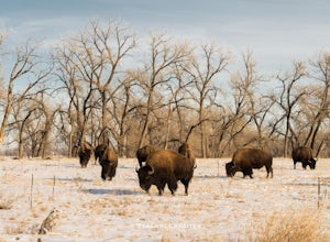
Photograph Bison at the Rocky Mountain National Arsenal Wildlife Refuge
5.09 miBison are the largest and heaviest land animals in North America. They are a symbol of a wild and free landscape. Despite their size these big beasts are extremely agile. They can run up to 35 miles per hour and jump 6ft high from a stand still. Very few animals pose a threat to a healthy, fully ...Read more -
Evergreen, Colorado
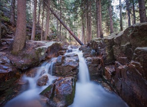
Maxwell Falls
3.43.95 mi / 928 ft gainLocated just outside of Evergreen, this beginner hike is a great escape from the city for a few hours. There are three different options to hike to the falls: Maxwell Falls Lower Trail (4 miles), Upper Maxwell Falls Trail (1.1 miles), and Maxwell Falls Bluffs Cliffside Trail Loop (5 miles). On th...Read more -
Conifer, Colorado
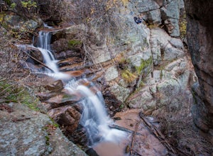
Upper Maxwell Falls Trail
1.11 mi / 135 ft gainUpper Maxwell Falls Trail is an out-and-back trail, which is the shortest and most direct route to Maxwell Falls located near Conifer, Colorado. If you're looking for a little longer trail, check out this Maxwell Falls adventure for a roughly 4-mile loop hike.Read more -
Sedalia, Colorado
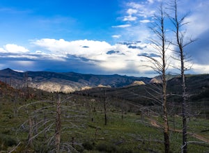
Camp at Goose Creek
3.08 mi / 1300 ft gainGoose Creek is a fantastic spot to hike or camp. There is a dirt road leading to the trailhead, and it winds through the mountains and offers a great view of the valley. The dirt road is relatively easy and well-maintained. The burn scar from the Hayman fire is still really evident, so there are ...Read more

