Dillon, Colorado
Looking for the best hiking in Dillon? We've got you covered with the top trails, trips, hiking, backpacking, camping and more around Dillon. The detailed guides, photos, and reviews are all submitted by the Outbound community.
Top Hiking Spots in and near Dillon
-
Golden, Colorado
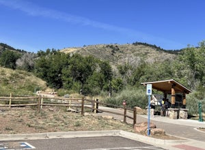
Argos Trail & Magic Mountain Trail Loop
5.01.91 mi / 397 ft gainArgos Trail & Magic Mountain Trail Loop is a scenic loop that's great for stretching your legs in Apex Park near Golden Colorado. This trail is fun for the family (baby carrier needed for families with newborns) and for your pup (on-leash). NOTEOdd days of the month (1st, 3rd, 5th, etc.) are...Read more -
Morrison, Colorado
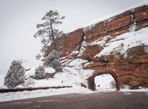
Explore Red Rocks Park in Winter
4.3Red Rocks is a bustling park in the summer when its famous amphitheater is filled with concerts. In winter though, the park dies down and becomes even more quiet when snow is falling. Grab your camera and head to the park during a winter storm to truly enjoy the beautiful red sandstone formations...Read more -
Golden, Colorado
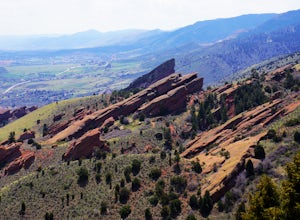
Hike the Morrison Slide in Matthews / Winters Park
4.24.7 mi / 600 ft gainStart at the trailhead located at 1103 County Hwy. 93 and enjoy a little warm up time by the creek that winds past wild plum, chokecherry, and willow trees. Matthews-Winters Park is filled with red rock formations that make for amazing scenery. It also has the remnants of a historic cemetery. The...Read more -
Golden, Colorado
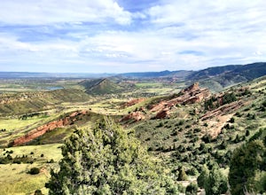
Matthews/Winters Park Loop
4.04.99 mi / 827 ft gainMatthews/Winters Park, which is part of the Jefferson County Open Space system, is proof that you do not have to go far from the city to enjoy the mountains. Nestled in the foothills between Golden and Morrison just off I-70 and C-470, Matthews/Winters is easy to access from Denver and any of the...Read more -
Littleton, Colorado
Hike the Eagle's View Trail
4.34.3 mi / 900 ft gainReynolds Park is part of the Jefferson County Open Space system. Located a few miles south of Conifer, off Hwy 285 on S. Foxton Road, it is a foothills park geared for families, groups, and the casual hiker. The network of trails on the west side of the road offers hikers and equestrians anything...Read more -
Grand Lake, Colorado
Hike to Cascade Falls, Rocky Mountain NP
5.06.8 mi / 425 ft gainCascade Falls is accessed through the North Inlet Trail on the western side of Rocky Mountain National Park. The trailhead, North Inlet Trailhead, is north of the main town area of Grand Lake. Parking at the trailhead is limited, so hikers can also park along the road leading to the trailhead. Th...Read more -
Grand Lake, Colorado
Backpack the CDT Loop in Rocky Mountain NP
24.3 mi / 4000 ft gainThis section of the CDT begins at the North Inlet trailhead, located on the western side of Rocky Mountain National Park. The trailhead is north of the main town area of Grand Lake. Parking at the trailhead is limited, so hikers can also park along the road leading to the trailhead. The hike foll...Read more -
Boulder, Colorado
Rattlesnake Gulch Trail
3.49 mi / 1093 ft gainRattlesnake Gulch Trail is a loop trail that takes you by a river located near Eldorado Springs, Colorado.Read more -
Boulder, Colorado
Hike the Rattlesnake Gulch Trail
4.35.3 mi / 1304 ft gainRattlesnake Gulch Trail is located in Eldorado Canyon State Park. It is a short 20 minute drive from Boulder and is one of three hikes in the park. You will need to pay an entrance fee to get inside to the park which costs $8. The trail is approximately 2.8 miles one way and carries a consistent ...Read more -
Pitkin County, Colorado
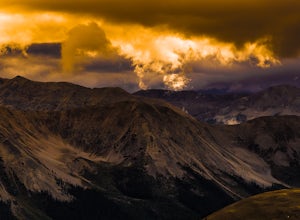
Sunset Hike to Twining Peak
4 mi / 1700 ft gainTwining Peak is a ranked 13er located 2 miles north of Independence Pass. The hike involves around 1700 feet of elevation and is mostly off-trail with some class 2 scrambling (class 3 can be had if you look hard enough). Independence Pass is a prominent and popular pass on Highway 82 between Twin...Read more -
Morrison, Colorado
Hike Dinosaur Ridge
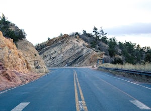
4.02 mi / 50 ft gainThe hiking trail starts at the parking lot located across from the Dinosaur Ridge Discovery center (which you should totally go check out!). Once you park you will follow the gated and paved Alameda Parkway towards the ridge. Along the way there will be several sites on the left until you reach t...Read more -
Golden, Colorado
Hike South Table Mountain
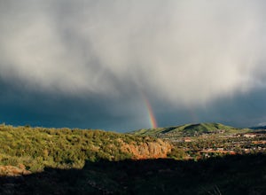
4.03.3 mi / 1500 ft gainWant to see a rainbow? Possibly some coyotes or other Colorado wildlife?This hike is full of twists and turns, mostly involving the trail, but also in surprises along the way.Drive into downtown Golden (grab some food if you're hungry) and then park at the base of the Golden Summit trail. Startin...Read more -
Boulder, Colorado
Green Mountain via West Ridge Trail
3.23 mi / 607 ft gainStarting at 7,600 ft this 1.35 mile (one-way) hike is the shortest, and by far the least strenuous, hike to summit one of Boulder's iconic peaks. Parking for this trail-head is available along the road a short drive, 4.5 miles, up Flagstaff Rd. The trail gently slopes along a ridge for the firs...Read more -
Boulder, Colorado
Mountain Bike the Betasso Preserve
4.03.3 mi / 564 ft gainThe Betasso Preserve features two loop trails that are accessible to both hikers and mountain bikers. Drive up (west) Boulder Canyon about 15 minutes outside of Boulder and turn right (north) on Sugarloaf Dr. After another 5 or so minutes you'll see a sign on the right-hand (northeast) side of...Read more -
Boulder, Colorado
Hike the Eldorado Canyon Trail
4.56.3 mi / 1875 ft gainEldorado Canyon Trail makes for a great day hike, with great views and a steady, challenging uphill – bring lots of water!For something shorter, try Streamside Trail (1 mile roundtrip), Fowler Trail (1.4 miles), or Rattlesnake Gulch (2.8 miles). Streamside, appropriately, leads you alongside a cr...Read more -
Independence, Ohio
Hike Mountain Boy Ridge from the Top of Independence Pass
5.06 miThe trailhead is to the Independence Pass viewing deck is located at the Summit parking area, which is about 20 miles from Aspen and 24 miles west of Highway 24 on the Leadville side. At the parking area you will notice a paved walkway that takes you to the viewdeck, which is a easy five minute w...Read more

