Dillon, Colorado
Looking for the best hiking in Dillon? We've got you covered with the top trails, trips, hiking, backpacking, camping and more around Dillon. The detailed guides, photos, and reviews are all submitted by the Outbound community.
Top Hiking Spots in and near Dillon
-
Allenspark, Colorado
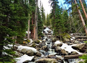
Hike to Ouzel Falls
4.05.22 mi / 870 ft gainLocated right outside of Rocky Mountain National Park, this hike is perfect for anyone looking to do a little exploring without the cost of a park fee. The drive through the Rocky Mountains to the trailhead is an added bonus. This hike is great because it has multiple attractions all along the wa...Read more -
Allenspark, Colorado
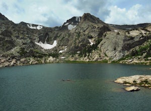
Backpack to Bluebird Lake
4.314 mi / 2500 ft gainStarting at the Wild Basin trailhead on the south side of Rocky Mountain National Park, hike through a wet forest towards upper and lower Copeland Falls, located 0.45 miles from the trailhead. From here, continue on the main trail along the North Fork of the Saint Vrain River to Calypso Cascades,...Read more -
Allenspark, Colorado
Hike to Thunder Lake
12 mi / 2275 ft gainStarting at the often-busy Wild Basin TH, the trail passes through dense forests as it follows the North Fork of the Saint Vrain River through the southernmost section of Rocky Mountain National Park. The trail passes alongside the small Copeland Falls before continuing west towards Calypso Casca...Read more -
Boulder, Colorado
Woods Quarry via NCAR
4.23.28 mi / 755 ft gainYou can start from Chautauqua Park, but I prefer to start at NCAR, especially since there is ample parking and you can take a bathroom break inside before hitting the trail. From the intersection of Table Mesa Drive and Broadway in Boulder, drive west on Table Mesa to its end at the NCAR buildin...Read more -
Allenspark, Colorado
Ouzel & Ogallala Peaks
17.18 mi / 4403 ft gainBegin at the Wild Basin Trailhead in southeastern Rocky Mountain National Park near the town of Allenspark. Plan to start before sunrise if attempting this trek as a day trip in order to avoid afternoon thunderstorms above the treeline. This trip can easily be made into a backpacking experience b...Read more -
Allenspark, Colorado
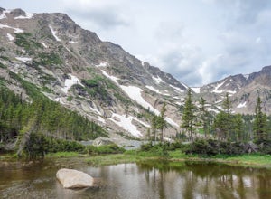
Hike to Pear Lake
5.013 mi / 2112 ft gainPear lake is a beautiful alpine lake in the southern Wild Basin region of Rocky Mountain National Park. Once used as a reservoir, Pear Lake has been restored to its natural state and lies in scenic basin below some of the most isolated mountains in the park. The trail to Pear Lake passes through ...Read more -
Allenspark, Colorado
Hike to Finch Lake
3.08.96 miThere are several ways to reach finch lake but this will cover the route from the Finch Lake Trailhead in the wild basin area of Rocky Mountain National Park. You can also loop it with other trails in the area or begin at the Allenspark Trailhead, which is technically outside the park and a bit e...Read more -
Lakewood, Colorado
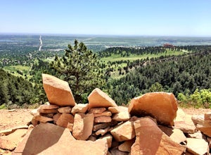
Hike to Radio Tower Overlook
4 mi / 1312 ft gainI loved this trail when I lived in Lakewood. It has a decent elevation gain, close to the city, spectacular views, and you can pretty much hike it year round unless you just had a winter snow storm (though you could just hike in snow boots!). I take the John O Hayden Trail from the Utah Parking l...Read more -
Boulder, Colorado
Hike the Flatirons Vista Loop Trail
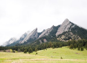
4.73.3 miFrom the parking lot, take South Flatiron Vista Trail for 2.4 miles, where you'll cross onto North Flatiron Vista Trail. In 1 mile, take the connector trail back to the trailhead. To shorten the loop to 2 miles, hike South Flatiron for just 1 mile to Prairie Vista Trail, which leads back to the c...Read more -
Lakewood, Colorado
Green Mountain Trail Loop
4.16.37 mi / 1060 ft gainGreen Mountain Trail is a 6.5-mile loop and has a challenging ascent to the park's highest point. Because the mountain is one of the first to rise out of the plains, you get unique views of where the mountains meet the prairie and fascinating geology. The summit, at 6,857' offers stunning views o...Read more -
Boulder, Colorado
Mars Blocks via Bear Canyon Trailhead
4.89 mi / 1923 ft gainThe Bear Canyon Trailhead is just one of many starting points for this hike, one could also start at NCAR, North Fork Shanahan, or any point on the Mesa Trail. For the purposes of this adventure, I'll start at Bear Canyon Trailhead in South Boulder. This hike will take you about 2-4 hours dependi...Read more -
Littleton, Colorado
Hike the Coyote Song-Swallow Trail Loop
3.83 mi / 350 ft gainWe all love to live our weekends to the fullest, but say you're itching for an adventure and it's midweek with the weekend still a good 3 or 4 days away? South Valley Park is the place to go if you're looking for an after-work adventure or just don't feel like driving too far from the city. A sho...Read more -
Sedalia, Colorado
Camp at Goose Creek
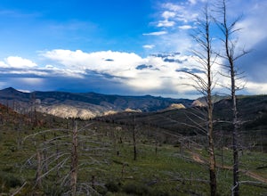
3.08 mi / 1300 ft gainGoose Creek is a fantastic spot to hike or camp. There is a dirt road leading to the trailhead, and it winds through the mountains and offers a great view of the valley. The dirt road is relatively easy and well-maintained. The burn scar from the Hayman fire is still really evident, so there are ...Read more -
Boulder, Colorado
Hike the Red Rocks Loop Trail
3.71 miParking is available on either Canyon or Sunshine Roads. During the weekends it tends to get crowded around sunset so plan accordingly. The entire trail is a loop and is a little over 1 mile in length so it doesn't take too long. The main feature is the massive red sand stone rocks that jut out o...Read more -
Boulder, Colorado
Royal Arch Trail
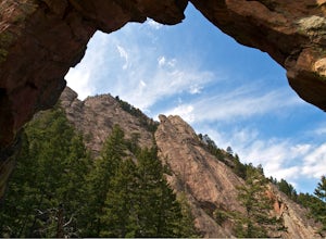
4.43.32 mi / 1220 ft gainRoyal Arch Trail climbs up Boulder's famous Chautauqua Park to an archway formed by sandstone rocks that tower over thirty feet high. Start at the Chautauqua Trail Station by the Ranger Station, and continue up Bluebell Road for 0.7 miles. You will then arrive at a more forested area, where you ...Read more -
Boulder, Colorado
Hike to the 1st Flatiron
4.62.4 mi / 1422 ft gainStarting at the ever-popular and ever-populated Chautauqua Trailhead, take the main trail (a highway version of a dirt trail) straight towards the Flatirons. Continue going straight passed the Ski Jump trail to your right (0.2 mi.), then at a crossroads with the Bluebell-Baird trail (0.3 mi.) tur...Read more

