Grand Lake, Colorado
Looking for the best hiking in Grand Lake? We've got you covered with the top trails, trips, hiking, backpacking, camping and more around Grand Lake. The detailed guides, photos, and reviews are all submitted by the Outbound community.
Top Hiking Spots in and near Grand Lake
-
Estes Park, Colorado
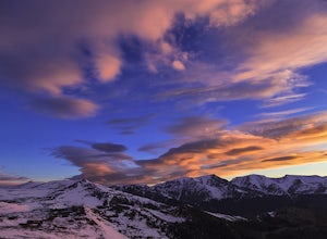
Hike along Tombstone Ridge
4.3 mi / 3250 ft gainTombstone ridge can be accessed via the ute trail from two directions. The lower trail starts at upper beaver meadows and is ~4.3 miles with 3250 feet of elevation gain. It can also be accessed at the Ute trail crossing along trail ridge road, which leaves you a 1.1 mile hike with just under 300 ...Read more -
Estes Park, Colorado
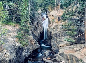
Chasm Falls
3.02.57 mi / 132 ft gainParking in Rocky Mountain National Park is tricky for Chasm Falls. Depending on where you are able to park, the hike will be a 0.1 mile, 2.8 mile, or 4.8 mile round-trip hike. It’s also important to know that Old Fall River Road is closed during the winter months from Nov 30th until the end of Ma...Read more -
40.387035,-105.610770
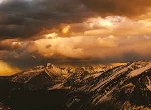
Rocky Mountain NP's Trail Ridge Road
4.939.06 miStart by entering Rocky Mountain National Park through Estes Park, Colorado. After acquiring a map start your ascent on Trail Ridge Rd (the road is closed in winter). The Road will take you up in elevation into the mountains so a good car is strongly recommended. As you wind up the switch backs,...Read more -
Estes Park, Colorado
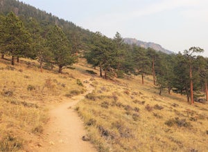
Hike Deer Mountain
6.03 mi / 1200 ft gainBeginning in Rocky Mountain National Park near the Deer Ridge Junction (where US 34 & US 36 meet), park your car in one of the 20 spots on either side of the road. Start at the trailhead booth and head north, keeping to the right-side trail at the first intersection about a tenth of a mile fr...Read more -
Estes Park, Colorado
Hike the Ypsilon Lake Trail
5.08.38 mi / 2000 ft gainTo get to the trailhead, enter Rocky Mountain National Park on the 36. Keep right at the fork with the 34 and then you'll take your next left and the parking for the trailhead is the first parking area on your right. There is an outhouse at the trailhead too, so if you need to take a pit stop b...Read more -
40.407117,-105.626146
Hike to Lawn Lake, Rocky Mountain NP
12.9 mi / 2558 ft gainThis 4 to 8 hour day hike leads to Lawn Lake, located inside a large basin at tree line, and surrounded by Fairchild Mountain, Hagues Peak, and Mummy Mountain. Lawn Lake is among the largest subapline lakes in Rocky Mountain National Park. As you ascend into the sub-alpine zone, you will be gree...Read more -
Estes Park, Colorado
Hike The Mummy Kill (a.k.a. Mummy Mania)
14.31 mi / 5600 ft gainWanna kill some mummies!? Of course you do! Who doesn't? Mount Chapin: 12,454 feet; Mount Chiquita: 13,069 feet; Ypsilon Mountain: 13,514 feet; Fairchild Mountain: 13,502 feet; Hagues Peak: 13,560 feet; Mummy Mountain: 13,425 feet The Mummy Kill is the perfect all-day hike for those seasoned h...Read more -
Estes Park, Colorado
Photograph Elk in Moraine Park
The perspective here is vastly different from other areas in Rocky Mountain National Park as Moraine Park is essentially a large, very flat valley surrounded by tall mountains. You'll want to come during the elks' rutting season, which is between mid-September and mid-October. Park at the lot on ...Read more -
Estes Park, Colorado
Chasm Lake via Longs Peak Trailhead
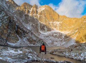
4.78.01 mi / 2425 ft gainThe 4-mile trail climbs around 2500ft from the Longs Peak trailhead and starts by winding through dense forest. In the morning darkness, trudging through thick trees isn’t the most exciting, but when you finally climb out above treeline, the massive profile of Longs and the slowly growing light o...Read more -
1398 Longs Peak Road, Colorado
Storm Peak and Mount Lady Washington
4.512.57 mi / 5312 ft gainThis adventure began at the Longs Peak trailhead in southeastern Rocky Mountain National Park, Colorado. I followed the Longs Peak trail for 6 miles to the Boulderfield backcountry camping area. This is a fairly steep on-trail climb of 3,360 feet. After setting up camp at 12,760 feet, my partner...Read more -
Estes Park, Colorado
Longs Peak
5.013.3 mi / 5100 ft gainFor the most part, this hike is very straightforward, so I'll essentially skip over the first 5.5 or so miles of the hike, but, in case you don't know: Start (very early so you get a parking spot) from the trailhead right next to the parking lot (the road to it is paved - seriously this mountain...Read more -
Estes Park, Colorado
Peacock Pool
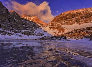
7.9 mi / 2438 ft gainThe peacock pool is a cool little tarn below the outlet to Chasm Lake. Please note that this adventure is best done in the winter/spring when snow is present to prevent erosion in the sensitive area. That is how the description will be written, assuming winter conditions. The approach is the sa...Read more -
Estes Park, Colorado
Boulderfield Campground via Longs Peak Trail
11.39 mi / 3337 ft gainBoulder Field is a high alpine backcountry site on Longs Peak, and is a popular camp for backpackers attempting to summit Longs Peak via the Keyhole route. At an impressive elevation of 12,760 feet, Boulder Field is a vast wasteland of rocks that sits 500 feet below the famous Keyhole feature, an...Read more -
Allenspark, Colorado
Hike to Ouzel Falls
4.05.22 mi / 870 ft gainLocated right outside of Rocky Mountain National Park, this hike is perfect for anyone looking to do a little exploring without the cost of a park fee. The drive through the Rocky Mountains to the trailhead is an added bonus. This hike is great because it has multiple attractions all along the wa...Read more -
Allenspark, Colorado
Backpack to Bluebird Lake
4.314 mi / 2500 ft gainStarting at the Wild Basin trailhead on the south side of Rocky Mountain National Park, hike through a wet forest towards upper and lower Copeland Falls, located 0.45 miles from the trailhead. From here, continue on the main trail along the North Fork of the Saint Vrain River to Calypso Cascades,...Read more -
Allenspark, Colorado
Hike to Thunder Lake
12 mi / 2275 ft gainStarting at the often-busy Wild Basin TH, the trail passes through dense forests as it follows the North Fork of the Saint Vrain River through the southernmost section of Rocky Mountain National Park. The trail passes alongside the small Copeland Falls before continuing west towards Calypso Casca...Read more

