Gunnison County, Colorado
Looking for the best hiking in Gunnison County? We've got you covered with the top trails, trips, hiking, backpacking, camping and more around Gunnison County. The detailed guides, photos, and reviews are all submitted by the Outbound community.
Top Hiking Spots in and near Gunnison County
-
Independence, Ohio
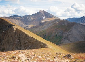
Hike Mountain Boy Ridge from the Top of Independence Pass
5.06 miThe trailhead is to the Independence Pass viewing deck is located at the Summit parking area, which is about 20 miles from Aspen and 24 miles west of Highway 24 on the Leadville side. At the parking area you will notice a paved walkway that takes you to the viewdeck, which is a easy five minute w...Read more -
Independence, Ohio
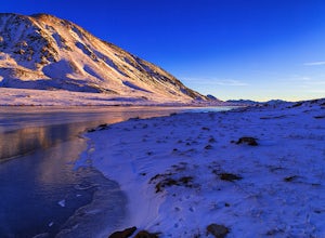
Hike Lost Man Pass via Independence Lake
5.04.5 mi / 1200 ft gainPark at the pull out just west of independence pass. From there, begin on the Linkin's Lake Trail. The trail is generally easy to follow (although it can be muddy as it is a wet area) and climbs 900 feet in the 1.8 miles to independence lake. From Independence lake it is about 0.5 miles and 400 f...Read more -
Carbondale, Colorado
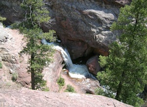
Explore Hayes Creek Falls
3.50 miRight off of Highway 133 about 2 miles south of Redstone, lies a very easy-to-get-to Waterfall. Park your car off to the side of the highway, walk about 100 feet and you will find this glorious waterfall. The fall is best to see in the late Spring to early Summer. From late Spring, to early Summe...Read more -
Pitkin County, Colorado
Sunset Hike to Twining Peak
4 mi / 1700 ft gainTwining Peak is a ranked 13er located 2 miles north of Independence Pass. The hike involves around 1700 feet of elevation and is mostly off-trail with some class 2 scrambling (class 3 can be had if you look hard enough). Independence Pass is a prominent and popular pass on Highway 82 between Twin...Read more -
Buena Vista, Colorado
Summit La Plata Peak
5.09.25 mi / 4500 ft gainThe Northwest Ridge is the most easily accessible and popular route, and for good reasons. The trailhead is on the side of Hwy 82, otherwise known as Independence Pass, about 14.5 miles from the Hwy 24 junction, or about 10 miles from Twin Lakes to the east. The trailhead is hard to miss, and you...Read more -
Buena Vista, Colorado
Hike Huron Peak
5.06.5 miIf you have a 4WD vehicle, drive 2 miles from Winfield along a dirt road to the trailhead. If you don't have a suitable vehicle, you can park before the road gets rough and hike the rest of the road to the trailhead.Starting at 10560 feet of elevation, this 6.5 mile roundtrip hike begins its 3500...Read more -
Buena Vista, Colorado
Summit Mount Huron
6 mi / 3500 ft gainThere are some dispersed campsites along side the 4x4 road that leads to the trailhead. Ideally you can sleep here to get an early start to your hike in the morning, to avoid the afternoon storms that frequent the mountains. The 4x4 is rough in spots, though my Subaru Outback did make the trek un...Read more -
Gunnison County, Colorado
Hike to Lost Lake
4.22.4 mi / 600 ft gainThis Trail starts at about 11,200 feet right before the top of cottonwood pass. The trailhead starts at the LAST pull-off before you reach the top of the pass, so if you reach the top, you've gone too far. The hike isn't a super difficult one, but you will go through numerous streams and flooded ...Read more -
Buena Vista, Colorado
Mt. Elbert via Black Cloud Trail
4.510.69 mi / 4967 ft gainDirections: Heading south from Leadville from U.S. 24: West on CO 82 for 10.5 miles to a hidden right turn that leads to a trail head. If you make it to the Mt. Elbert Lodge, you have gone just a bit too far. The parking lot (aka: dirt access) should be relatively empty as everyone tends to hik...Read more -
Basalt, Colorado
Camp at Thomas Lake and Summit Mt. Sopris
5.013 mi / 4400 ft gainWith the Elk Mountain range behind it, It appears to be standing by itself, and has the resemblance of a grand volcano.From Hwy 133 out of Carbondale, turn down Prince Creek Road and drive 6 miles to the trailhead. The trail is a nice mixture of meadows and woods, with excellent views of the vall...Read more -
Basalt, Colorado
Hike Hay Park
Head south out of Carbondale on Highway 133. Two miles from the Main Street roundabout, take a left on Prince Creek Road. Follow this road up to Dinkle Divide and follow the signs to Dinkle Lake. Continue up the road until you see a large, fenced in parking area with a toilet on the left. This is...Read more -
Buena Vista, Colorado
Hope Pass via Willis Gulch
5.08.75 mi / 3297 ft gainHope Pass is accessed from the Willis Gulch trailhead about 25 miles outside of Leadville, Colorado. To get to the trail head, follow Highway 24 East for about 16 miles until you arrive at the junction for Highway 82. Turn right and follow Highway 82 for about 8.3 miles. You will see a sign on th...Read more -
Meredith, Colorado
Hike to Chapman Lake
1.6 miFrom downtown Basalt, drive up the Fryingpan River Road 28 miles and turn right on CR #504, also known as Elliot Way, just before Norrie Colony. Drive across the river and up the switchbacks for approximately 3 miles. Take the left fork, continue 1 mile and take the right fork approximately 1/2 m...Read more -
Parlin, Colorado
Hike to Roosevelt Mine
5.01.5 miAbandoned in 1919, Roosevelt Mine is a lost treasure of Gunnison County, Colorado. Exactly three miles outside the tiny town of Ohio City is the unmarked trailhead on the side of a road pull off for Roosevelt the mine. The trail is otherwise well established and easy to follow. The trail is a lit...Read more -
Buena Vista, Colorado
Mt. Belford and Mt. Oxford
4.510.34 mi / 5856 ft gainYou'll being your ascent at the Missouri Gulch Trailhead, which is located a few miles up Chaffee County Road 390, at around 9,600 feet. The trail is very clear and very well maintained, but is steeper than most trails (even quite a few of the 14er trails I've done) right from the get-go. Remembe...Read more -
Buena Vista, Colorado
Hike Missouri Mountain
5.010.5 mi / 4500 ft gainGetting there: The trail begins at Missouri Gulch TH. If you are a car camper or are trying to snag a sunrise summit, there are many many drive off sites in trees and near water before and after the trailhead. The road to get to the trailhead is not paved, but is well maintained - a super high cl...Read more

