Gunnison, Colorado
Looking for the best camping in Gunnison? We've got you covered with the top trails, trips, hiking, backpacking, camping and more around Gunnison. The detailed guides, photos, and reviews are all submitted by the Outbound community.
Top Camping Spots in and near Gunnison
-
Aspen, Colorado
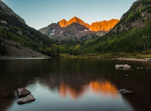
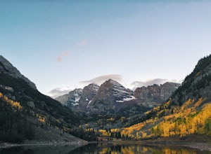
Car Camp at Maroon Lake
5.00.3 mi / 0 ft gainMaybe you've seen the photos a million times before - it's for good reason. Maroon Bells is just stunning. Watching the first rays of sunlight scratch the very top of Maroon Bells and slowly crawl their way down the massive slabs of granite is simply a must for the checklist. Taking in the sunris...Read more -
Aspen, Colorado
Snowmass Lake via Maroon-Snowmass Trail
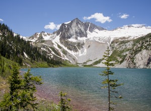
4.316.53 mi / 5023 ft gainFor the adventurous backpacker looking to get backcountry in central Colorado, the stunning beauty of the Maroon Bells-Snowmass Wilderness cannot be beaten. While the Maroon Bells just outside of Aspen might be the most photographed mountains in North America, the beauty is definitely rivaled by ...Read more -
Pitkin County, Colorado
Four Pass Loop in the Maroon Bells
4.825.99 mi / 7566 ft gainUpdates will be posted here. The Four Pass Loop begins at Maroon Lake, famous for its iconic view of the Maroon Bells (Maroon Peak and North Maroon Peak), deemed the “most-photographed spot in Colorado.” After taking in this majestic view, continue to walk down the Maroon Lake Scenic Trail unti...Read more -
Buena Vista, Colorado
Backpacking to Kroenke Lake
9 mi / 2750 ft gainStarting at the North Cottonwood trailhead just outside of Buena Vista, Colorado. This hike will take you 4.5 miles to the lake with about 2750 feet of elevation gain. The hike is mostly mellow and you'll likely see hikers heading up to Horn Fork basin to hike Mt. Harvard and Columbia. Campsites ...Read more -
Salida, Colorado
Hike Mount Shavano and Tabeguache Peak
4.09.25 mi / 4600 ft gainStart out on the Shavano and Tabeguache Trailhead off of FR 252 outside of Poncha Springs, at about 9,700 feet, and begin your trek into the forest. In the first half of a mile there are a few trail marker signs that should be read carefully to insure the right path is followed, but these signs ...Read more -
Aspen, Colorado
Conundrum Hot Springs via Conundrum Creek
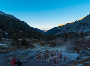
4.316.77 mi / 2717 ft gainAfter picking up your required overnight permit, start your morning with a coffee in Aspen, then drive out 15 min to the trailhead at the end of Conundrum Creek road. The trail is a straight shot 9 miles up the valley, through expansive meadows and an always incredible view of the mountains and ...Read more -
Aspen, Colorado
Camp at Silver Queen Campground
To start it off, head out from Aspen on Maroon Creek Road. Once you get to the park, you will either have to pay the charge at the booth or if you get there after 5pm, you can self pay at the cash box, which is $10. You'll also want to get an overnight parking pass set up which doesn't cost extra...Read more -
Montrose, Colorado
Hike to Tomichi Point and Gunnison Point Overlooks
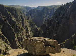
5.02 miTo access the South Rim of the Black Canyon of the Gunnison National Park, take US 50 and CO 347 to the south entrance, 15 miles east of Montrose. There is no bridge between the north and south rims of the canyon - make sure you enter from the Montrose side.After passing through the entrance stat...Read more -
Montrose, Colorado
Camp at Black Canyon of the Gunnison's South Rim Campground
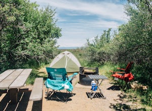
5.0The South Rim Campground is located about 6 miles inside Black Canyon of the Gunnison National Park. There are a total of 88 sites, 34 of which are available year-round. Reservations are definitely recommended, but are not required - loop C is first-come, first-served. Loop B fills up first, as i...Read more -
Aspen, Colorado
Weller Lake Trail
4.01.17 mi / 312 ft gainWeller Lake Trail is an out-and-back trail that takes you by a lake located near Aspen, Colorado.Read more -
Montrose, Colorado
Drive the East Portal Road
Want an easier way to get to the bottom of the canyon without the rugged hiking trails? Drive to the bottom via the East Portal Road. Open once the harsh winter breaks, this road switchbacks its way to the bottom at the meeting place of Curecanti National Recreation area and Black Canyon of the G...Read more -
Aspen, Colorado
Camp Difficult Campground, Aspen
This is a great backup campground if all of Maroon Bells campgrounds are full, which in all reality is highly likely. If you're looking to beat the crowds, this is a good number campground to consider. This campground is right off the highway, 5 miles away from the town of Aspen, easy to find, an...Read more -
Aspen, Colorado
Camp at Silver Bell Campground
Escape the bustle of town and head out of Aspen on Maroon Creek Road. Follow the signs to Maroon-Bells Snowmass Wilderness Area. There is a $10 entrance fee (unless you are a national parks pass cardholder) plus an additional fee to camp. Continue down the road to Silver Bell Campground. With a t...Read more -
Aspen, Colorado
Hike Lost Man Loop
5.08.8 mi / 1290 ft gainThis 8.8 mile "loop" is not a true loop and the trail ends 4 miles apart along Independence Pass, so a car shuttle is recommended. I would recommend starting at the west trailhead (closer to Aspen) but will describe both trailheads so you can set up another car or shuttle at the other one.1) West...Read more -
Buena Vista, Colorado
Hike Missouri Mountain
5.010.5 mi / 4500 ft gainGetting there: The trail begins at Missouri Gulch TH. If you are a car camper or are trying to snag a sunrise summit, there are many many drive off sites in trees and near water before and after the trailhead. The road to get to the trailhead is not paved, but is well maintained - a super high cl...Read more -
Independence, Ohio
Hike Lost Man Pass via Independence Lake
5.04.5 mi / 1200 ft gainPark at the pull out just west of independence pass. From there, begin on the Linkin's Lake Trail. The trail is generally easy to follow (although it can be muddy as it is a wet area) and climbs 900 feet in the 1.8 miles to independence lake. From Independence lake it is about 0.5 miles and 400 f...Read more

