Idaho Springs, Colorado
Looking for the best hiking in Idaho Springs? We've got you covered with the top trails, trips, hiking, backpacking, camping and more around Idaho Springs. The detailed guides, photos, and reviews are all submitted by the Outbound community.
Top Hiking Spots in and near Idaho Springs
-
Berthoud Pass Parking Lot, Colorado
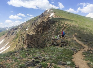
Mount Flora
5.06.29 mi / 1788 ft gainColorado’s Rocky Mountains offer hikes of all lengths, sizes and difficulties. Mt. Flora stands at a lofty 13,146 ft and is a great intro to climbing peaks in Colorado. Roundtrip, this hike is 6.3 miles and will take you (in the summer) through fields of alpine wildflowers as you climb into Color...Read more -
Dillon, Colorado
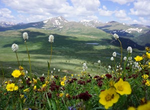
Mount Bierstadt
4.67.18 mi / 2697 ft gainIf you’re ready for your first 14er, Mount Bierstadt holds a reputation for a great “starter” 14er. Of course, experienced climbers will enjoy this (relatively speaking) easy mountain as well. Besides the joy of the hike itself, Bierstadt is a stunning wildflower hike in July and August. Thanks t...Read more -
Idaho Springs, Colorado
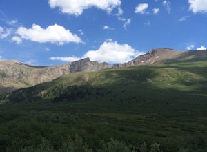
Bierstadt, Evans, and The Sawtooth Loop
4.59.76 mi / 3438 ft gainStarting from the oddly poorly marked Guanella Pass Trailhead (Google maps directions to Guanella Campground and then drive about two miles past it to the south), the trail heads southeast toward Bierstadt, and much of your route to the first summit is visible from the parking lot. The trail to ...Read more -
Idaho Springs, Colorado
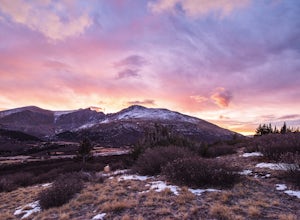
Watch the Sunrise at Guanella Pass
5.01 mi / 100 ft gainFrom Denver, take i70 to Georgetown and simply follow the signs through town to the top. This pass can also be accessed from the south via US Highway 285 at the town of Grant. Guanella Pass is closed in the winter, typically from about the last week in November through the last week of May. Watch...Read more -
Georgetown, Colorado
Hike to Square Top Lakes
4.3 mi / 1080 ft gainStarting from Guanella Pass, right across from the Bierstadt trailhead, Square Top Lakes is definitely a hidden gem. Most people here are attempting to do the 14er, but if you've already bagged that one (or are just looking for some high altitude hiking to get you ready for it), Square Top Lakes ...Read more -
Winter Park, Colorado
Snowshoe to Broome Hut
1.5 mi / 729 ft gainTake I-70 from Denver and then US 40, go all the way to Mile marker 240 of US 40 and park in the area at the side of the road. The Second Creek trail head is just behind the parking area and is easy to find.The trail climbs from a start at 10,600ft and finishes up at 11,325ft at the hut, but you ...Read more -
Winter Park, Colorado
Twin Cones via Second Creek Trailhead
5.04.85 mi / 1614 ft gainThis hike begins at Second Creek Trailhead off of US Highway 40. It's pretty steep right off the bar gaining about 800ft of elevation in the first mile. This first mile takes you to Broome Hut, which has a bathroom and is a great place to stop and take a break. Keep in mind that there are no dogs...Read more -
Dillon, Colorado
Silver Dollar Lake Trail
5.03.93 mi / 945 ft gainGuanella Pass, which connects the charming and historic town of Georgetown in the north to the blink-and-you’ll-miss-it Grant to the south, is a recreational outdoorsman’s dream. Volumes could be written on what this 22-mile scenic byway has to offer. Silver Dollar Lake Trail is just one tiny po...Read more -
Nederland, Colorado
Hike to the Lost Lakes via the Hessie Trail
4 mi / 1000 ft gainAccessed by Hessie Trailhead, Lost Lake is a relatively moderate 4 mile round-trip hike with about 1,000 feet of elevation. The core of the hike is uphill and on a gravel path, 2/3rds of the hike runs parallel to a rushing waterfall. After parking your car, head towards the Hessie Trailhead. Yo...Read more -
Nederland, Colorado
King Lake via Hessie Trailhead
5.011.32 mi / 2375 ft gainThe normal route from the east side is via the Hessie trailhead outside Nederland Colorado. From the west it is most often accessed via the short trail from Rollins pass, which is open in the summer. As noted above, it is also a lake and area ripe for creating your own adventure. The description ...Read more -
Nederland, Colorado
Snowshoe Lost Lake
5.02.7 mi / 791 ft gainDriving through the towns of Nederlands and Eldora alone is a beautiful experience. Once you come up to Hessie Trailhead, you'll already be in a daze because you'll be staring at Eldora Mountain and will see some ski runs in the distance.Getting to the trailhead early is best. Parking starts alon...Read more -
Nederland, Colorado
Snowshoe to Jasper Lake
5.011 mi / 2000 ft gainStarting at 9100 feet, the Hessie trailhead is easily accessible by both 2 and 4 wheel drive cars (depending on how far you want to travel down the road). The trail is fairly easy and often packed down snow up to the cut off point to the Devil's Thumb Bypass, which allows a bypass of Lost Lake an...Read more -
Nederland, Colorado
Hiking the Indian Peaks Wilderness' Lost Lake
4.34.5 mi / 1000 ft gainLost Lake of the Indian Peaks Wilderness area is a scenic short hike (about 3 hours) with a lot to see. The trailhead is tucked at the end of a road that passes through Eldora, a charming village of cabins and old abandoned buildings. You will pass by the lost "town" of Hessie on foot, which is w...Read more -
Nederland, Colorado
Drive the Peak to Peak Highway
4.555 mi / 705 ft gainThe Peak to Peak Highway is a 55-mile stretch of road that winds its way from Nederland to Estes Park (or Estes Park to Nederland). This road connects to many points of exploration, Indian Peaks Wilderness Area and Rocky Mountain National Park to name a couple, but the drive itself is an adventur...Read more -
Golden, Colorado
Hike the North Table Mountain Loop
3.1 mi / 400 ft gainThe hike starts out from the North Table Mountain Park parking lot just east of Highway 93 on the North Table Loop Trail, with a half-mile fire road straight up the mountain. This fire road is by far the most strenuous part of the hike, and is essentially the sole elevation gain for the hike; onc...Read more -
Golden, Colorado
Hike the Golden Cliffs Trail
5.0From here, you can choose a few different hiking paths. This out-and-back trek starts at the trailhead up and to the left. Along the way you'll pass a bench dedicated to Craig Luebben — a writer, photographer and climbing guide. At this point, you probably haven't even broken a sweat yet. It's ti...Read more

