Leadville, Colorado
Looking for the best hiking in Leadville? We've got you covered with the top trails, trips, hiking, backpacking, camping and more around Leadville. The detailed guides, photos, and reviews are all submitted by the Outbound community.
Top Hiking Spots in and near Leadville
-
Aspen, Colorado
Hike Lost Man Loop
5.08.8 mi / 1290 ft gainThis 8.8 mile "loop" is not a true loop and the trail ends 4 miles apart along Independence Pass, so a car shuttle is recommended. I would recommend starting at the west trailhead (closer to Aspen) but will describe both trailheads so you can set up another car or shuttle at the other one.1) West...Read more -
Buena Vista, Colorado
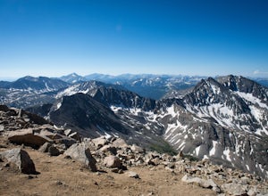
Summit Mount Huron
6 mi / 3500 ft gainThere are some dispersed campsites along side the 4x4 road that leads to the trailhead. Ideally you can sleep here to get an early start to your hike in the morning, to avoid the afternoon storms that frequent the mountains. The 4x4 is rough in spots, though my Subaru Outback did make the trek un...Read more -
Breckenridge, Colorado
Hike the Sawmill Trail to Fairy Forest
3.01.5 mi / 250 ft gainIf you brought the family to Breckenridge chances are you're probably not bringing the little ones on your next 14'er summit. Are you looking for an easy hike to let the kiddos experience some nature and run around a bit? Well then this short hike is perfect for you and the family. Plus, it's rig...Read more -
Breckenridge, Colorado
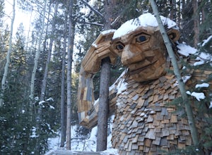
Breckenridge Troll
5.00.2 mi / 26 ft gainIsak Heartstone, otherwise known as the Breckenridge troll, can be accessed from the Illinois Gulch Trailhead. This trailhead can be full for much of the day, so it is advisable to find parking in town and then take a bus, walk, or bike to the starting point of this short walk. Once at the trai...Read more -
Breckenridge, Colorado
Camp at Boreas Pass
9 mi / 1500 ft gainBoreas pass is a high mountain pass in the Rocky Mountains that sits on the Continental Divide at 11,481'. Forest Service Road 33 goes over the pass and has numerous campsites all along its length, with several near the summit that feature breathtaking views of the Tenmile Range and the Breckenri...Read more -
Breckenridge, Colorado
Hike Baker's Tank Loop
3.86 mi / 645 ft gainWhen the aspens are sporting their golden hues of autumn, Baker's Tank Loop is a perfect fall hike. The trailhead is about ten minutes from downtown Breckenridge. For part of the hike, you may have the world to yourself. But, for the road portion, you'll likely have to share with the leaf peep...Read more -
Buena Vista, Colorado
Hike Huron Peak
5.06.5 miIf you have a 4WD vehicle, drive 2 miles from Winfield along a dirt road to the trailhead. If you don't have a suitable vehicle, you can park before the road gets rough and hike the rest of the road to the trailhead.Starting at 10560 feet of elevation, this 6.5 mile roundtrip hike begins its 3500...Read more -
Breckenridge, Colorado
B&B to Reiling Dredge to Minnie Mine
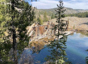
4.02.84 mi / 436 ft gainB&B to Reiling Dredge to Minnie Mine is a loop trail that provides a good opportunity to view wildlife located near Breckenridge, Colorado.Read more -
Basalt, Colorado
Hike to Eagle Lake, Colorado
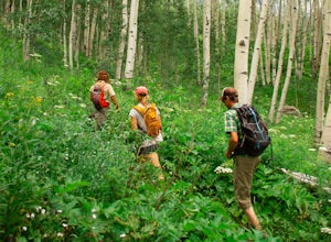
5.05.5 mi / 1036 ft gainIf you find yourself back in the Lime Creek area just outside of Eagle, Colorado and south of Sylvan Lake State Park - you should make the time to get yourself up to Eagle Lake! The hike starts off of Brush Creek Road and follows a property line in the forest of Aspens and towering wildflowers fo...Read more -
Fairplay, Colorado
French Pass Trail
5.06.87 mi / 1736 ft gainFrench Pass Trail is an out-and-back trail where you may see beautiful wildflowers located near Jefferson, Colorado.Read more -
Aspen, Colorado
Grottos Trail
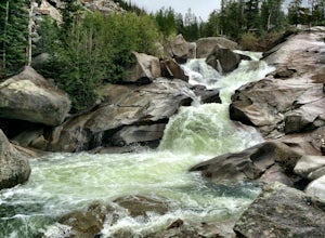
5.00.53 mi / 72 ft gainJust nine miles east of Aspen on Highway 82, Independence Pass, are grottos. A grotto is a geological term for a cave or cavern. The Grottos near Aspen were formed by rushing water of the Roaring Fork River. There is only an elevation gain of 300 feet on the three-quarters of a mile loop making...Read more -
Frisco, Colorado
Climb Mount Royal
4.7To access the trailhead, drive 4 blocks South to the end of 2nd Avenue from Frisco's Main Street. The trailhead is located around 9,075 feet.Being a popular hike, the trail is clear in the summer months and usually populated by boot prints and snowshoe tracks in the winter. Follow the trail from ...Read more -
Breckenridge, Colorado
Mount Guyot Snow Climb
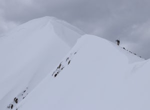
5 mi / 2500 ft gainFrom Jefferson follow 35 north to 54 and drive up 54 as far as possible ending a few miles before Georgia pass. Depending on the snowpack and drifts on the unplowed road, you could hike as few as 5 miles round trip or as many as 10. If the snow blocks you from driving past Michigan Creek Campgro...Read more -
Frisco, Colorado
Hike or Snowshoe to Rainbow Lakes
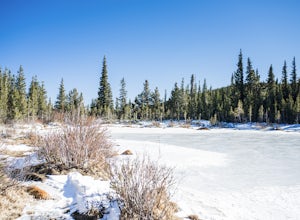
5.03 mi / 250 ft gainYou can do this hike two different ways: 1- Start from the Peaks Trail Trailhead for an out and back hike, distance is a little over 2 miles roundtrip. 2- Start along the Summit County Recreational Trail (as marked on this map), also out and back hike, total distance just over 3 miles, and provid...Read more -
Frisco, Colorado
Mount Royal Trail
3.98 mi / 1391 ft gainMount Royal Trail is an out-and-back trail that takes you through a nice forest located near Frisco, Colorado.Read more -
Aspen, Colorado
Weller Lake Trail
4.01.17 mi / 312 ft gainWeller Lake Trail is an out-and-back trail that takes you by a lake located near Aspen, Colorado.Read more


