Ward, Colorado
Top Spots in and near Ward
-
Estes Park, Colorado
Estes Cone
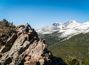
4.08.22 mi / 2275 ft gainThe trail begins on the left on a park service road before reaching a junction with the Storm Pass Trail just past .2 miles. Follow the trail as it enters the forest and continue past the private property signs and over a footbridge. Past the bridge the trail climbs more steadily for just under 2...Read more -
Estes Park, Colorado
Rock Climb above Lilly Lake
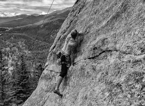
3.5Lilly Lake is known as a very popular, easy hike in Rocky Mountain National Park. Lilly Lake itself is very pretty and also has some good fishing and walking opportunities.Rock rises up nearby the northwest area of the lake, and offers some of the most fun rock climbing in the area. There are num...Read more -
Boulder, Colorado
South Boulder Creek - Mesa Trail - Lower Big Bluestem Loop
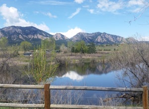
4.04.46 mi / 453 ft gainThis 4 mile loop ascends only a slight amount in elevation, making for a pleasant loop in which opportunities for appreciation of the nature around you and broad vista photography are in plentiful supply. A great hike for those who may still be building their fitness, as so many trails in Boulder...Read more -
Golden, Colorado
Hike the Blue Grouse Trail Loop
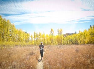
3.06 mi / 400 ft gainStart the hike at the Blue Grouse Trailhead located next to Kriley Pond. Travel along Blue Grouse Trail for 0.7 miles until you reach a fork in the trail at Mule Trail where you will take a right. Along the Mule Trail you will travel up a series of switch backs before the trail levels out and you...Read more -
Golden, Colorado
Summit Windy Peak via the Burro Trail
4.06.35 mi / 1825 ft gainThe Burro Trail starts at the Bridge Creek Trailhead Parking Lot and leads off to the left. While this trail is incredibly well marked it wouldn't hurt to grab a map at the visitors center before you start! From the parking lot you'll travel along the trail for 0.7 miles until you reach your firs...Read more -
Golden, Colorado
Hike to Forgotten Valley
4.33.6 mi / 852 ft gainThere are over 35 miles of hiking trails in the park. The twelve trails in Golden Gate Canyon State Park are named after an animal and marked with the animal’s footprint.For a 2.6 round trip hike, start at the Burro Trailhead in Golden Gate Canyon State Park. You’ll immediately cross over a lit...Read more -
Golden, Colorado
Hike Racoon Trail to Panorama Point
4.03.3 mi / 750 ft gainSummer is a magical time of year in the Rocky Mountains. One great way to experience this stunning beauty is through hiking Raccoon Trail to Panorama Point at Golden Gate State Park. Raccoon Trail is 3.3 mile moderately difficult hike which can be completed in under an hour, although it will like...Read more -
Golden, Colorado
Hike the Mountain Lion Trail
6.7 mi / 1230 ft gainThere are three parking lots with direct access to the Mountain Lion Trail. The main one is off of Crawford Gulch Road, but any of them are good starting points! This loop has pretty similar elevation gain and loss profiles no matter which way you go, so you can go any direction. This adventure ...Read more -
Golden, Colorado
Hike Beaver Trail in Golden Gate Canyon State Park
2.3 mi / 1046 ft gainThis trail starts off at Slough Pond, a great fishing pond or picnic spot. The trail starts out tree-covered. After a few tenths of a mile you have the choice to go clockwise or counter-clockwise. If you go counter-clockwise you have about 3/4 of a mile of steep uphill hiking to do (the Park rate...Read more -
Boulder, Colorado
Hike the Flatirons Vista Loop Trail
4.73.3 miFrom the parking lot, take South Flatiron Vista Trail for 2.4 miles, where you'll cross onto North Flatiron Vista Trail. In 1 mile, take the connector trail back to the trailhead. To shorten the loop to 2 miles, hike South Flatiron for just 1 mile to Prairie Vista Trail, which leads back to the c...Read more -
Larimer County, Colorado
Winter Hike to Loch Vale
4.05.4 mi / 1056 ft gainThis winter adventure begins at the popular Glacier Gorge Trailhead in Rocky Mountain National Park. Make sure you arrive early as the parking lot fills up quickly! We started the hike with our microspikes on and carried our snowshoes. The park ranger informed us snowshoes may be necessary in som...Read more -
Larimer County, Colorado
Hike the Spearhead
5.012.44 mi / 3300 ft gainBeginning from the Glacier Gorge trailhead, follow trail signs towards Mills Lake. At Mills, continue onward past Black Lake, and then continue hiking up into the incredible basin above Black Lake. Spearhead will be unmissable. Once in the basin, head to the north side of Spearhead. By hugging t...Read more -
Larimer County, Colorado
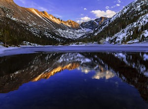
Hike to Jewel Lake
4.06.12 mi / 727 ft gainThis trail starts at the Glacier Gorge Trailhead. This trailhead fills quickly at any time of year, so it's best to get there early to guarantee a parking spot. You can also park at Bear Lake where there's more spaces and add just under 2 miles to your round trip length. A mile into the hike, y...Read more -
Estes Park, Colorado
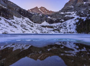
Black Lake Trail
5.09.17 mi / 1400 ft gainThe Black lake hike begins at the very popular Glacier Gorge trailhead along Bear Lake road in Rocky Mountain National Park. During the summer and weekends, the park shuttle may be the best parking option as the lot is often full by 7am and can be difficult to find a spot throughout the day. Fr...Read more -
Larimer County, Colorado
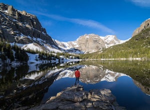
The Loch Vale Hike
5.05.53 mi / 1056 ft gainThe trail starts at the Glacier Gorge trailhead along the road to Bear Lake. After hiking for just under a mile, you'll pass Alberta Falls and continue up the trail through the gorge. At about 2 miles you'll reach a clear junction, with trails towards Mills Lake, Lake Haiyaha, and The Loch. Take ...Read more -
Larimer County, Colorado
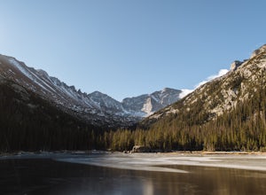
Mills Lake via Glacier Gorge Trailhead
4.85.24 mi / 940 ft gainStart hiking at the Glacier Gorge Trailhead down the bear lake road in rocky mountain national park. The trailhead is very popular so it can be difficult to find a parking place at times. From Glacier Gorge, follow the obvious trail and signs towards mills lake. In the summer the trail will go p...Read more

