Ashton, Idaho
Looking for the best hiking in Ashton? We've got you covered with the top trails, trips, hiking, backpacking, camping and more around Ashton. The detailed guides, photos, and reviews are all submitted by the Outbound community.
Top Hiking Spots in and near Ashton
-
Alta, Wyoming
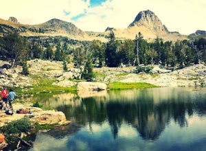
Backpack to Alaska Basin via Death Canyon
28.2 mi / 7500 ft gainDeath Canyon Trailhead is easily accessed by heading south on Moose-Wilson Rd. from Grand Teton National Park Headquarters for 3 miles. Once at the junction turn right onto an uneven dirt road and go north 0.7 miles to the parking area.Day 1: (8.3 miles) From Death Canyon Trailhead hike west for ...Read more -
Alta, Wyoming
Backpack to the Death Canyon Shelf
20 mi / 2700 ft gainIf you can snag a permit to camp at Death Canyon Shelf, consider yourself lucky. This backcountry camping zone holds some of the best sites in Grand Teton National Park. The shelf is a 3-mile stretch of the Teton Crest trail between Fox Creek Pass and Mount Meek Pass, and runs parallel to Death C...Read more -
Alta, Wyoming
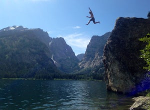
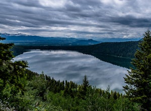
Hike to Phelps Lake
4.94.22 mi / 974 ft gainDon’t look down! You’re about to cliff jump 40 feet from a granite boulder into a lake cold with Glacier runoff. This short and beautiful hike, with a four hundred foot climb, will lead you to our favorite summertime activity…jumping and swimming! If you park at the Preserve trailhead, plan to g...Read more -
Alta, Wyoming
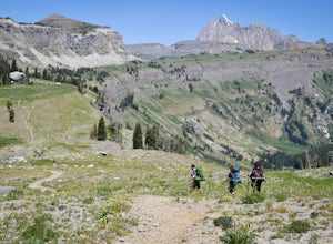
Patrol Cabin at Death Canyon via Death Canyon Trail
5.07.52 mi / 2000 ft gainYour adventure begins at 7,000 feet along lodge pole pines and small creeks. Just a few minutes into the hike, you will reach the Valley Trail Junction. Stay left and continue towards Death Canyon. The first mile of the trail climbs 400 feet through pine forests and aspen groves to the Phelps Lak...Read more -
Alta, Wyoming
Death Canyon to Fox Creek Pass
5.018.15 miDay 1: This trip begins at the Death Canyon Trailhead. Try to arrive early, as it gets crowded and various groups day hike from here. After the first few miles, you’ll encounter Phelps Lake. You’ll have several opportunities for photos, and they will all be beautiful. As you continue on, be on t...Read more -
Moose, Wyoming
Teton Park Road
15.73 mi / 646 ft gainTeton Park Road Trail is a point-to-point trail where you may see beautiful wildflowers located near Moose, Wyoming.Read more -
Moose, Wyoming
Taggart Lake Trail
5.03.73 miThis is an easy, four-mile loop hike that doesn't have much of elevation gain. Start off at the Taggart Lake Trailhead. Hike through the forest following a stream until you reach an opening. Continue hiking until you reach the lake. Sit back and enjoy reaching the lake with a snack and some wate...Read more -
Moose, Wyoming
Hike to Bradley Lake
5.58 mi / 7022 ft gainSo the hike starts out at Taggart Lake Trailhead ( 6625') and the highest point on the trail is (7022'). Follow this trail all the way along the stream to your left. You will go through a pretty dense forest for a bit, this area can get wet and muddy depending on the season so equip yourself acco...Read more -
Moose, Wyoming
Snowshoe to Taggart Lake
3.04 mi / 460 ft gainPark at the nicely kept Taggart Lake trailhead parking lot and grab your snowshoes for an exciting 2 mile trail hike to the gorgeous frozen Taggart Lake. The lake is situated right in the middle of a view of the Mount Wister, South Teton, and Middle Teton peaks. The trails are all well kept and p...Read more -
Moran, Wyoming
Signal Mountain
5.07.72 mi / 1158 ft gainThis gorgeous hike to Signal Mountain begins from the Signal Mountain Lodge parking area. The trailhead is located on the opposite side of the entrance road from the lodge. To reach the trailhead from the parking area you can either walk westbound along the road, passing the general store, showe...Read more -
Yellowstone National Park, Wyoming
Drive The Firehole Lake Loop
5.0Firehole Lake Drive is a 2 mile one way road, near the Lower Geyser Basin in Yellowstone National Park. This is one of the hidden gems in Yosemite where you'll find solitude and quietness. You may see a few people here on a busy day, but you can often find yourself alone.While driving around the ...Read more -
Alta, Wyoming
Hike Coal Creek Trail
Imagine hiking through the expansive valleys of wildflowers and evergreen forests with grand views of the Tetons. That is exactly what this trail provides. The coal creek trail is an access trail to many other great trails throughout the Bridger-Teton National Forest. This gives the adventurer th...Read more -
Alta, Wyoming
Taylor Mountain via Cole Creek
8.76 mi / 3261 ft gainThe Coal Creek Trailhead is at 7,250 feet. Follow the trail as it goes up Coal Canyon and through Coal Creek Meadows. Taylor mountain is the peak on the left side of the canyon as you climb. When you come to a fork at 2.5 miles (just after the meadow), take the left fork (toward the west) to begi...Read more -
Jackson, Wyoming
Hike the Rockefeller Preserve Loop
4.33 miThe Rockefeller Preserve loop starts from a gravel trail that begins in the parking lot. The gravel pathway leads to a meadow and then goes right up to the visitor center. From the visitor center the trail continues to a thick forest that parallels the scenic Lake Creek. The trail leads around th...Read more -
44.567236,-110.835176
Sentinel Meadows to Fairy Falls and Imperial Geyser
4.88.53 mi / 500 ft gainThis hike starts on a long, straight, wide and flat path due south from the trailhead. After about a half a mile, you will come to the "Ojo Caliente" spring and a bridge crossing the Firehole River. If you go down below either side of the bridge, you'll see dozens of bird's nests. Right after ...Read more -
Teton Village, Wyoming
Hike the Granite Canyon Trail
3.013.14 mi / 1703 ft gainThe Granite Canyon Trail is located near Teton Village, Wyoming and is best for experienced hikers. The trail is typically trafficked from March until August. This hike can be shortened by taking the tram in Teton Village to the top of Rendezvous Mountain, and then hiking down to Marion Lake and ...Read more
Top Activities
Visit Idaho
Idaho is a picturesque state filled with beautiful scenery and warm, wonderful people. It's an ideal destination for family travelers, outdoor enthusiasts, adventure seekers, or those just looking for a relaxing getaway.
Learn More

