Williamsburg, Kentucky
Looking for the best hiking in Williamsburg? We've got you covered with the top trails, trips, hiking, backpacking, camping and more around Williamsburg. The detailed guides, photos, and reviews are all submitted by the Outbound community.
Top Hiking Spots in and near Williamsburg
-
Jamestown, Tennessee
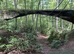
Natural Bridge Loop
1.05 mi / 148 ft gainThis trail is located in Pickett State Park which is a close neighbor to Big South Fork National Recreation Area. This is one of the many trailheads that connect to the Natural Bridge loop however, this trailhead is the closest to the natural bridge. From the road it is only a few hundred feet wa...Read more -
Jamestown, Tennessee
Hazard Cave and Natural Bridge Trail
2.33 mi / 240 ft gainHazard Cave and Natural Bridge Trail is a loop trail combining two of the major attractions of Pickett CCC Memorial State Park located near Jamestown, Tennessee. This hike is about two and a third miles, with 240 feet of elevation gain. It will take a little over an hour to complete the loop if y...Read more -
Jamestown, Tennessee
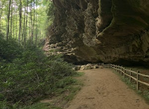
Hike to Indian Rockhouse
0.4 mi / 65 ft gainThis hike is a great, short hike for all ages. It shows the sandstone formation of the area very well and features a large cliff, an overhang, and a small stream at the bottom. The hike is only 0.4 of a mile total and has a small elevation change. It is probably the easiest hike in this area. Th...Read more -
Jamestown, Tennessee
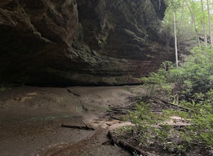
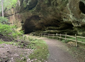
Hazard Cave Loop
5.01.51 mi / 210 ft gainHazard Cave is a gorgeous very large sandstone formation. The hike is located in Pickett State Park which is right next to Big South Fork National Recreation Area. This hike is the shortest option to get to Hazard Cave. If you are looking for a longer hike you can take the entire loop hike to get...Read more -
Ewing, Virginia
Backpack to White Rocks in Cumberland Gap National Historic Park
6.4 mi / 2000 ft gainCumberland Gap National Historic Park encompasses more than 20,000 acres of mountainous terrain spread out across Virginia, Tennessee, and Kentucky. The park offers miles of trails and many historic curiosities, including the actual saddle where pioneers first found their way over the Cumberland ...Read more -
Ewing, Virginia
Hike to the Sand Caves
4.78 mi / 2000 ft gainAfter a 2.5 mi hike up the Ewing Trail, you will reach the Ridge Trail. Go left for approximately 1 mi until you reach a landing for horses. Another 0.25 mi down the trail, you will encounter some steep wooden steps as well as several slippery boulders. Depending on recent weather and season, you...Read more -
Ewing, Virginia
Hike to White Rocks
5.06 mi / 1500 ft gainStarting at the Ewing Trailhead, in Ewing, VA, you will meander up the ridge for about 2.5 mi before meeting up with Ridge Trail. The ascent is approximately 1500 ft up the side of the majestic White Rock Ridge. Mud, loose rocks, and some very steep climbs are included.Once at the top, left takes...Read more -
McKee, Kentucky
Explore Flat Lick Falls
5.00.5 miThe hike begins at the parking area, just before the restrooms. Following a short, paved path will bring you to a small overlook of Flat Lick Falls. While this overlook is nice, the real treat comes when you venture to the base of the falls. Look for a small dirt path to the right of the overlook...Read more -
Wartburg, Tennessee
Hike to Debord and Emory Gap Falls in Frozen Head SP
4.33.2 mi / 465 ft gainThe trail head begins just over the bridge and is labeled as the Panther Branch trail head. To began you will continue straight and within .6 miles of hiking you will come to the first waterfall on a branch off on the right side of the trail. This first waterfall is Debord Falls and it can be eas...Read more -
Wartburg, Tennessee
Hike to Frozen Head State Park Fire Tower
4.54.5 mi / 1300 ft gainTo get to this hike the easiest way is to go up Petros hwy near the closed Brushy Mountain State prison. The trailhead is a large gravel lot on the side of the road. The trail is an old road so it is wide and well taken care of. However, the trail is very steep all the way up. The trail has only ...Read more -
Wartburg, Tennessee
Old Mac Mountain and Frozen Head Firetower
6.42 mi / 1906 ft gainOld Mac Mountain and Frozen Head Firetower is an out-and-back trail that takes you past scenic surroundings located near Wartburg, Tennessee.Read more -
Jamestown, Tennessee
Northrup Falls
4.21.39 mi / 98 ft gainTruly a hidden gem, this trail seems to get little to no attention, yet is absolutely amazing. To get to the trail from I-40 near Crossville, Tennessee, take Highway 127 north toward Jamestown. Before getting to Jamestown, turn right on State Route 296 east, toward the town of Allardt. In Allardt...Read more -
Corryton, Tennessee
Hike House Mountain, TN
5.03 miHouse Mountain is a short, at times strenuous hike that is doable in all weather conditions. Going at different times of year can be a treat due to the unique beauty of each season adding some spice to this quick trip. There are 5-7 switchbacks to push through, but the view atop House Mountain am...Read more

